Reisjärvi
| Reisjärvi | ||
|---|---|---|
| Municipality | ||
| Reisjärven kunta | ||
|
Reisjärvi Church | ||
| ||
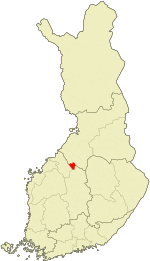 Location of Reisjärvi in Finland | ||
| Coordinates: 63°36.3′N 24°56′E / 63.6050°N 24.933°ECoordinates: 63°36.3′N 24°56′E / 63.6050°N 24.933°E | ||
| Country | Finland | |
| Region | Northern Ostrobothnia | |
| Sub-region | Nivala–Haapajärvi sub-region | |
| Charter | 1868 | |
| Government | ||
| • Municipal manager | Pekka Leppänen | |
| Area (2011-01-01)[1] | ||
| • Total | 503.17 km2 (194.28 sq mi) | |
| • Land | 474.36 km2 (183.15 sq mi) | |
| • Water | 28.81 km2 (11.12 sq mi) | |
| Area rank | 231st largest in Finland | |
| Population (2016-03-31)[2] | ||
| • Total | 2,885 | |
| • Rank | 250th largest in Finland | |
| • Density | 6.08/km2 (15.7/sq mi) | |
| Population by native language[3] | ||
| • Finnish | 99.5% (official) | |
| • Swedish | 0.1% | |
| • Others | 0.4% | |
| Population by age[4] | ||
| • 0 to 14 | 20.1% | |
| • 15 to 64 | 60.7% | |
| • 65 or older | 19.1% | |
| Time zone | EET (UTC+2) | |
| • Summer (DST) | EEST (UTC+3) | |
| Municipal tax rate[5] | 21% | |
| Website | www.reisjarvi.fi | |


Reisjärvi is a municipality of Finland.
It is located in the province of Oulu and is part of the Northern Ostrobothnia region. The municipality has a population of 2,885 (31 March 2016)[2] and covers an area of 503.17 square kilometres (194.28 sq mi) of which 28.81 km2 (11.12 sq mi) is water.[1] The population density is 6.08 inhabitants per square kilometre (15.7/sq mi).
The municipality is unilingually Finnish.
Geography
The habitation in Reisjärvi is clustered into villages ("kylä"). The locals might recognize at least the following villages: Keskusta (the center), Hylkiranta, Järvikylä, Kalaja, Kangaskylä, Kinnulanranta, Kiljanranta, Köyhänperä, Leppälahti, Levonperä, Lokkiperä, Metsäperä, Mäntyperä, Räisälänmäki.
Reisjärvi has a highly diverse nature, with lots of lakes, ponds and smaller rivers, rocks and cliffs but also marshes and lowlands. A very remarkable sight of Reisjärvi nature is one of the northernmost in Finland habitats of wild Small-leaved Lime (Tilia cordata), 63° 38′ N (right after the northernmost reliably confirmed natural habitats in the municipality of Sonkajärvi in the vicinity of the lake of Kangaslampi, 63° 45′ N and near the hill of Salmisenmäki, 63° 43′ 42" N).[6] There have still been growing 7 old long-boled limes in mixed forest on the cape of Kokkoniemi jutting out into the lake of Pitkäjärvi. The site is in private possession but it is a grove of national significance which has been under state protection since 13.04.1989.[7][8][9][10][11] Following the Peuranpolku ("deer's path") trailing route, which begins in Reisjärvi, provides an excellent view into the landscape of the area. The cliffs and rock fields of the Raura area have been shaped by the ice age.
Politics
Reisjärvi has traditionally been a strong area for the Centre Party. For example, in the first round of 2006 presidential elections, the Centre Party candidate Matti Vanhanen got 57.1% of all votes from Reisjärvi. The municipal council of Reisjärvi is also dominated by the Centre Party: in the period 2004–2008 it held 15 positions against 4 positions for National Coalition Party and 1 for Social Democrats and Left Alliance each.
Events
- The Finnish Porcelain Summer, organized every year since 1996. International get-together for porcelain painters and anyone interested in the art of porcelain. Main organizer is Aira Suomela.
References
- 1 2 "Area by municipality as of 1 January 2011" (PDF) (in Finnish and Swedish). Land Survey of Finland. Retrieved 9 March 2011.
- 1 2 "Ennakkoväkiluku sukupuolen mukaan alueittain, maaliskuu.2016" (in Finnish). Statistics Finland. Retrieved 31 March 2016.
- ↑ "Population according to language and the number of foreigners and land area km2 by area as of 31 December 2008". Statistics Finland's PX-Web databases. Statistics Finland. Retrieved 29 March 2009.
- ↑ "Population according to age and gender by area as of 31 December 2008". Statistics Finland's PX-Web databases. Statistics Finland. Retrieved 28 April 2009.
- ↑ "List of municipal and parish tax rates in 2011". Tax Administration of Finland. 29 November 2010. Retrieved 13 March 2011.
- ↑ Ylä-Savon Instituutti - Sonkajärven luonto. (in Finnish) (PDF).
- ↑ REISJÄRVEN RANTAOSAYLEISKAAVAN LUONTOSELVITYS. KASVILLISUUS JA LUONTOTYYPIT. Motiivi Oy. Tmi Arta Hautala. Ympäristo ja kalatalouspalvelut, 2001. (in Finnish) (PDF).
- ↑ LUONTAINEN NIINIPUU KESKI-POHJANMAALLA JA LÄHIYMPÄRISTÖSSÄ — Suomen pohjoisimmat esiintymät. Loppuraportti Metsämiesten Säätiölle hankkeesta ”Luonnonvaraisen metsälehmuksen eli niinipuun esiintymisen ja sen historian selvittäminen Keski-Pohjanmaalla ja lähiympäristössä”. Esa Heino: Metla/Kannuksen yksikkö 2005. (in Finnish) (PDF).
- ↑ "METSÄLEHMUS JA SEN MIKROLISÄYS" — HAMK — Hämeen Ammattikorkeakoulu. Ammattikorkeakoulun opinnäytetyö. Maisemasuunnittelun koulutusohjelma. Rauli Häyrynen: Lepaa, 15.4.2011. (in Finnish) (PDF).
- ↑ NatureGate: Small-leaved Lime (Tilia cordata)
- ↑ Helsingin yliopisto. Kasviatlas. Suomen putkilokasvien levinneisyyskartasto. Metsälehmus (Tilia cordata) (in Finnish)
External links
-
 Media related to Reisjärvi at Wikimedia Commons
 - Municipality of Reisjärvi – Official website (Finnish)
| Municipalities |  | |
|---|---|---|
| Former | ||