Reform, Alabama
| Reform | |
|---|---|
| City | |
 Location in Pickens County and the state of Alabama | |
| Coordinates: 33°22′51″N 88°0′54″W / 33.38083°N 88.01500°W | |
| Country | United States |
| State | Alabama |
| County | Pickens |
| Area | |
| • Total | 8 sq mi (20.9 km2) |
| • Land | 8 sq mi (20.8 km2) |
| • Water | 0 sq mi (0.1 km2) |
| Elevation | 240 ft (73 m) |
| Population (2010) | |
| • Total | 1,702 |
| • Density | 247.3/sq mi (94.6/km2) |
| Time zone | Central (CST) (UTC-6) |
| • Summer (DST) | CDT (UTC-5) |
| ZIP code | 35481 |
| Area code(s) | 205 |
| FIPS code | 01-64104 |
| GNIS feature ID | 0125544 |
Reform is a city in Pickens County, Alabama, United States. At the 2010 census the population was 1,702, down from 1,978 in 2000.
History
Sparsely settled after statehood, Reform first received a post office in 1841. It wasn't incorporated until March 2, 1898, following the community getting train service via the Mobile and Ohio Railroad.[1] In May 1968, a mule train, part of the Southern Christian Leadership Conference sponsored Poor People's Campaign, stopped for two days in Reform before heading to Tuscaloosa, Alabama on its way to Washington, DC.[2]
Geography
Reform is located at 33°22′51″N 88°0′54″W / 33.38083°N 88.01500°W (33.380835, -88.015022).[3]
According to the U.S. Census Bureau, the city has a total area of 8.1 square miles (21 km2), of which 8.0 square miles (21 km2) is land and 0.04 square miles (0.10 km2) (0.37%) is water.
According to local tradition, the community was so named after a preacher refused to return until the townspeople reformed their ways.
Demographics
| Historical population | |||
|---|---|---|---|
| Census | Pop. | %± | |
| 1900 | 198 | — | |
| 1910 | 550 | 177.8% | |
| 1920 | 1,069 | 94.4% | |
| 1930 | 898 | −16.0% | |
| 1940 | 885 | −1.4% | |
| 1950 | 1,141 | 28.9% | |
| 1960 | 1,241 | 8.8% | |
| 1970 | 1,893 | 52.5% | |
| 1980 | 2,245 | 18.6% | |
| 1990 | 2,105 | −6.2% | |
| 2000 | 1,978 | −6.0% | |
| 2010 | 1,702 | −14.0% | |
| Est. 2015 | 1,632 | [4] | −4.1% |
| U.S. Decennial Census[5] 2013 Estimate[6] | |||
As of the 2010 United States Census, there were 1,702 people residing in the town. 50.6% were White, 48.2% African American, 0.1% Native American, 0.4% from some other race and 0.7% of two or more races. 0.9% were Hispanic or Latino of any race.
As of the census[7] of 2000, there were 1,978 people, 793 households, and 521 families residing in the city. The population density was 245.9 people per square mile (95.0/km²). There were 925 housing units at an average density of 115.0 per square mile (44.4/km²). The racial makeup of the city was 53.34% White, 44.89% Black or African American, 0.30% Native American, 0.05% from other races, and 1.42% from two or more races. 0.35% of the population were Hispanic or Latino of any race.
There were 793 households out of which 31.7% had children under the age of 18 living with them, 39.1% were married couples living together, 22.7% had a female householder with no husband present, and 34.3% were non-families. 33.0% of all households were made up of individuals and 16.6% had someone living alone who was 65 years of age or older. The average household size was 2.40 and the average family size was 3.06.
In the city the population was spread out with 28.0% under the age of 18, 7.3% from 18 to 24, 24.7% from 25 to 44, 20.4% from 45 to 64, and 19.7% who were 65 years of age or older. The median age was 37 years. For every 100 females there were 76.1 males. For every 100 females age 18 and over, there were 68.7 males.
The median income for a household in the city was $20,625, and the median income for a family was $24,875. Males had a median income of $27,019 versus $16,827 for females. The per capita income for the city was $11,429. About 26.3% of families and 30.0% of the population were below the poverty line, including 38.9% of those under age 18 and 26.6% of those age 65 or over.
Education
Education in Reform is overseen and governed by the Pickens County Board of Education. Students of Reform and its surrounding areas are served by Reform Elementary School and Pickens County High School.
Notable people
- Tony Dixon, Safety for the Dallas Cowboys
- Doug Elmore, punter for the Washington Redskins
- Andrew F. Fox, Member of US House of Representatives.
- James L. Malone, Head football coach at Northeast Louisiana State College from 1951 through 1953.
- John Proctor, FBI agent instrumental in solving the 1964 Mississippi civil rights workers' murders case.[8]
- Michael Williams, NFL tight end for the New England Patriots
References
- ↑ http://www.encyclopediaofalabama.org/article/h-3456
- ↑ Emilye Crosby (2011). Civil Rights History from the Ground Up: Local Struggles, a National Movement. University of Georgia Press. p. 124. ISBN 978-0-8203-3865-1.
- ↑ "US Gazetteer files: 2010, 2000, and 1990". United States Census Bureau. 2011-02-12. Retrieved 2011-04-23.
- ↑ "Annual Estimates of the Resident Population for Incorporated Places: April 1, 2010 to July 1, 2015". Retrieved July 2, 2016.
- ↑ "U.S. Decennial Census". Census.gov. Retrieved June 6, 2013.
- ↑ "Annual Estimates of the Resident Population: April 1, 2010 to July 1, 2013". Retrieved June 3, 2014.
- ↑ "American FactFinder". United States Census Bureau. Retrieved 2008-01-31.
- ↑ James L. Dickerson; Alex A. Alston, Jr. (1 July 2009). Devil's Sanctuary: An Eyewitness History of Mississippi Hate Crimes. Chicago Review Press. p. 251. ISBN 978-1-56976-316-2.
Reform, Alabama :: CityofReform.com
Coordinates: 33°22′51″N 88°00′54″W / 33.380835°N 88.015022°W
Municipalities and communities of Pickens County, Alabama, United States | ||
|---|---|---|
| Cities | 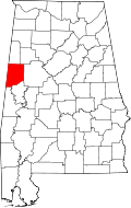 | |
| Towns | ||
| CDP | ||
| Unincorporated communities | ||