Redding Township, Jackson County, Indiana
| Redding Township | |
|---|---|
| Township | |
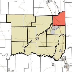 Location in Jackson County | |
| Coordinates: 39°00′30″N 85°50′59″W / 39.00833°N 85.84972°WCoordinates: 39°00′30″N 85°50′59″W / 39.00833°N 85.84972°W | |
| Country | United States |
| State | Indiana |
| County | Jackson |
| Government | |
| • Type | Indiana township |
| Area | |
| • Total | 34.61 sq mi (89.6 km2) |
| • Land | 34.06 sq mi (88.2 km2) |
| • Water | 0.55 sq mi (1.4 km2) 1.59% |
| Elevation | 646 ft (197 m) |
| Population (2010) | |
| • Total | 4,233 |
| • Density | 124.3/sq mi (48.0/km2) |
| GNIS feature ID | 0453784 |
Redding Township is one of twelve townships in Jackson County, Indiana, United States. As of the 2010 census, its population was 4,233 and it contained 1,786 housing units.[1]
Geography
According to the 2010 census, the township has a total area of 34.61 square miles (89.6 km2), of which 34.06 square miles (88.2 km2) (or 98.41%) is land and 0.55 square miles (1.4 km2) (or 1.59%) is water.[1] Lakes in this township include Peters Lake. The streams of Sand Creek and Thompson Slough run through this township.
Cities and towns
- Seymour (northeast edge)
Unincorporated towns
Extinct towns
- Conologue
- Peters Switch
Adjacent townships
- Sand Creek Township, Bartholomew County (north)
- Geneva Township, Jennings County (northeast)
- Spencer Township, Jennings County (east)
- Jackson Township (south)
- Hamilton Township (west)
- Wayne Township, Bartholomew County (northwest)
Cemeteries
The township contains two cemeteries: Glasson and Riverview.
Major highways
References
- 1 2 "Population, Housing Units, Area, and Density: 2010 - County -- County Subdivision and Place -- 2010 Census Summary File 1". United States Census. Retrieved 2013-05-10.
External links
Municipalities and communities of Jackson County, Indiana, United States | ||
|---|---|---|
| City | ||
| Towns | ||
| Townships | ||
| CDPs | ||
| Other unincorporated communities |
| |
This article is issued from Wikipedia - version of the 11/15/2014. The text is available under the Creative Commons Attribution/Share Alike but additional terms may apply for the media files.