Red Burn
The Red Burn is one of two main streams which flow out of Cumbernauld. The Scottish New Town’s name derives from the Gaelic for "the meeting of the waters" and there is broad agreement that one of these waters is the Red Burn.
Source and course of the river
The Red Burn's headwater begins as a rivulet on the west side of Fannyside Lochs[1] know as the Glencryan Burn.
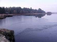
It flows west through Palacerigg Golf Course and becomes a significant geographic feature when it produces the Glencryan Reservoir[2] south of Forest Road in Cumbernauld. The name of the stream from its source until it enters the Vault Glen is the Glencryan Burn. It enters Cumbernauld behind Cumbernauld Academy[3] (formerly Cumbernauld High). The river then runs under Forest Road and its name changes to The Red Burn on the other side. The river takes a sudden turn to the east and is joined by a few nameless rivulets which come down from both the steep sided banks, the left bank being Kildrum and the right hand being Abronhill. The Scottish Wildlife Trust owns the land around the river at this point with the exception of a sewage pipeline which runs through the Vault Glen.[4] The Vault Glen has very steep sides with the stream some 25-30m below the brow of the hill and any rubbish dropped is difficult to remove although there have been some attempts to clean it up.[5]
The Red Burn crosses the railway under a large viaduct before its confluence with the Bog Stank[6] just down river from the bridge over the path from the Park above.


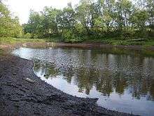
After the confluence the Red Burn passes the dovecote and Broom Road, Abronhill before flowing back under the Forest Road Bridge heading towards Dunns Wood. From there the river passes through a sewage works. Work costing £3.8 million was completed on upgrading the water treatment system in 2013.[7] Its purpose is to clean water from the Wardpark Estate before it joins the river.[8] Scottish Water designed a system to take surface water runoff through a series of ponds and mimic a natural catchment.
These ponds, known as a Sustainable Urban Drainage System (SUDS), reduce the speed of the run off to prevent flooding. By filtering and treating the water, pollutants are removed and the quality of water that reaches the burn is much improved. Given the size of the catchment area, six ponds covering 14 hectares were needed to deal with the large volume of surface water. In addition to the ponds, the £10.5million Dunnswood waste water treatment works project constructed a whole new waste water treatment process alongside the existing process.[9] This provides a higher standard of waste water treatment, and allows for future population growth in the area as a result of development in and around Cumbernauld.

The only significant subsequent tributary of the Red Burn is the Walton Burn which flows round the east side of Abronhill.[10] The river forms the border between Falkirk and North Lanarkshire councils[11] at this point. The Red Burn then flows under the M80, the B816 and the 18th century Castlecary Viaduct carrying the railway track. This is close to the historic Castle Cary Castle.
After the Red Burn has crossed the road and the railway it is then crossed by the Forth and Clyde Canal[12] on an aqueduct[13] close to Bonny Water.[14]
The Red Burn's confluence with the smaller Bonny Water occurs just north of the canal and the river is now called the Bonny Water until it reaches the River Carron downstream. The Carron itself enters the Firth of Forth at Grangemouth.
Competing Theories for Cumbernauld's Name
Cumbernauld is the largest town in North Lanarkshire. Some people think the name Cumbernauld's Gaelic name [15] Comar nan Allt meaning "the confluence of the waters" refers to the meeting of the Red Burn with the Bog Stank stream.[16] This occurs in the Vault Glen down the hill but very close to the site of the Comyn’s Castle. In support of this argument the oldest maps of Cumbernauld still in existence show the “Rid Burn” joining three other streams. On the map they all seem to come together at one point although this bears little relation to the current watercourses. Probably the earliest map which shows the river is the 1596 Pont's Map[17] but is much easier to pick out on Blaeu's coloured map which was derived from it.[18] Another stream named as the Horseward Burn is mentioned and is shown to join with the Red Burn. What this refers to is not at all clear. These older maps are reminiscent of the modern Friends of the Glen map which is also a stylised representation of the Park.[19] Pont's map does mention the Luggie but doesn't seem to associate this with Cumbernauld or its castle. In fact the Luggie is a considerable distance from Cumbernauld Village. The name Condorrat, formerly a separate village but now part of the town, has a Gaelic origin too: "Comh Dobhair Alt" - The joint river place.[20] This name may be close in meaning to Cumbernauld's.
The other competing theory is that the etymology of the name is to do with Cumbernauld being a Scottish watershed. In that case the waters referred to are the Red Burn and the Luggie Water even though they do not in fact meet.[21] In other words from its high point in the Central Belt, The Luggie Water and the Red Burn flow either west to the River Clyde or east to the Firth of Forth so Cumbernauld is a watershed. Jim Carruth, poet laureate of Glasgow, has a poem called Watershed[22] which is inscribed on the base of Andy Scott's Arria, The Angel of the 'Naud, statue which overlooks the A80 in Cumbernauld. This presupposes the etymology of the name is about Cumbernauld being a watershed. Hugo Millar, the respected local historian and author of two books about the town, espoused this view.[23]
Peter Drummond[24] gives an analysis of both viewpoints from historical and geographical perspectives.[25] What can be said with confidence is that Cumbernauld is named after the Red Burn.
Influence on Local Placenames
Three streets in Cumbernauld are named after the Red Burn and also use the older form of the name where Redburn is just one word.[26] These are in the Abronhill part of the town. Similarly Redburn School[27] takes its name from the stream.
Roman History
The Antonine Wall named after the Roman Emperor Antoninus Pius, crosses the Red Burn at Castlecary and Roman remains have been found on both sides of the river. The wall, built by Urbicus's men is named on the Unesco World Heritage list as a Frontier for the Roman Empire.[28] However the land has been considerably worked for the Forth and Clyde Canal, the Glasgow to Edinburgh railway[29] and the A80 now M80 road system. Older maps show how the fort[30][31] of Castle Cary was to the east of the river, as was the later Castle Cary Castle.[32] There is also the site of a Roman camp to the west of the river near the modern Castlecary Hotel.
There is a gruesome story about how the Red Burn (sometimes called the Rid Burn or Redburn) was named.[33] It involves the killing of Agricola's Roman soldiers whose bodies were dumped in the river at Castlecary making it run red.
Other Cumbernauldian Watercourses
Contrary to Jon Ronson's insulting comments[34] endorsed by Craig Ferguson on C.B.S.'s Late, Late Show, Cumbernauld does have at least two rivers: the Red Burn and the Luggie Water. There is also the Moss Water which was dammed to form Broadwood Loch.
References
- ↑ "West Fannyside Loch". Open Street Map. Retrieved 11 August 2016.
- ↑ "Dumbartonshire 034.03 (includes: Cumbernauld) 1898". The National Library of Scotland Maps. O.S. Retrieved 11 August 2016.
- ↑ "Glencryan Burn turns into Red Burn". Open Street Map. Retrieved 10 August 2016.
- ↑ "Cumbernauld Glen - Features map" (PDF). Scottish Wildlife Trust. Retrieved 13 August 2016.
- ↑ Gavan, Ryan (22 June 2014). "Abronhill Primary pupils kick-start burn clean up". Retrieved 6 August 2016.
- ↑ "Map of Bog Stank". The Gazetteer for Scotland. Retrieved 13 August 2016.
- ↑ "Water works give something to ponder". Cumbernauld News. 2 May 2013. Retrieved 12 August 2016.
- ↑ "Case Study 1 Improving water quality in the Red Burn" (PDF). Cumbernauld Living Landscape. Retrieved 11 August 2016.
- ↑ Gaines, Maureen (27 Jan 2014). "Dunnswood WwTW upgrade completed". WET News. Wastewater Treatment. Retrieved 13 August 2016.
- ↑ "Dumbarton Sheet XX.14 (Cumbernauld) 1864". The National Library of Scotland Map. O.S. Retrieved 12 August 2016.
- ↑ "Red Burn". The Gazetteer for Scotland. Retrieved 13 August 2016.
- ↑ "Stirlingshire 029.07 (includes: Cumbernauld; Denny; Falkirk; Kilsyth) 1898". National Library of Scotland MAp. O.S. Retrieved 12 August 2016.
- ↑ "Red Burn Aqueduct". Open Street Map. Retrieved 10 August 2016.
- ↑ http://www.scotlandsplaces.gov.uk/record/nls/24816/ordnance-survey-six-inch-mile-dunbartonshire-sheet-n-xxixse/OS6Inch2nd?inline=true#map-wrapper Zoom on right hand map for canal crossings
- ↑ http://theses.gla.ac.uk/5270/1/2014DrummondPhD.pdf#233 Peter Drummond PhD 2004 pg 233
- ↑ "Bog Stank". Scottish Places Info. The Gazetteer for Scotland 2016. Retrieved 12 August 2016.
- ↑ Pont, Timothy. "[The East Central Lowlands (Stirling, Falkirk & Kilsyth)] - Pont 32". National Library of Scotland. Retrieved 9 August 2016.
- ↑ Blaeu, Joan. "Sterlinensis praefectura, [vulgo], Sterlin-Shyr / Auct. Timoth. Pont.". National Library of Scotland. Retrieved 9 August 2016.
- ↑ Stylised map from Friends Of Cumbernauld Glen Map including Vault Glen
- ↑ http://theses.gla.ac.uk/5270/1/2014DrummondPhD.pdf#229 For historical pronunciations
- ↑ "CUMBERNAULD- PLACE NAMES". D-block GB-276000-675000. BBC Doomsday 1986. Retrieved 12 August 2016.
- ↑ Carruth, Jim. "Watershed (Comar nan Allt)". Jim Carruth. Retrieved 11 August 2016.
- ↑ Millar, Hugo B. (1968). Historical Cumbernauld (1 ed.). Glasgow: MacNaughtan & Sinclair Ltd. p. 9.
- ↑ "Peter Drummond". The University of Glasgow. Retrieved 13 August 2016.
- ↑ Drummond, Peter John (2014). An analysis of t oponyms and toponymic patterns in eight parishes of the upper Kelvin basin (PDF). School of Humanities College of Arts: University of Glasgow. pp. 232–234. Retrieved 12 August 2016.
- ↑ "Road List". North Lanarkshire Council. Retrieved 13 August 2016.
- ↑ "Redburn School and Nursery". North Lanarkshire Council. Retrieved 13 August 2016.
- ↑ "Frontiers of the Roman Empire". World Heritage List. UNESCO. Retrieved 13 August 2016.
- ↑ Stuart, Robert (1845). Caledonia romana: a descriptive account of the Roman antiquities of Scotland. Edinburgh: Bell and Bradfute. pp. 337–345.
- ↑ "CASTLECARY ROMAN FORT and CASTLECARY TOWER". castles forts battles. Retrieved 13 August 2016.
- ↑ "Exploring the environs of Roman forts along the Antonine Wall". archaeology research. The University of Glasgow. Retrieved 13 August 2016.
- ↑ "Dumbartonshire Sheet nXXIX (includes: Cumbernauld; Denny; Falkirk; Kilsyth) 1922". National Library of Scotland Map. O.S. Retrieved 13 August 2016.
- ↑ Baird, Hugh (1864). Castlecary and the great Roman wall. Falkirk: Charles Jeffrey. pp. 25–26.
- ↑ Williams, Martin (4 Mar 2012). "Craig Ferguson tells USA: There's one thing wrong with Scotland – Cumbernauld". Herald Scotland. Retrieved 13 August 2016.