Rechtsupweg
| Rechtsupweg | ||
|---|---|---|
| ||
 Rechtsupweg | ||
Location of Rechtsupweg within Aurich district 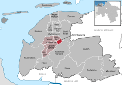
 | ||
| Coordinates: 53°31′46″N 7°19′36″E / 53.52944°N 7.32667°ECoordinates: 53°31′46″N 7°19′36″E / 53.52944°N 7.32667°E | ||
| Country | Germany | |
| State | Lower Saxony | |
| District | Aurich | |
| Municipal assoc. | Brookmerland | |
| Government | ||
| • Mayor | Karl-Edzard Walzer (SPD) | |
| Area | ||
| • Total | 5.13 km2 (1.98 sq mi) | |
| Population (2015-12-31)[1] | ||
| • Total | 2,017 | |
| • Density | 390/km2 (1,000/sq mi) | |
| Time zone | CET/CEST (UTC+1/+2) | |
| Postal codes | 26529 | |
| Dialling codes | 04934 | |
| Vehicle registration | AUR | |

Rechtsupweg is a municipality in the district of Aurich, in Lower Saxony, Germany.
Towns and municipalities in Aurich (district) | ||
|---|---|---|
References
This article is issued from Wikipedia - version of the 6/21/2015. The text is available under the Creative Commons Attribution/Share Alike but additional terms may apply for the media files.