Reamstown, Pennsylvania
| Reamstown, Pennsylvania | |
|---|---|
|
North Reamstown Road at Church Street | |
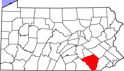 Lancaster County's location in Pennsylvania | |
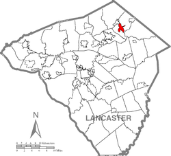 Reamstown's location in Lancaster County | |
| Coordinates: 40°12′43″N 76°7′3″W / 40.21194°N 76.11750°WCoordinates: 40°12′43″N 76°7′3″W / 40.21194°N 76.11750°W | |
| Country |
|
| State | Pennsylvania |
| County | Lancaster |
| Area | |
| • Total | 2.3 sq mi (5.888 km2) |
| • Land | 2.3 sq mi (5.888 km2) |
| • Water | 0 sq mi (0 km2) |
| Elevation | 392 ft (119 m) |
| Population (2010) | |
| • Total | 3,361 |
| • Density | 1,520.87/sq mi (594.09/km2) |
| Time zone | EST (UTC-5) |
| • Summer (DST) | EDT (UTC-4) |
| ZIP Code | 17567 |
| Area code(s) | 717 |
| Website | http://www.reamstown.org |

Reamstown (Pennsylvania Dutch: Riemeschteddel) is a census-designated place (CDP) in Lancaster County, Pennsylvania, United States. The population was 3,361 at the 2010 census.
Geography
Reamstown is located at 40°12′43″N 76°7′3″W / 40.21194°N 76.11750°W (40.212046, -76.117587).[1] According to the United States Census Bureau, the CDP has a total area of 50 square miles (130 km2), all of it land.
History
The town was named after Eberhard Ream (Johann Eberhardt Riehm 1687–1779), whose son, Tobias Ream, founded it in the 1740s. It was originally known as "Zohar" according to a local highway marker. During the Revolution, Reamstown served as one of a number of field hospitals for the wounded following the Battle of Brandywine on September 11, 1777. A dozen or more of these troops died here and are buried in unmarked graves in the Salem Evangelical Cemetery. The cemetery is also home to a large boulder that once served as a mortar and pestle by the Indians who lived on nearby Ephrata Mountain. It was transported to Reamstown by Pierce Lesher and today a plaque on the stone details both the Native American and military history.
Demographics
As of the census[2] of 2000, there were 3,498 people, 1,161 households, and 897 families residing in the CDP. The population density was 1,542.0 people per square mile (595.0/km²). There were 1,194 housing units at an average density of 526.3/sq mi (203.1/km²). The racial makeup of the CDP was 95.23% White, 0.31% African American, 0.26% Native American, 2.23% Asian, 0.03% Pacific Islander, 0.80% from other races, and 1.14% from two or more races. Hispanic or Latino of any race were 1.92% of the population.
There were 1,161 households, out of which 41.6% had children under the age of 18 living with them, 67.9% were married couples living together, 6.1% had a female householder with no husband present, and 22.7% were non-families. 18.1% of all households were made up of individuals, and 6.5% had someone living alone who was 65 years of age or older. The average household size was 2.85 and the average family size was 3.25.
In the CDP the population was spread out, with 28.6% under the age of 18, 6.0% from 18 to 24, 33.3% from 25 to 44, 19.8% from 45 to 64, and 12.3% who were 65 years of age or older. The median age was 36 years. For every 100 females there were 99.7 males. For every 100 females age 18 and over, there were 97.6 males.
The median income for a household in the CDP was $53,423, and the median income for a family was $58,625. Males had a median income of $40,516 versus $25,625 for females. The per capita income for the CDP was $21,143. About 3.3% of families and 5.5% of the population were below the poverty line, including 9.1% of those under age 18 and 4.8% of those age 65 or over.
Notable native
- George S. Howard - Commander and conductor of the United States Air Force band
- Bryan P. Smith - Graduate of The United States Military Academy at West Point, veteran of Operation Iraqi Freedom 06-08 and 09-10 and current engineer in the Oil and Gas industry.
- Timothy A. Eckert - Graduate of Washington Educational Center. US Army Specialist Veteran of Operation Enduring Freedom 11-12 and current Army Reserve.
- Kasey Saraka - Employee of Encore Sausage Co.
References
- ↑ "US Gazetteer files: 2010, 2000, and 1990". United States Census Bureau. 2011-02-12. Retrieved 2011-04-23.
- ↑ "American FactFinder". United States Census Bureau. Retrieved 2008-01-31.
| Wikimedia Commons has media related to Reamstown, Pennsylvania. |