Rawalpindi
| Rawalpindi راولپنڈی | |||||
|---|---|---|---|---|---|
| Metropolis | |||||
Clockwise from left: Rawalpindi Railway Station, St. Joseph's Cathedral, Rawalpindi, replicas of Statue of Liberty and Effiel Tower in Bahria Town, and Pharwala | |||||
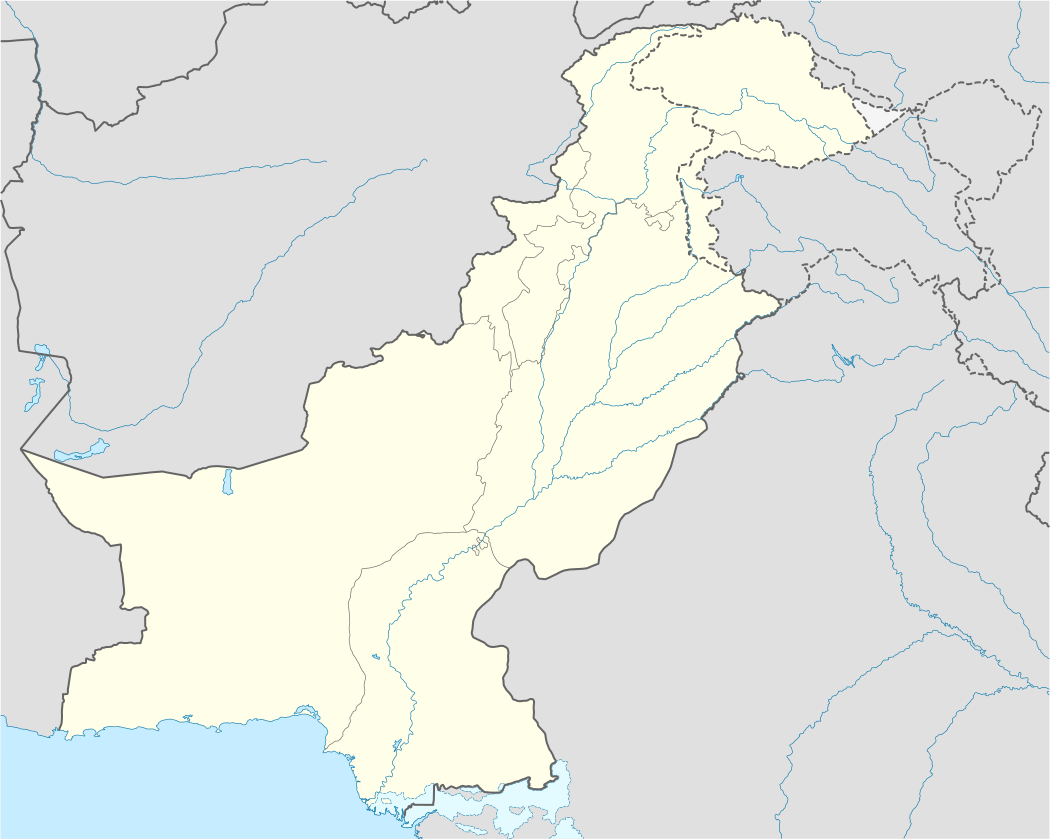 Rawalpindi Location in Pakistan | |||||
| Coordinates: 33°36′N 73°02′E / 33.600°N 73.033°ECoordinates: 33°36′N 73°02′E / 33.600°N 73.033°E | |||||
| Country |
| ||||
| Region | Punjab | ||||
| Division | Rawalpindi Division | ||||
| Autonomous towns | 8 | ||||
| Union councils | 38 | ||||
| Government | |||||
| • Type | Municipal Corporation | ||||
| • Mayor of Rawalpindi | TBD | ||||
| • Deputy Mayor of Rawalpindi | TBD | ||||
| Area | |||||
| • Total | 259 km2 (100 sq mi) | ||||
| Elevation | 508 m (1,667 ft) | ||||
| Population (2014) | |||||
| • Total | 3,198,911 | ||||
| • Density | 12,000/km2 (32,000/sq mi) | ||||
| Time zone | PKT (UTC+5) | ||||
| • Summer (DST) | PKT (UTC+6) | ||||
| Area code(s) | 051 | ||||
| Website |
www | ||||


Rawalpindi (Punjabi, Urdu: راولپنڈى, Rāwalpiṅḋī, commonly known as Pindi (Punjabi: پنڈی), is a city in the Punjab, Pakistan. It is the fourth-largest city in Pakistan by population, while the larger Islamabad Rawalpindi metropolitan area is the country's third-largest area. The economy of Rawalpindi is interlinked with Islamabad, and the two are jointly known as the "twin cities". The city is the administrative seat of the Rawalpindi District.[1]
Rawalpindi is located on the Pothohar Plateau, which is known for the existence of a Buddhist community, particularly in neighbouring town of Taxila, which is a UNESCO World Heritage Site.[2] The city was destroyed during the invasion of Mahmud of Ghazni before being taken over Gakhars who went on to name the city as "Rawalpind" in 1493. In 1765, Gakhar's where defeated as Rawalpindi became part of the Sikh Empire. The city became part of the British Raj in 1849 and in 1851 became the largest garrison town for the British Indian Army.[3] After the partition of India in 1947, the city became home to the headquarters of Pakistan Army hence retaining its status as a major military city.[4][5]
The city received a major boost with the start of the construction of Islamabad in 1961 which saw greater investment and even enjoyed a brief stunt as the country's temporary capital.[6] The modern-day city is socio-economically tied with Islamabad and the larger metropolitan area, with a large people commuting to Islamabad, particularly due to the presence of several suburb's in Rawalpindi.[7][8] The city is also a major transit point due to presence on the Grand Trunk Road and presence of Benazir Airport and the under-construction Liaquat Airport.[9] The city is also a tourist attraction due to its historical haveli's, while it is a popular transit point for tourists visiting Rohtas Fort, Azad Kashmir, Taxila and Gilgit-Baltistan.[10][11][12]
History
Rawalpindi has been inhabited for thousands of years; it is believed that a distinct culture flourished on this plateau as far back as c. 1000 BC. The material remains found at the site prove the existence of a Buddhist establishment contemporary to Taxila, and of a Vedic civilisation. According to the Guinness Book of World Records, the nearby town of Taxila is home to the world's oldest university - Takshashila University.[13] In Takshashila, 19 km (12 mi) north-west of Rawalpindi, traces have been found of at least 55 stupas, 28 Buddhist monasteries, 9 temples, a copper plate inscribed with the name "Takshashila", a vase with Kharoshthi script, among other things.[14]
Sir Alexander Cunningham identified certain ruins on the site of the cantonment with the ancient city of Ganjipur (or Gajnipur), the capital of the Bhatti tribe in the ages preceding the Christian era. Graeco-Bactrian coins, together with ancient bricks, occur over an area of 500 hectares (1.9 sq mi). Known within historical times as Fatehpur Baori, Rawalpindi fell into decay during one of the Mongol invasions in the 14th century.[15]
It appears that the ancient city went into oblivion as a result of the White Hun devastation. The first Muslim invader, Mahmud of Ghazni (979-1030), gave the ruined city to a Gakhar Chief, Kai Gohar. The town, however, being on an invasion route, could not prosper and remained deserted until Jhanda Khan, another Gakhar Chief, restored it and named it Rawalpindi after the village Rawal in 1493.
Mughal rule
Rawalpindi remained under the rule of the Gakkhars under the suzernaity of the Mughal Empire until Muqarrab Khan, the last Gakkhar ruler, was defeated by the Sikhs under Sardar Milkha Singh Thehpuria (Pindvala) in 1765. The present native infantry lines mark the site of a battle fought by the Gakhars under their famous chief Sultan Mukarrab Khan in 1765. Sardar Milkha Singh invited traders from the neighboring commercial centers of Jhelum and Shahpur to settle in the territory.[15]
Afghan and Sikh rule
After the third Battle of Panipath in 1761, Afghans under Ahmed Shah Abdali annexed the region as part of the kingdom of Afghanistan. Early in the 19th century Rawalpindi became for a time the refuge of Shah Shuja, the exiled king of Afghanistan, and of his brother Shah Zaman. Shah Shuja had the Koh-e-Noor Diamond on him in Rawalpindi; the Sikhs knew about it and had him give it up in Lahore to Maharaja Ranjit Singh in 1814. Rawalpindi was taken by the Sikh ruler Maharaja Ranjit Singh in 1818 after defeating the Afghans. Rawalpindi remained part of the Sikh Empire till the defeat of the Sikh Empire at the hand of British East India Company in 1849.
British rule


Following the British invasion of the region after the fall of the Sikh Empire and their occupation of Rawalpindi in 1850, the city became a permanent garrison of the British army in 1851. In the late 1870s a railway line to Rawalpindi was laid, and train service was inaugurated on 1 October 1880. The need for a railway link arose after Lord Dalhousie made Rawalpindi the headquarters of the Northern Command and the city became the largest British military garrison in the British Raj.
On the introduction of British rule, Rawalpindi became the site of a cantonment and, shortly afterward, the headquarters of the 2nd (Rawalpindi) Division. Its connection with the main railway system by the extension of the North-Western Railway to Peshawar immensely developed its size and commercial importance. The municipality was created in 1867.
Rawalpindi at the beginning of the 1900s became the most important cantonment in the British Raj - the colonial dominion of the British Raj. For example, the municipality's population in 1901 was 40 611, larger than any other cantonment. Its income and expenditure during the ten years ending 1902-3 averaged 180 000 and 210 000 Rs. (rupees), respectively. Income derived mostly (89%) from municipal import duties (octroi) which in that year ran 160 000 Rs. Expenditure included administration (35 000 Rs. or 17%), conservancy (27 000 Rs. or 13%), hospitals and dispensaries (25 000 Rs. or 12%), public works (9 000 Rs. or 3%), and public safety (17 000 Rs. or %).
The cantonment was a major center of military power of the Raj after an arsenal was established in 1883.[15] In 1901 Rawalpindi was the winter headquarters of the Northern Command and of the Rawalpindi military division. It quartered six regiments - one each of British and Native cavalry; two each of British and Native infantry; three companies, one of garrison artillery and two of sappers and miners, including a balloon section; three batteries - one each of horse, field artillery, and mountain; and one ammunition column of field artillery. It has been recently disclosed that the British Government tested poison gas on Indian troops during a series of experiments that lasted over a decade.[16]
Post-independence
The predominantly Muslim population supported Muslim League and Pakistan Movement. After the independence of Pakistan in 1947, the minority Hindus and Sikhs migrated to India while the Muslim refugees from India settled in Rawalpindi. In the succeeding years, Rawalpindi saw an influx of Muhajir, Pashtun and Kashmiri settlers. In 1959, the city became the interim capital of the country after President Ayub Khan sought the creation of a new planned capital of Islamabad in the vicinity of Rawalpindi. As a result, Rawalpindi saw most major central government offices and institutions relocate to nearby territory, and its population boom.
In 1951, Rawalpindi saw the assassination of the first elected Prime Minister of Pakistan, Liaquat Ali Khan in Company Bagh, now known as Liaquat Bagh Park (also called Liaquat Garden.) On 27 December 2007, Liaquat Bagh Park's rear gate in Rawalpindi was the site of the assassination of former Prime Minister Benazir Bhutto.[17] Her father, former Prime Minister Zulfikar Ali Bhutto was hanged in Rawalpindi in 1979.[18]
The famous Murree Road has been a hot spot for various political and social events. Nala Lai, in the middle of the city, had water historically described as pure enough for drinking but now it has become polluted with the waste water from all sources including factories and houses. Kashmir Road was renamed from Dalhousie Road, Haider Road from Lawrence Road, Bank Road from Edwards Road, Hospital Road from Mission Road, Jinnah Road from Nehru Road. Today Rawalpindi is the headquarters of the Pakistani Army. Pakistan Air Force also has an active airbase in the Chaklala region of Rawalpindi.[19][20]
Boundary and expansion
Though Rawalpindi has expanded mostly due to explosive population pressure, Nespak has been given the responsibility to render the urban planning services—analysing available data and other documents like master plans, structure plans, outline development plans and census reports. It is also responsible for defining the geographical features of the city and provides the a rough idea of how the city could be expanded in the next 20 years.[21][22]
Climate
Rawalpindi features a humid subtropical climate (Köppen: Cwa)[23] with long and very hot summers, a wet monsoon and short, mild and wet winters. Rawalpindi and its twin city Islamabad, during the year experiences an average of 91 thunderstorms, which is the highest frequency of any plain elevation city in the country. Strong windstorms are frequent in the summer during which wind gusts have been reported by Pakistan Meteorological Department to have reached 176 km/h (109 mph). In such thunder/wind storms, which results in damage of infrastructure especially electric poles, billboards and sometimes buildings too.[24] Rawalpindi is chaotic, but relatively dust-free. The weather is highly variable due to the proximity of the city to the foothills of Himalayas. The average annual rainfall is 1,200 mm (47 in), most of which falls in the summer monsoon season. However, westerly disturbances also bring quite significant rainfall in the winter. In summer, the record maximum temperature has soared to 48.4 °C (119 °F) recorded in June 1954, while it has dropped to a minimum −3.9 °C (25 °F) in the winter several times in the past. The last time it reached that temperature was in January 1967.
| Climate data for Rawalpindi | |||||||||||||
|---|---|---|---|---|---|---|---|---|---|---|---|---|---|
| Month | Jan | Feb | Mar | Apr | May | Jun | Jul | Aug | Sep | Oct | Nov | Dec | Year |
| Average high °C (°F) | 17 (63) |
19.5 (67.1) |
24.2 (75.6) |
29.9 (85.8) |
35.4 (95.7) |
39.5 (103.1) |
35.8 (96.4) |
33.7 (92.7) |
33.6 (92.5) |
30.9 (87.6) |
25 (77) |
19.3 (66.7) |
28.65 (83.6) |
| Daily mean °C (°F) | 9.8 (49.6) |
12.5 (54.5) |
17.3 (63.1) |
22.6 (72.7) |
27.6 (81.7) |
32 (90) |
30.3 (86.5) |
28.6 (83.5) |
27.6 (81.7) |
22.7 (72.9) |
16.2 (61.2) |
11.3 (52.3) |
21.54 (70.81) |
| Average low °C (°F) | 2.7 (36.9) |
5.5 (41.9) |
10.4 (50.7) |
15.3 (59.5) |
19.9 (67.8) |
24.5 (76.1) |
24.8 (76.6) |
23.6 (74.5) |
21.6 (70.9) |
14.5 (58.1) |
7.5 (45.5) |
3.3 (37.9) |
14.47 (58.03) |
| Average precipitation mm (inches) | 58 (2.28) |
56 (2.2) |
68 (2.68) |
44 (1.73) |
38 (1.5) |
37 (1.46) |
237 (9.33) |
236 (9.29) |
92 (3.62) |
23 (0.91) |
16 (0.63) |
36 (1.42) |
941 (37.05) |
| Source: Climate-Data.org, altitude: 497m[23] | |||||||||||||
Economy

The economy of Rawalpindi and the surrounding district has a diverse industrial base, but remains mainly service based. According to the general survey of industry conducted by Directorate of Industries and Mineral Development Punjab, there are 939 industrial units operating in the district. This district is not famous for industrial goods like other districts. The progress has been mostly in the private sector. The existing industrial units provide employment to about 35,000 people, i.e., about 1.6% of district population is directly employed in large, medium and small industrial units. The Technical/Vocational Training Institute operating in the district turns out about 1,974 technicians/artisans annually. They are trained in engineering, air conditioning, drafting, metallurgy, welding, auto knitting, telecom and commerce, etc. Jinnah Road, formerly known as City Saddar Road, is one of the busiest business markets. It could be considered as business headquarters northern Pakistan including retailers, wholesalers, distributors, manufacturers having an approximately cash flow of more than 1 billion rupees per day. The importance of Jinnah Road can be seen by the presence of more than nine banks on the road with more opening soon.[8]
Major business
- Kahuta Research Laboratories, Kahuta Project.
- Kohinoor Textile Mills is the largest unit in the district. It is located near Naseerabad and is equipped with 50,000 spindles and 1,021 power looms.
- Wattan Woolen and Hosiery Mills is fitted with 10,000 spindles.
- Rahat Woolen Mills, established in 1954, is one of the oldest and most prominent mills in Rawalpindi.
- DM Textile Mills established in 1950 was also one of the biggest textile mills of its time.
- Bahria Group, the largest real-estate developers and investors in Pakistan, and the largest private housing society in Asia, is headquartered and has its signature investment in Rawalpindi, which is spread over 40,000 Hectares.[25]
- Murree Brewery, one of the largest company in the heart of the city, is the only licensed company in Pakistan to make alcoholic products.[26]
- Roots School System, Pakistan's third largest private school chain, is headquartered in Rawalpindi.[27]
- Army Welfare Trust is a military owned corporation which owns over a dozen companies.[28]
- Attock Group of Companies is a multinational conglomerate company has its headquarters and oil refinery in the city established in 1922. It is the sole vertically integrated oil conglomerate of the country, it includes 7 subsidiaries.[29]
- Defence Housing Authority, Islamabad has its headquarters in Phase-I, and investment in developing the upcoming Phase-IV, which are technically parts of Rawalpindi.[30]
Civic administration

The City-District of Rawalpindi comprises eight autonomous tehsils, besides Rawalpindi city (divided into Rawal & Potohar Tehsils)
The famous Murree Road has been a hot spot for various political and social events. Nala Lai, in the middle of city, history describes Nala Lai water as pure enough for drinking but now it has become polluted with the waste water from all sources including factories and houses. Kashmir Road, was renamed from Dalhousie Road, Haider road from Lawrence road, Bank Road from Edwards Road, Hospital Road from Mission Road, Jinnah Road from Nehru Road.
Rawalpindi also holds many private colonies that have developed themselves rapidly, e.g. Gulraiz Housing Society, Korang Town, Agochs Town, Ghori Town, Pakistan Town, Judicial Town, Bahria Town[31] which is the Asia's largest private colony, Kashmir Housing Society, Danial Town, Al-Haram City, Education City.
Demographics
The population of Rawalpindi is approximately 1,991,656 according to the 2006 census which includes many people who come from Punjab villages looking for work in the city. When it comes to Religion, Islam is followed by 98% of the population. Majority being from Sunni sect, Minority sects include Shia Ismailis and Noorbakhshis. There are many mosques throughout the city. The most famous Mosques are Jamia Mosque, Raja Bazaar Mosque and Eid Gah Mosque which attract thousands of visitors daily. Other minority religions are Christian, Zoroastrian, Bahai, Parsi, Ahmadiyya, Hinduism and Sikhism. The literacy rate is 80% (2006–07), which is the highest in the Punjab province and only second highest to Islamabad in the country. The population is ethnically heterogeneous, comprising Rajputs, Awans, Jats, Gujjars, Paharis, Sheikhs, Kashmiris, Pakhtuns, Muhajirs, Hindkowans, and Qureshis.
Languages
Punjabi is the language of people and most people speak Pothohari dialect of Punjabi language.
As per the 1998 census of Pakistan, the following are the demographics of the Rawalpindi district, by spoken language:
- Punjabi language: 90%
- Other: 10%
Punjabi
Inhabitants of Rawalpindi District speak a great variety of Punjabi dialects:
- Pothohari (Tehsils of Kahuta,Gujar khan,Potohar Town Rawat & Kallar syedan)
- Majhi or Standard (Tehsil Rawal town and in cities)
- Pahari (Tehsil Muree, Kotli sattian and people of AJK living in the district)
- Chhachi (A variety of hindko spoken in Tehsil Taxila)
- Ghebi (South western border areas to Attock district)
- Dhani (Southern borders near district Chakwal)
- Shah puri (People of Sargodha division living in the district)
- Hindko (Tehsils of Abbottabad,Hazara District)
Other languages
Other languages are:
- Urdu is the mother tongue of a few people but being a national language it is spoken and understood by a sizable population.
- English is an official and educational language; it is understood and spoken by the sizable educated/worker class.
- Pashto: mainly Afghan refugees as well as a few Pakistani Pashtun live in the city.
- Minority languages spoken in Rawalpindi city are languages of different parts of Pakistan and Afghanistan by refugees (Sindhi, Kashmiri, Shina, Balti, Khower, Burshiski, Gujri, Hindko, Ladakhi, Hazargi, Tajik, Sindhi, Saraiki, Baluchi, Brahwi).
Culture
Rapidly developing into a large city, Rawalpindi has many good hotels, restaurants, clubs, museums and parks, of which the largest is the Ayub National Park. Rawalpindi forms the base camp for the tourists visiting the holiday resorts and hill stations of the Galiyat area, such as Murree, Nathia Gali, Kotli, Ayubia, Rawlakot, Muzaffarabad, Bagh, Abbottabad, Samahni, Swat, Kaghan, Gilgit, Hunza, Skardu and Chitral.
The crowded alleys of the old city are home to many attractions, including Hindu (in ruins now), Zoroastrian, Sikh temples and Islamic shrines. There are several museums and arts galleries.
Markets and bazaars

The main bazaar areas are Raja Bazaar in the old city, Moti Bazaar, Lal Kurti (B1 British Infantry Bazaar), Said Pur Road, Banni Chowk market and adjacent areas which offers whole sale and retail shops for almost every thing, Purana Qilla Market famous for its beautiful bridal dresses. Moti Mahal, Bhabra Bazaar, China Market and Saddar Bazaar, which developed as the cantonment bazaar between the old city and The Mall.
Military headquarters

Rawalpindi has been a military city since colonial times and remained an Army headquarters after independence in 1947. The city is home to the Pakistan Army Museum, with displays on colonial and present day armies, armoury of historical significance and war heroes. Today Rawalpindi is the headquarters of the Pakistani Army.
Parks and places of interest
Ayub National Park is located beyond the old Presidency on Jhelum Road. It covers an area of about 2,300 acres (930 ha) and has a playland, lake with boating facility, an aquarium and a garden-restaurant. Rawalpindi Public Park is on Murree Road near Shamsabad. The Park was opened to the public in 1991. It has a playland for children, grassy lawns, fountains and flower beds.
In 2008 Jinnah Park was inaugurated at the heart of Rawalpindi and has since become a hotspot of activity for the city. People from as far out as Peshawer come to Jinnah Park to enjoy its modern facilities. It houses a state-of-the-art cinema, Cinepax,[32] a Metro Cash and Carry supermart, an outlet of McDonalds, gaming lounges, Motion Rides and other recreational facilities. The vast lawns also provide an adequate picnic spot.[33][34] In mid-2012 3D cinema, The Arena, started its operations in Bahria Town Phase-4 in Rawalpindi.[35][36] The cinema has a maximum capacity of 264 people and caters to the needs of both Rawalpindi and Islamabad residents.
Rawat Fort is 17 km (11 mi) east of Rawalpindi, on the Grand Trunk (G.T.) Road leading to Lahore. Gakhars, a fiercely independent tribe of the Pothohar Plateau, built the fort in the early 16th century. The grave of a Gakhar Chief, Sultan Sarang Khan is inside the fort. He died in 1546 fighting against the forces of Sher Shah Suri. A climb up the broken steps inside the tomb is rewarded with a panoramic view of the plateau and the Mankiala Stupa. Besides Rawat, about an hour's drive from Rawalpindi on the Grand Trunk Road toward Peshawar, is Attock Fort. The Akbari fort is not open to the public as it is in active military use.
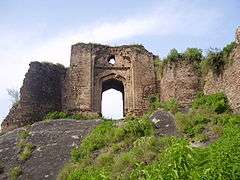
Pharwala Fort is about 40 km (25 mi) from Rawalpindi beyond Lehtrar road. It is a Gakhar fort built it in the 15th century on the ruins of a 10th-century Hindi Shahi Fort. Emperor Babur conquered it in 1519. Later, in 1825, Sikhs expelled Gakhars from this fort. Though in a crumbling state, it is still an attraction for castle lovers. The fort, situated in prohibited area, is only open to Pakistani visitors.
Architecture
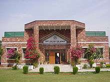
Rawalpindi has numerous sights of architectural masterpieces. A few of the heritage buildings are Purana Qil'aa (The Old Fort), Bagh Sardaran (Chief's Gardens), Haveli Sujaan Sigh (the remains of the Sikh Maharajas of Rawalpindi; the grand building has been converted into Fatima Jinnah Women University, which is the only female university established in the region).
Other ancient buildings include Jain Mandir, Jain Temple. Gordon College, an institution of high learning was set during the British Raj. The shrine of Hazrat Sakhi Shah Chan Charagh is one of the centres devotees flock to. An institution of high devotion and solace located near the famous Raja Bazar. He is the patron saint of the city and regarded as one of the two protectors of the twin cities, i.e., Islamabad and Rawalpindi, with Hazrat Bari Imam, his cousin brother. Similarly, Darbar of descendants of Hazrat Bari Imam i.e. Shah Miran Mustafa and Shah Sharif Badshah is located at Dhaman Syedan, Rawalpindi. Peer Syed Salamat Hussain Kazmi, a successor of Shah Miran Mustafa and Shah Sharif Muhammad, spread a message of peace, brotherhood and respect for humanity, as taught by his ancestors. Before the death of Peer Salamat Hussain Kazmi, he handed over all the religious responsibilities to his son Syed Talat Abbas Kazmi, who is adamant to the teachings of his father and forefathers.
Sports
The city has an array of stadiums and grounds to meet the needs of all the popular sports played in the country. Rawalpindi is home to some of the many recognized players in the history of Pakistani cricket and is known to produce high-quality fast-bowlers. The most notable of the lot is the maverick paceman Shoaib Akhtar, known as the Rawalpindi Express. Mohammad Aamir is another aspiring fast-bowler from Rawalpindi.
The Rawalpindi Cricket Stadium, built in 1992, has a grass pitch, floodlights, and an initial capacity to hold 20,000 spectators. In mid-2008 plans to increase its capacity were made but lack of adequate funds, and later the attack on Sri Lankan cricket team lead to abandoning of the project . The home team are the, one-time T20 champion, Rawalpindi Rams who enjoy fervent support and a considerable following for their swashbuckling brand of cricket. Apart from the RCS, there are many other cricket grounds in the city, including, Pindi Club Ground (home to the Pindi Club), KRL Stadium, CMTSD Cricket stadium as well as the Attock Oil Refinery cricket ground.
There are stadiums for hockey such as the Army Hockey Stadium, Army Signals Hockey ground as well as the Noor Station Ground Dhoke Hassu. A full-fledged, international hockey stadium, to be named after the hockey great Shahnaz Sheikh, is under construction near Municipal Road and was expected to be completed in late 2012.
There are stadiums for football including the Municipal Football stadium and the Army Football ground as well. The COD sports complex houses admirable facilities for indoor games.
Education

Rawalpindi boasts one of the highest literacy rates in the country. Its 80% is second only to the capital, Islamabad's 87%. The local populace can easily communicate in Urdu, and a significant portion also understands and speaks English very well. Punjabi is the mainstream local language; however other Punjabi dialects such as Saraiki, Hindko, Dhani and Pahari are also understood fairly well. Education in Rawalpindi can be divided into five levels: primary (grades one through five); middle (grades six through eight); high (grades nine and ten, leading to the Secondary School Certificate); intermediate (grades eleven and twelve, leading to a Higher Secondary School Certificate); and university programs leading to graduate and advanced degrees. Rawalpindi has both public and private educational institutions. Most educational institutions are gender-based, from primary to university level.
- Board of Intermediate and Secondary Education, Rawalpindi, established in 1978 to conduct SSC and HSSC examinations.
- Pir Mehr Ali Shah, Arid Agriculture University (also known as Barani University) is a renowned public university offering research and education in a number of fields and specializing in agriculture. It is on the Murree Road and is placed near other landmarks of the city including the Pindi cricket stadium, Nawaz Sharif Park, Rawalpindi Arts Council etc.
- Army Medical College is also known as the College of Medical Sciences and is on Abid Majid Road in Rawalpindi. Separate computer labs are available for post-graduate and undergraduate students. Other facilities in the campus include a library, cafeteria, college mosque, swimming pool, gym, squash court, and auditorium. There are seven hostels for male and female students near the college campus.
- College of Electrical and Mechanical Engineering is located on Grand Trunk Road in Rawalpindi, EME is the largest constituent college of NUST.[37] The campus includes all on-campus facilities, auditorium and conference hall, accommodation and mess facilities. The library is fully computerized, with a collection of 70,000 volumes.
- Military College of Signals is on Hamayun Road in Rawalpindi Cantt; it is the oldest constituent college of NUST, founded in 1947 after the independence of Pakistan to train the members of Pakistan Armed Forces. The College of Telecommunication Engineering is located on this campus. The MCS library is computerized, with over 55,000 volumes.
- Rawalpindi Medical College provides education in health care. It is a comprehensive, state-assisted institution. It was established in March 1974.
- The Rawalpindi Public Library was one of the earliest private public libraries organized after separation from India. The building was donated for a public library by the then-Deputy Commissioner Major Davis on the initiative of philanthropist Khurshid Anwar Jilani, an attorney, writer and social worker. However, the building was confiscated for election and political campaigning during the last days of Field Marshal Ayub Khan's reign, and rare manuscripts and artifacts were taken away by the influential.
- Fatima Jinnah Women University The first ever Women University of Pakistan
- Gordon College Rawalpindi is one of the oldest colleges located in the heart of the city. It was established in 1872. The college has beautiful colonial style campus. College offers Graduate and master's degree programa. Historically the college has been known for its cultural activities as it has one of the largest auditorium in which stage dramas and other programs were regularly conducted. College remained co-education till early 70's but after Zia-ul-Haq regime it was converted to boys only. Several notable people are graduates of this college.
Transport
There are many ways to get in and around Rawalpindi. Public transport is diverse, ranging from yellow taxis, auto-rickshaws, mini-buses and even tongas (horse-drawn carriages). Due to the lack of street planning, traffic jams are found even on smaller roads. For inter-city travel, air-conditioned and non-air-conditioned buses and coaches are regularly available to many destinations in Pakistan.
Bus rapid transit
The work on the Rawalpindi-Islamabad Metrobus Service was inaugurated in February 2014 and the system launched on 4 June 2015. The Route begins at Saddar, Rawalpindi and ends at Secretariat, Islamabad. The last stop in Rawalpindi is at the end of Stadium Road.
Rail
The Rawalpindi central railway station that allows travel to every major city in Pakistan. In addition to freight, Pakistan Railways provides passenger rail service throughout the day, with train coaches that have air-conditioning in first-class.
The Rawalpindi Railway Station is in the Saddar. It was built in the 1880s by the government of British India. The British built many railways across South Asia to facilitate trade and to consolidate their rule.
The routes the British built from Rawalpindi, which contained a major military base, linked to Lahore, Karachi, Peshawar, Quetta, Multan, Faisalabad, Hyderabad, Sindh, Sukkur, Bahawalpur, Jhelum, Gujrat, Gujranwala, Kohat, Khanewal, Nawabshah, Nowshera and the Malakand Pass.
Airport

Benazir Bhutto International Airport is at Chaklala, which is a part of Rawalpindi. The airport is served by over 25 airlines, both national and international. Pakistan International Airlines (PIA), the national carrier, has numerous routes, with many domestic and international flights every day. Construction on the new Rawalpindi/Islamabad international airport has been started near the town of Fateh Jang approximately 25 kilometres (20 mi) from both cities.
Roads
The main road running through Rawalpindi is the Peshawer Road. It passes through the city in an east-west direction linking up with the N-5. Another major artery in Rawalpindi is the Murree Road. It runs south-north through the city (after branching from Peshawar Road) and continues to the hill station of Murree. Murree Road is one of the busiest in the Punjab Province of Pakistan.
Rawalpindi is on the ancient Grand Trunk Road (also known as G.T. Road or, more recently, N-5) which links Rawalpindi to nearly every major city in northern and southern Pakistan, from Karachi, to Peshawar, Lahore, Quetta, Multan, Faisalabad, Hyderabad, Sukkur, Bahawalpur, Jhelum, Gujrat, Gujranwala, Kohat, Khanewal, Nawabshah, Nowshera and the Malakand Pass.
The city is served by two nearby six-lane motorways: M2 (Lahore-Islamabad) and M1 (Islamabad-Peshawar), which were completed in the 1990s. Somewhat further away is the famous Karakoram Highway, the world's highest international road, which connects Pakistan to China.
Bus Stations
General Bus Stand, Pir Wadhai is the principal station for interstate buses and other public vehicles which regularly transports passengers. Daewoo Express has a terminal on Peshawar Road along with Niazi Express.
Telecommunication
The Pakistan Telecommunication Company (PTCL) provides the main network of landline telephone with minority shares of other operators. All major mobile phone companies operating in Pakistan provide service in Rawalpindi.
Pakistan's broadband revolution has had a significant impact on telecommunications in Rawalpindi. The city, along with other major cities of Pakistan, enjoys a widespread coverage from WiFi and WiMAX operators, with Wateen, WiTribe, Qubee having the most shares. DSL internet also has a major coverage in the city with NayaTel and PTCL the main stakeholders.
A high speed 3G Network, EVO Nitro, was set up by PTCL with maximum speeds of 9.3 Mbit/s to add to the, already established, EVO 3G Network. Though localized, it is the first instance in the history of telecommunication that EVDO RevB technology was commercially launched.
The city has an optic fibre network, with nearly all major commercial and household areas covered. This network allows the local residents to enjoy maximum internet speeds of 50 Mbps, IPTV services and along with high-quality telephony services.[38] Nayatel and PTCL are the market-leaders in the 'triple-play' service. While another operator (DHA-Teleman) has a network and currently serves all the military residential and civil areas.
Parks

- Ayub National Park formerly known as 'Topi Rakh' (keep the hat on) is by the old Presidency, between the Murree Brewery Co. and Grand Trunk Road. It covers an area of about 2,300 acres (930 ha) and has a play area, lake with boating facility, an aquarium, a garden-restaurant and an open-air theater. This park hosts "The Jungle Kingdom" which is particularly popular among young residents.[39]
- Liaquat Bagh, formerly known as the "company bagh" (East India Company's Garden), is of great historical interest. The first prime minister of Pakistan, Liaquat Ali Khan, was assassinated here in 1950. Pakistan's Prime Minister Banazir Bhutto was assassinated here on 27 December 2007. She was the youngest elected prime minister in the world.
- Rawalpindi Public Park (also known as Nawaz Sharif Park) is located on Murree Road. The park was opened in 1991. It has a play area for children, lawns, fountains and flower beds. A cricket stadium was built in 1992 opposite the public park. The 1996 World Cup matches were held on this cricket ground.
- Rawalpindi Golf Course was completed in 1926 by Rawalpindi Golf Club, one of the oldest golf clubs of Pakistan. The facility was initially developed as a nine-hole course. After several phases of development, it is now a 27-hole course and the biggest in Pakistan.[40] From the clubhouse, there is a panoramic view of Faisal Mosque, the twin cities of Islamabad and Rawalpindi, and the course itself. Major golf tournaments are regularly held here.
- Playland is another public park parallel to Ayub Park; its nearness to many classy colonies and housing schemes makes this wonderland an attractive hotspot during the holidays.
- Liaquat National Bagh
- Jinnah Park
- Rumi Park
- Army Race Course Ground
- Children Park
- 502 (Workshop) Park
- Rose and Jasmine Garden
- Triangular Park (Tikoona Baagh) located just opposite to Military Hospital Rawalpindi.
Media
Rawalpindi, being so close to the capital, has an active media and newspaper climate. There are over a dozen of newspaper companies based in the city including Daily Nawa-i-Waqt, Daily Jang, Daily Asas, The Daily Sada-e-Haq, Daily Express, Daily Din, Daily Aajkal Rawalpindi, Daily Islam, and Daily Pakistan in Urdu and Dawn, Express Tribune, Daily Times, The News International and The Nation in English. The prominent online newspaper of the city is Rawalpindi Times (راولپنڈی ٹائمز).
There are a large number of Cable TV service providers in the city. Pakistan Broadcasting Corporation has a centre in Rawalpindi Television channels based in Rawalpindi include:
- ATV
- Lights Asia
- Aapna Channel
- Pothohari TV (Regional language channel)
- City 51
- Pahariwood Network (Regional language channel)
- K2 TV
- Oxygene TV
Hospitals
Medical facilities are readily accessible in Rawalpindi being the largest city in a 150 kilometer radius, being the district headquarters and due to its importance as a military headquarters. The following is a list of large hospitals:-
- Al-Shifa Eye Hospital
- Begum Akhtar Rukhsana Memorial Trust Hospital
- Benazir Bhutto Hospital (also known as Center Hospital)
- Bilal Hospital
- Bangash Clinic
- Combined Military Hospital Rawalpindi (also known as CMH)
- Cantonment Board Hospital Rawalpindi
- District Headquarter Hospital Rawalpindi (also known as DHQ Hospital)
- Fauji Foundation Hospital
- Jinnah Memorial Hospital
- Holy Family hospital
- Maryam Memorial Hospital
- Military Hospital Rawalpindi (also known as MH)
- Quaid-e-Azam International Hospital
- Railway Hospital
- Valley Clinic
- Safari Hospital
See also
- Demography of Rawalpindi District
- Climate of Rawalpindi
- Lal Haveli
- Rawalpindi Gazetteer
- Christ Church Rawalpindi
- Military Hospital Rawalpindi
- Benazir Bhutto Road
- Pakhral
- Janjua
- Jajja Rajput
- Dhamial Rajputs
- Dhamial
- Adyala jail
References
- ↑ http://www.pbs.gov.pk/sites/default/files//tables/POPULATION%20SIZE%20AND%20GROWTH%20OF%20MAJOR%20CITIES.pdf
- ↑ "Rawalpindi: History behind a bustling city". 2012-08-26. Retrieved 2016-09-24.
- ↑ "Rawalpindi: History behind a bustling city". Retrieved 2016-06-18.
- ↑ Junaidi, Ikram (2015-10-23). "What is being built on GHQ land?". www.dawn.com. Retrieved 2016-06-18.
- ↑ "The lost Jewish history of Rawalpindi". Retrieved 2016-09-24.
- ↑ Planet, Lonely. "History of Islamabad & Rawalpindi - Lonely Planet Travel Information". www.lonelyplanet.com. Retrieved 2016-06-18.
- ↑ Abbasi, Aamir Yasin | Kashif (2015-07-08). "Rawalpindi-Islamabad metro bus project not waterproof". www.dawn.com. Retrieved 2016-06-18.
- 1 2 "Furniture". Scribd. Retrieved 2016-09-24.
- ↑ "New Islamabad Airport: 'Faulty' airport design stirs Senate debate - The Express Tribune". The Express Tribune. 2016-06-18. Retrieved 2016-06-18.
- ↑ Kalhoro, Zulfiqar Ali (2015-06-13). "The havelis of Potohar: Pakistan's opportunity to promote heritage tourism". www.dawn.com. Retrieved 2016-06-18.
- ↑ Reporter, A (2013-03-20). "NCA to document Potohar history". www.dawn.com. Retrieved 2016-06-18.
- ↑ Shamil, Taimur (2015-10-16). "The temples of Rawalpindi: Old wisdom in a new world". Retrieved 2016-09-24.
- ↑ "Takshashila – World's Oldest University". Hitxp.com. Retrieved 20 August 2012.
- ↑ Dutt, Nalinaksha (1998). Buddhist Sects in India. Motilal Banarsidass Publ. ISBN 978-8120804289.
- 1 2 3 "Imperial Gazetter of India, Volume 21, page 272 - Imperial Gazetteer of India - Digital South Asia Library". Dsal.uchicago.edu. 2013-02-18. Retrieved 22 November 2013.
- ↑ "UK tested poison gas on Indian soldiers". Usatoday.Com. 2007-09-01. Retrieved 22 November 2013.
- ↑ "Benazir Bhutto killed in attack". BBC. 2007-12-27. Retrieved 2007-12-31.
- ↑ Siddiqui, Salman. "No Morning English Daily Carried the News of Bhutto's Hanging". Daily Dawn. Retrieved 20 August 2012.
- ↑ "Pakistan Air Force". Defense General. Retrieved 20 August 2012.
- ↑ "PAF Active Bases". Pakistan Air Force. Retrieved 20 August 2012.
- ↑ "It Be Blog". Momers.tumblr.com. Retrieved 23 December 2011.
- ↑ "Picasa Web Albums - Omer Sheikh". Picasaweb.google.com. 2010-07-23. Retrieved 23 December 2011.
- 1 2 "Climate: Rawalpindi - Climate graph, Temperature graph, Climate table". Climate-Data.org. Retrieved 7 September 2013.
- ↑ "Weather History for Islamabad, Pakistan | Weather Underground". Wunderground.com. 2006-10-13. Retrieved 22 November 2013.
- ↑ Malik Riaz, Chief Executive of Bahria Town (April 14, 2005). "Housing boom a solution to Pakistan's problems". Speech given at the NAB conference in Islamabad. Daily Times. Retrieved May 24, 2009.
- ↑ "Murree Brewery". Murree Brewery. Retrieved 22 November 2013.
- ↑ http://www.rootsschool.edu.pk/contact.html
- ↑ "Rmy Welfare Trust - Contact". Awt.com.pk. Retrieved 2015-05-14.
- ↑ "Attock Refinery Limited - Company Profile". Arl.com.pk. 1915-01-22. Retrieved 2015-05-14.
- ↑ "DHA Islamabad-Rawalpindi". Dhai-r.com.pk. 2011-12-08. Retrieved 2015-05-14.
- ↑ "About Bahria Town Rawalpindi - Bahria Town - Your Lifestyle Destination". Bahriatown.com. Retrieved 22 November 2013.
- ↑ "Cinepax". Cinepax. 2011-12-02. Retrieved 23 December 2011.
- ↑ Abbasi, Obaid (2011-11-10). "Eid festivity: Picnics, sightseeing and a lot of swings for the young ones – The Express Tribune". Tribune.com.pk. Retrieved 23 December 2011.
- ↑ "Digital fountain installed at Jinnah Park | Provinces". Dawn.Com. 2011-08-22. Retrieved 23 December 2011.
- ↑ Arena, The. "The Arena: About Us". Bahria Construction.
- ↑ "Pakistan's first gold class 3D cinema: 'The Arena' opened at Bahria Town". The Nation.
- ↑ "NUST". Nust.edu.pk. Retrieved 22 November 2013.
- ↑ Nayatel, Communications. "Nayatel Coverage Area". Nayatel.pk. Retrieved 22 November 2013.
- ↑ "Two tiger cubs draw crowds to Rawalpindi park – The Express Tribune". Tribune.com.pk. Retrieved 23 December 2011.
- ↑ M.M. Ahmed 1985.
Bibliography
- M.M. Ahmed (1985), Teenager, Volume 16, The University of Virginia, p. 11
External links
| Wikisource has the text of the 1911 Encyclopædia Britannica article Rawalpindi. |
- CDG Rawalpindi, Official Website
- Rawalpindi (Pakistan) -- Britannica Online Encyclopedia
 Rawalpindi travel guide from Wikivoyage
- Rawalpindi at DMOZ
| Federal/National | ||
|---|---|---|
| Former (federal/national) | ||
| Provincial | ||
| Territorial | ||
| |||||||||||||||||||||||||||||||||
| |||||||||||||||||||||||||||||||||
| |||||||||||||||||||||||||||||||||
| |||||||||||||||||||||||||||||||||
| |||||||||||||||||||||||||||||||||
| |||||||||||||||||||||||||||||||||