Ransom Place Historic District
|
Ransom Place Historic District | |
|
Camp Street in Ransom Place, April 2011 | |
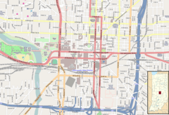    | |
| Location | Roughly bounded by 10th, St. Clair, West and Camp Sts., Indianapolis, Indiana |
|---|---|
| Coordinates | 39°46′44″N 86°10′11″W / 39.77889°N 86.16972°WCoordinates: 39°46′44″N 86°10′11″W / 39.77889°N 86.16972°W |
| Area | 6 acres (2.4 ha) |
| Architectural style | Queen Anne, L-Plan Cottage |
| NRHP Reference # | 92001650[1] |
| Added to NRHP | December 10, 1992 |

Ransom Place Historic District is a national historic district located at Indianapolis, Indiana. The district encompasses 74 contributing buildings in a historically African-American residential section of Indianapolis. It was developed between about 1890 and 1942, and include representative examples of Queen Anne style architecture. Notable buildings include the Light of the World Christian Church (1910).[2]
It was listed on the National Register of Historic Places in 1992.[1]
References
- 1 2 National Park Service (2010-07-09). "National Register Information System". National Register of Historic Places. National Park Service.
- ↑ "Indiana State Historic Architectural and Archaeological Research Database (SHAARD)" (Searchable database). Department of Natural Resources, Division of Historic Preservation and Archaeology. Retrieved 2016-08-01. Note: This includes Suzanne T. Rollins (April 1992). "National Register of Historic Places Inventory Nomination Form: Ransom Place Historic District" (PDF). Retrieved 2016-08-01., Site map, and Accompanying photographs
| Wikimedia Commons has media related to Ransom Place Historic District. |

This article is issued from Wikipedia - version of the 12/2/2016. The text is available under the Creative Commons Attribution/Share Alike but additional terms may apply for the media files.