Ralston, Wyoming
| Ralston, Wyoming | |
|---|---|
| CDP | |
 Location of Ralston, Wyoming | |
 Ralston, Wyoming Location in the United States | |
| Coordinates: 44°42′52″N 108°52′32″W / 44.71444°N 108.87556°WCoordinates: 44°42′52″N 108°52′32″W / 44.71444°N 108.87556°W | |
| Country | United States |
| State | Wyoming |
| County | Park |
| Area | |
| • Total | 5.6 sq mi (14.6 km2) |
| • Land | 5.6 sq mi (14.6 km2) |
| • Water | 0.0 sq mi (0.0 km2) |
| Elevation | 4,554 ft (1,388 m) |
| Population (2010)[1] | |
| • Total | 280 |
| • Density | 50/sq mi (19/km2) |
| Time zone | Mountain (MST) (UTC-7) |
| • Summer (DST) | MDT (UTC-6) |
| ZIP code | 82440 |
| Area code(s) | 307 |
| FIPS code | 56-63465[2] |
| GNIS feature ID | 1593141[3] |
Ralston is a census-designated place (CDP) in Park County, Wyoming, United States. The population was 280 at the 2010 census.
Geography
Ralston is located at 44°42′52″N 108°52′32″W / 44.71444°N 108.87556°W (44.714544, -108.875598).[4]
According to the United States Census Bureau, the CDP has a total area of 5.6 square miles (14.6 km²), all of it land.[5]
History
Ralston post office was established March 16, 1907.[6]
Demographics
As of the census[2] of 2000, there were 233 people, 96 households, and 74 families residing in the CDP. The population density was 41.3 people per square mile (16.0/km²). There were 101 housing units at an average density of 17.9/sq mi (6.9/km²). The racial makeup of the CDP was 95.71% White, 1.29% Native American, 2.58% from other races, and 0.43% from two or more races. Hispanic or Latino of any race were 6.44% of the population.
There were 96 households out of which 20.8% had children under the age of 18 living with them, 68.8% were married couples living together, 7.3% had a female householder with no husband present, and 22.9% were non-families. 17.7% of all households were made up of individuals and 8.3% had someone living alone who was 65 years of age or older. The average household size was 2.43 and the average family size was 2.70.
In the CDP the population was spread out with 19.3% under the age of 18, 5.2% from 18 to 24, 24.0% from 25 to 44, 31.8% from 45 to 64, and 19.7% who were 65 years of age or older. The median age was 46 years. For every 100 females there were 95.8 males. For every 100 females age 18 and over, there were 97.9 males.
The median income for a household in the CDP was $40,893, and the median income for a family was $41,429. Males had a median income of $29,091 versus $28,333 for females. The per capita income for the CDP was $22,320. None of the population or families were below the poverty line.
References
- ↑ "2010 City Population and Housing Occupancy Status". U.S. Census Bureau. Retrieved July 13, 2012.
- 1 2 "American FactFinder". United States Census Bureau. Retrieved 2008-01-31.
- ↑ "US Board on Geographic Names". United States Geological Survey. 2007-10-25. Retrieved 2008-01-31.
- ↑ "US Gazetteer files: 2010, 2000, and 1990". United States Census Bureau. 2011-02-12. Retrieved 2011-04-23.
- ↑ "2010 Wyoming Place Names". U.S. Census Bureau. Retrieved July 13, 2012.
- ↑ Gallagher, John S. and Patera, Alan H. (1980) Wyoming Post Offices, 1850–1980, p. 100. Burtonsville, Maryland: The Depot.
Municipalities and communities of Park County, Wyoming, United States | ||
|---|---|---|
| Cities | 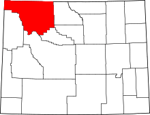 | |
| Towns | ||
| CDPs | ||
| Unincorporated communities | ||
| Ghost town | ||
| Footnotes | ‡This populated place also has portions in an adjacent county or counties | |