Rajhradice
| Rajhradice | |||
|---|---|---|---|
| Municipality | |||
|
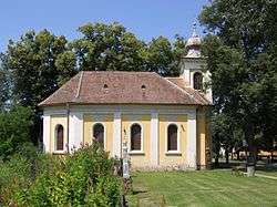
Chapel of Saint Scholastica | |||
| |||
 Rajhradice | |||
| Coordinates: 49°5′27″N 16°37′54″E / 49.09083°N 16.63167°ECoordinates: 49°5′27″N 16°37′54″E / 49.09083°N 16.63167°E | |||
| Country |
| ||
| Region | South Moravian | ||
| District | Brno-Country | ||
| Area | |||
| • Total | 5.43 km2 (2.10 sq mi) | ||
| Elevation | 186 m (610 ft) | ||
| Population (1.1.2012) | |||
| • Total | 1,290 | ||
| • Density | 240/km2 (620/sq mi) | ||
| Postal code | 664 61 | ||
| Website | http://www.rajhradice.cz | ||


Rajhradice is a village and municipality (obec) in Brno-Country District in the South Moravian Region of the Czech Republic.
The municipality covers an area of 5.43 square kilometres (2.10 sq mi), and has a population of 1,250.
Rajhradice lies approximately 13 kilometres (8 mi) south of Brno and 195 km (121 mi) south-east of Prague.
References
| Wikimedia Commons has media related to Rajhradice. |
This article is issued from Wikipedia - version of the 4/7/2016. The text is available under the Creative Commons Attribution/Share Alike but additional terms may apply for the media files.