Rainish Eilean Mòr
| Gaelic name | Rainish Eilean Mòr |
|---|---|
| Meaning of name | large island of Rainish |
| Location | |
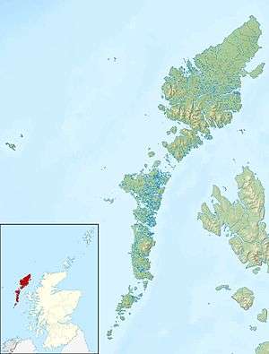 Rainish Eilean Mòr Rainish Eilean Mòr shown within the Outer Hebrides | |
| OS grid reference | NB386280 |
| Physical geography | |
| Island group | Freshwater |
| Area | 27 hectares (67 acres)[1] |
| Highest elevation | c. 70 m[2] |
| Administration | |
| Sovereign state | United Kingdom |
| Country | Scotland |
| Council area | Na h-Eileanan Siar |
| Demographics | |
| Population | 0 |
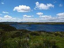
Coordinates: 58°9′41″N 6°26′43″W / 58.16139°N 6.44528°W Rainish Eilean Mòr is an uninhabited island in Loch Orasaigh, north of the village of Leurbost in the area of South Lochs on the island of Lewis. At 27 hectares (67 acres) in extent, it is one of Scotland's larger freshwater islands, but it is probably the largest relative to the size of the body of water in which it sits, Loch Orasaigh being only about 125 hectares (310 acres) all told.
The entirety of the loch has been an SSSI since 1983 and the island's perimeter and the neighbouring islet to the south west have woodland cover including the species of Rowan, Aspen, Downy Birch, Grey Willow and Sallow Willow. The underlying geology is Lewisian Gneiss overlain by peaty podzols and gleys.[1]
The Gaelic name of the island, means "large island of Rainish" and is taken from the surrounding area, which itself means "Roe deer headland", from Old Norse.[3]
References
- Western Isles Native Woodland Restoration Survey Report. (pdf) (2008) Comhairle nan Eilean Siar/SNH. Stornoway. Retrieved 23 January 2010.
Notes
- 1 2 SNH (2008) p. 18.
- ↑ Ordnance Survey. Get-a-map (Map). 1:25,000. Leisure. Ordinance Survey. Retrieved 21 August 2013.
- ↑ Mac an Tàilleir, Iain (2003) Ainmean-àite/Placenames. (pdf) Pàrlamaid na h-Alba. Retrieved 26 August 2012.