Rainbow Falls Provincial Park
| Rainbow Falls Provincial Park | |
|---|---|
|
IUCN category II (national park) | |
|
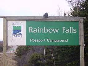
Rainbow Falls sign on HWY 17, east of Rossport, ON c. 1991 | |
 | |
| Location | Ontario, Canada |
| Nearest city | Schreiber |
| Coordinates | 48°50′32″N 87°23′43″W / 48.84222°N 87.39528°WCoordinates: 48°50′32″N 87°23′43″W / 48.84222°N 87.39528°W[1] |
| Area | 575 ha (1,420 acres) |
| Established | 1963[2] |
| Governing body | Ontario Parks |
|
www | |
Rainbow Falls Provincial Park is a recreation-class provincial park within the Ontario Parks system. This 575-hectare (1,421-acre) park includes the historic Rossport Campground which is near the fishing community of Rossport, Ontario.[3] This park offers campers a choice of camping on the calm shorelines of Whitesand Lake in the main park, or on the rough and rocky shorelines of Lake Superior with their two campgrounds which dot Highway 17. Whitesand Lake campground offers scenic trails to the falls on the Hewitson River and also the Back-40 trail goes through an abandoned campground to a panoramic view of the Lake Superior shoreline. The Rainbow Falls Trail has a waterside boardwalk trail. This park runs a small Natural Heritage Education program with a small visitor centre on the beach and an interpretive program offered on Saturdays and Sundays during the summer months.
References
- ↑ "Toporama - Topographic Map Sheet 42D14". Atlas of Canada. Natural Resources Canada. Retrieved 2009-11-10.
- ↑ "Rainbow Falls Provincial Park - Recreation". Protected Planet. Archived from the original on 27 August 2014.
- ↑ "Rainbow Falls". Ontario Parks. 2003-06-04. Archived from the original on 2009-05-20. Retrieved 2009-11-10.
External links
| National parks |  | |
|---|---|---|
| Provincial parks | ||
| Conservation areas | ||
| UNESCO Biosphere Reserves | ||
| National Historic Sites of Canada | ||
| Other areas | ||