Raga, South Sudan
| Raga | |
|---|---|
| Town | |
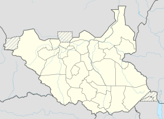 Raga Location in South Sudan | |
| Coordinates: SS 08°28′12″N 25°40′48″E / 8.47000°N 25.68000°ECoordinates: SS 08°28′12″N 25°40′48″E / 8.47000°N 25.68000°E | |
| Country |
|
| State | Lol State |
| County | Raga County |
| Elevation | 1,788 ft (545 m) |
| Population (2010 Estimate) | |
| • Total | 3,700 |
| Time zone | EAT (UTC+3) |
Raga also called Raja is a town in South Sudan and the capital of Lol State.
Location
The town is located in Raga County, Lol State, in the northwestern corner of South Sudan,[1] near the International borders with the Republic of Sudan and the Central African Republic. It is located approximately 300 kilometres (190 mi), by road, northwest of Wau, the capital of Western Bahr el Ghazal State. This location lies approximately 950 kilometres (590 mi), by road, northwest of Juba, the capital and largest city in that country.[2] The coordinates of Raga are: 8° 28' 12.00"N, 25° 40' 48.00"E (Latitude: 8.4700; Longitude: 25.6800). Raga's average elevation is 545 metres (1,788 ft) above sea level.[3]
Climate
Köppen-Geiger climate classification system classifies its climate as tropical wet and dry (Aw).
| Climate data for Raga (1961–1990) | |||||||||||||
|---|---|---|---|---|---|---|---|---|---|---|---|---|---|
| Month | Jan | Feb | Mar | Apr | May | Jun | Jul | Aug | Sep | Oct | Nov | Dec | Year |
| Record high °C (°F) | 40.6 (105.1) |
41.6 (106.9) |
43.7 (110.7) |
42.7 (108.9) |
41.5 (106.7) |
39.0 (102.2) |
36.7 (98.1) |
36.2 (97.2) |
36.4 (97.5) |
38.2 (100.8) |
38.7 (101.7) |
40.3 (104.5) |
43.7 (110.7) |
| Average high °C (°F) | 34.2 (93.6) |
35.8 (96.4) |
37.3 (99.1) |
37.5 (99.5) |
35.1 (95.2) |
32.5 (90.5) |
30.7 (87.3) |
30.8 (87.4) |
31.8 (89.2) |
33.2 (91.8) |
34.6 (94.3) |
34.2 (93.6) |
34.0 (93.2) |
| Daily mean °C (°F) | 22.1 (71.8) |
24.8 (76.6) |
28.0 (82.4) |
29.3 (84.7) |
28.7 (83.7) |
26.5 (79.7) |
25.7 (78.3) |
25.7 (78.3) |
26.1 (79) |
26.4 (79.5) |
25.0 (77) |
23.2 (73.8) |
26.0 (78.8) |
| Average low °C (°F) | 11.6 (52.9) |
13.8 (56.8) |
18.7 (65.7) |
21.0 (69.8) |
22.2 (72) |
20.6 (69.1) |
20.6 (69.1) |
20.5 (68.9) |
20.3 (68.5) |
19.6 (67.3) |
15.4 (59.7) |
12.2 (54) |
18.0 (64.4) |
| Record low °C (°F) | 4.2 (39.6) |
7.5 (45.5) |
10.4 (50.7) |
11.0 (51.8) |
17.2 (63) |
17.3 (63.1) |
17.1 (62.8) |
17.8 (64) |
17.3 (63.1) |
11.0 (51.8) |
7.5 (45.5) |
3.6 (38.5) |
3.6 (38.5) |
| Average precipitation mm (inches) | 0.5 (0.02) |
1.6 (0.063) |
19.7 (0.776) |
48.8 (1.921) |
123.4 (4.858) |
167.1 (6.579) |
227.4 (8.953) |
254.9 (10.035) |
176.0 (6.929) |
84.4 (3.323) |
37.8 (1.488) |
0.0 (0) |
1,141.6 (44.945) |
| Average precipitation days (≥ 0.1 mm) | 0.1 | 0.5 | 1.9 | 4.8 | 10.3 | 11.1 | 15.1 | 16.1 | 12.7 | 7.8 | 0.7 | 0.0 | 81.1 |
| Average relative humidity (%) | 32 | 33 | 39 | 50 | 65 | 71 | 75 | 75 | 71 | 61 | 44 | 37 | 54.4 |
| Mean monthly sunshine hours | 300.7 | 263.2 | 254.2 | 249.0 | 241.8 | 207.0 | 189.1 | 207.7 | 207.0 | 235.6 | 273.0 | 313.1 | 2,941.4 |
| Percent possible sunshine | 83 | 80 | 69 | 67 | 62 | 56 | 49 | 52 | 76 | 63 | 77 | 86 | 68 |
| Source #1: NOAA[4] | |||||||||||||
| Source #2: Climate Charts[5] | |||||||||||||
Overview
Raga is a small but growing town that straddles the Raga River. Life in Raga has been described by a native author, Naomi Baki, who was raised in Raga till she was forced to leave the city at the age of 14.[6]
Population
It is estimated that the population of Raga was 3,700 in 2010.[7]
Transport
From Raga, the main road north (B41) leads to Al Murrah in the Republic of Sudan. B41-South leads to Wau, South Sudan. Raga is also served by Raga Airport.
External links
- Location of Raga At Google Maps
- Profile At Places-in-the-world.com
- Firsthand Account of Visit To Raga, South Sudan
See also
References
- ↑ South Sudan army says “bandits” repulsed from Lol state capital Sudan Tribune
- ↑ Esstimated Road Distance Between Juba And Raga With Map
- ↑ Raga's Elevation Is 1,788 Feet Above Sea Level
- ↑ "Raga Climate Normals 1961–1990". National Oceanic and Atmospheric Administration. Retrieved January 18, 2016.
- ↑ "Raga, Sudan: Climate, Global Warming, and Daylight Charts and Data". Climate Charts. Retrieved 25 August 2013.
- ↑ Read Naomi Baki, Je suis encore vivante, dix ans d'errance, Dix ans d'errance du Soudan à l'Europe, Paris, Le Cerf, 2013.
- ↑ Estimated Population In 2010