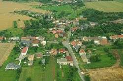
Radvanice (Přerov District)
| Radvanice | |||
|---|---|---|---|
| Municipality | |||
 | |||
| |||
 Radvanice | |||
| Coordinates: 49°30′58″N 17°29′9″E / 49.51611°N 17.48583°ECoordinates: 49°30′58″N 17°29′9″E / 49.51611°N 17.48583°E | |||
| Country |
| ||
| Region | Olomouc | ||
| District | Přerov | ||
| Area | |||
| • Total | 2.91 km2 (1.12 sq mi) | ||
| Elevation | 268 m (879 ft) | ||
| Population (2012) | |||
| • Total | 290 | ||
| • Density | 100/km2 (260/sq mi) | ||
| Postal code | 751 21 | ||
| Website | http://www.obecradvanice.cz | ||


Radvanice is a village and municipality (obec) in Přerov District in the Olomouc Region of the Czech Republic.
The municipality covers an area of 2.91 square kilometres (1.12 sq mi), and has a population of 289 (as at 3 July 2006).
Radvanice lies approximately 8 kilometres (5 mi) north of Přerov, 20 km (12 mi) south-east of Olomouc, and 230 km (143 mi) east of Prague.
References
| Wikimedia Commons has media related to Radvanice (Přerov District). |
This article is issued from Wikipedia - version of the 4/7/2016. The text is available under the Creative Commons Attribution/Share Alike but additional terms may apply for the media files.