Rabinal
| Rabinal | |
|---|---|
| Nickname(s): Rabinal | |
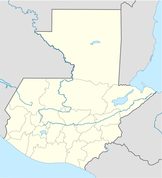 Rabinal Location in Guatemala | |
| Coordinates: 15°4′4.70″N 90°29′20.50″W / 15.0679722°N 90.4890278°WCoordinates: 15°4′4.70″N 90°29′20.50″W / 15.0679722°N 90.4890278°W | |
| Country |
|
| Department |
|
| Founded | 1537 |
| Government | |
| • Mayor | Luis Morales (PP) |
| Area | |
| • Total | 304 km2 (117 sq mi) |
| Population (2002) | |
| • Total | 45,000 |
| Climate | Aw |
| Website | Official Website of the Municipality of Rabinal |
Rabinal is a small town located in the Guatemalan department of Baja Verapaz, at 15°5′4.70″N 90°29′20.50″W / 15.0846389°N 90.4890278°W. It serves as the administrative seat for the surrounding municipality of the same name. The municipality covers 504 km² and, in 2004, had a population of around 36,000. The local people are predominantly Achi Maya Native Americans who speak the Achi Maya language.
History
The settlement of Rabinal is founded by Bartolomé de Las Casas, during his expedition into the lands of the Maya in 1537.
Spanish conquest and the Dominican friars
On his second visit to Guatemala, in 1537, friar Bartolome de las Casas, O.P. wanted to employ his new method of conversion based on two principles: 1) to preach the Gospel to all men and treat them as equals, and 2) to assert that conversion must be voluntary and based on knowledge and understanding of the Faith. It was important for Las Casas that this method be tested without meddling from secular colonists, so he chose a territory in the heart of Guatemala where there were no previous colonies and where the natives were considered fierce and war-like. Because of the fact that the land had not been possible to conquer by military means, the governor of Guatemala, Alonso de Maldonado, agreed to sign a contract promising that if the venture was successful he would not establish any new encomiendas in the area. Las Casas's group of friars established a Dominican presence in Rabinal, Sacapulas and Cobán, reaching as far as Chahal. Through the efforts of Las Casas' missionaries the so-called "Land of War" came to be called "Verapaz", "True Peace". Las Casas's strategy was to teach Christian songs to merchant Indian Christians who then ventured into the area. In this way he was successful in converting several native chiefs, among them those of Atitlán and Chichicastenango, and in building several churches in the territory named Alta Verapaz. These congregated a group of Christian Indians in the location of what is now the town of Rabinal.[1] In 1538 Las Casas was recalled from his mission by Bishop Francisco Marroquin who wanted him to go to Mexico and then on to Spain in order to seek more Dominicans to assist in the mission.[2]
In 1572 construction finished on the grand colonial Catholic Baroque church, a project begun by then Bishop of Chiapas Bartolomé de Las Casas.
During the mid-19th century Charles-Étienne Brasseur de Bourbourg, serving as Parish Priest, conducts some of the first ethnographic studies of the highland Maya and collects folk tales and documents making the first translations into European languages, of the Rabinal Achí. As of 1850, the population was estimated to be 6,500.[3]
Rabinal is the site of some of the bloodiest massacres in Guatemala's Civil War, including those of Plan de Sánchez and Río Negro. The actual town of Rabinal was also the site of a large-scale massacre during the Independence Day celebration of 1981.
Doctrine of Order of Preachers

After the conquest, the Spanish crown focused on the Catholic indoctrination of the natives. Human settlements founded by royal missionaries in the New World were called "Indian doctrines" or simply "doctrines". Originally, friars had only temporary missions: teach the Catholic faith to the natives, and then transfer the settlements to secular parishes, just like the ones that existed in Spain at the time; the friars were supposed to teach Spanish and Catholicism to the natives. And when the natives were ready, they could start living in parishes and contribute with mandatory tithing, just like the people in Spain.[4]
But this plan never materialized, mainly because the Spanish crown lost control of the regular orders as soon as their friars set course to America. Shielded by their apostolic privileges granted to convert natives into Catholicism, the missionaries only responded to their order local authorities, and never to that of the Spanish government or the secular bishops. The orders local authorities, in turn, only dealt with their own order and not with the Spanish crown. Once a doctrine had been established, the protected their own economic interests, even against those of the King and thus, the doctrines became Indian towns that remains unaltered for the rest of the Spanish colony.
The doctrines were founded at the friars discretion, given that they were completely at liberty to settle communities provided the main purpose was to eventually transfer it as a secular parish which would be tithing of the bishop. In reality, what happened was that the doctrines grew uncontrollably and were never transferred to any secular parish; they formed around the place where the friars had their monastery and from there, they would go out to preach to settlements that belong to the doctrine and were called "annexes", "visits" or "visit towns". Therefore, the doctrines had three main characteristics:
- they were independent from external controls (both ecclesiastical and civilian )
- were run by a group of friars
- had a relatively larger number of annexes.[4]
The main characteristic of the doctrines was that they were run by a group of friars, because it made sure that the community system would continue without any issue when one of the members died.[5]
In 1638, the Order of Preachers split their large doctrines —which meant large economic benefits for them— in groups centered around each one of their six monasteries, and the Rabinal doctrine was moved under the Santiago de los Caballeros de Guatemala monastery jurisdiction:[6]
| Monastery | Doctrines |
|---|---|
| Santiago de los Caballeros de Guatemala |
|
Culture
The town of Rabinal boasts a large, colonial-era baroque church. Alongside the church is a small municipal museum, with exhibits on the local culture (particularly native healing techniques) and a section dealing with the massacres of the 1980s. Various pre-Hispanic archaeological sites are also located in the surrounding hills.
The town's annual fiesta patronal takes place in late January each year and is famous for its dances, including one that recreates a legendary battle between the Achi and the K'iche Maya, declared a UNESCO World Heritage Cultural monument, known as The Rabinal Achí.
Climate
Rabinal has a tropical savanna climate (Köppen: Aw).
| Climate data for Rabinal | |||||||||||||
|---|---|---|---|---|---|---|---|---|---|---|---|---|---|
| Month | Jan | Feb | Mar | Apr | May | Jun | Jul | Aug | Sep | Oct | Nov | Dec | Year |
| Average high °C (°F) | 27.5 (81.5) |
28.8 (83.8) |
30.5 (86.9) |
30.7 (87.3) |
30.0 (86) |
28.5 (83.3) |
28.4 (83.1) |
28.7 (83.7) |
28.3 (82.9) |
27.8 (82) |
27.7 (81.9) |
27.8 (82) |
28.73 (83.7) |
| Daily mean °C (°F) | 20.5 (68.9) |
21.4 (70.5) |
23.1 (73.6) |
23.8 (74.8) |
23.7 (74.7) |
23.2 (73.8) |
23.0 (73.4) |
23.0 (73.4) |
22.7 (72.9) |
22.2 (72) |
21.3 (70.3) |
20.8 (69.4) |
22.39 (72.31) |
| Average low °C (°F) | 13.5 (56.3) |
14.1 (57.4) |
15.7 (60.3) |
16.9 (62.4) |
17.4 (63.3) |
18.0 (64.4) |
17.6 (63.7) |
17.3 (63.1) |
17.1 (62.8) |
16.6 (61.9) |
15.0 (59) |
13.8 (56.8) |
16.08 (60.95) |
| Average precipitation mm (inches) | 5 (0.2) |
9 (0.35) |
10 (0.39) |
24 (0.94) |
90 (3.54) |
188 (7.4) |
125 (4.92) |
69 (2.72) |
132 (5.2) |
84 (3.31) |
27 (1.06) |
6 (0.24) |
769 (30.27) |
| Source: Climate-Data.org[7] | |||||||||||||
Geographic location
 |
Uspantan, municipality of Quiché Department | | ||
| Cubulco, municipality of Baja Verapaz Department | |
San Miguel Chicaj, municipality of Baja Verapaz Department[8] | ||
| ||||
| | ||||
| Santa Cruz El Chol, Granados, municipalities of Baja Verapaz Department[8] | Salamá, municipality of Baja Verapaz Department |
See also
Notes and references
References
- ↑ Wagner & Parish 1967, pp. 86–93.
- ↑ Wagner & Parish 1967, pp. 94–95.
- ↑ Baily, John (1850). Central America; Describing Each of the States of Guatemala, Honduras, Salvador, Nicaragua, and Costa Rica. London: Trelawney Saunders. p. 87.
- 1 2 van Oss 1986, p. 53.
- ↑ van Oss 1986, p. 54.
- 1 2 Belaubre, Christopohe (2001). "Poder y redes sociales en Centroamérica: el caso de la Orden de los Dominicos (1757-1829)" (PDF). Mesoamérica. 41. Archived from the original (PDF) on 21 January 2015.
- ↑ "Climate: Rabinal". Climate-Data.org. Retrieved 20 August 2015.
- 1 2 "Municipios de Baja Verapaz, Guatemala". Secretaría General de Planificación y Programación de la Presidencia de la República. Guatemala. Archived from the original on 29 June 2015. Retrieved 29 June 2015.
Bibliography
- van Oss, Adriaan C. (1986). Catholic Colonialism: A Parish History of Guatemala, 1524-1821. Cambridge, UK: Cambridge University Press.
- Wagner, Henry Raup; Parish, Helen Rand (1967). The Life and Writings of Bartolomé de Las Casas. University of New Mexico Press.
External links
![]() Media related to Rabinal at Wikimedia Commons
Media related to Rabinal at Wikimedia Commons
- Museo Comunitario Rabinal Achi
- Rabinal Achí in the UNESCO web site
- Rabinal: extensive photographic essay about the town and its people
- "Guatemala: The Forgotten Spirits of Rabinal," by Thaddeus al Nakba, describes the Independence Day massacre in detail
| Capital | 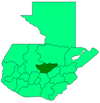 | |
|---|---|---|
| Municipalities | ||