RAF Ascension Island
| RAF Ascension | |||||||
|---|---|---|---|---|---|---|---|
| Wideawake Airbase/Field | |||||||
| Georgetown in Saint Helena, Ascension and Tristan da Cunha | |||||||
 | |||||||
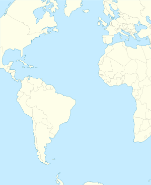 FHAW Shown within Atlantic Ocean | |||||||
| Coordinates | 07°58′10″S 014°23′38″W / 7.96944°S 14.39389°WCoordinates: 07°58′10″S 014°23′38″W / 7.96944°S 14.39389°W | ||||||
| Type | Royal Air Force station | ||||||
| Site information | |||||||
| Owner | Ministry of Defence | ||||||
| Operator | Royal Air Force / Serco[1] | ||||||
| Website | www.ascension-flights.com | ||||||
| Site history | |||||||
| Built | 1939 | ||||||
| In use | 1939 – present | ||||||
| Airfield information | |||||||
| Identifiers | IATA: ASI, ICAO: FHAW | ||||||
| Elevation | 85 metres (279 ft) AMSL | ||||||
| |||||||
| No Instrument landing system (ILS) | |||||||
RAF Ascension (IATA: ASI, ICAO: FHAW) (more commonly known as RAF Ascension Island, and sometimes known as Wideawake Airfield or Ascension Island Base), is a British Royal Air Force station on Ascension Island in the Atlantic Ocean, near the Equator.
History
In 1939 Ascension became important as a HF/DF radio station covering trade routes. The first aircraft to land on Ascension Island was a Fairey Swordfish from HMS Archer in 1942.
Wideawake Airfield
Wideawake Airfield (named for a noisy colony of sooty terns nearby) was a World War II US military installation built in 1943 by arrangement with the British government. The airfield was built using a US task force[2] and went on to be used by more than 25,000 aircraft as a staging point during the war.[3] The airfield was abandoned at the end of the war and fell into disuse.
Ascension Island Auxiliary Field
Ascension Island Auxiliary Field was being built by 181 men from Saint Helena for the United States Air Force (USAF) by 1957[4] (official activation as a satellite of Patrick Air Force Base in Florida was on 25 June 1956.)[5]
Target Tracking Radar Station
The Target Tracking Radar Station was a Nike Zeus test facility for tracking reentry vehicles from Cape Canaveral missile launches. Built from 1960-1961 for anti-ballistic missile measurement, the "Golf Ball" was on Cat Hill, and a collimation tower for radar calibration was towards English Bay.[4]
NASA stations
The NASA Tracking Station at Devil's Ashpit and the Cable & Wireless Earth Station at Donkey Plain were built in the mid-1960s for space operations and communications, including the latter's use for transmitting "microwave borne data via the Early Bird Satellite back to the NASA facility at Andover, Maine."
RAF airfield
RAF Ascension Island was re-garrisoned by the RAF in 1982 and used extensively as a staging airfield during the Falklands War. A series of long-range bombing raids was carried out from there under the name Operation Black Buck. The airfield continues this staging post role for the Falkland Islands for the RAF.
Operations
The station comes under the overall jurisdiction of the Commander British Forces South Atlantic Islands, an officer of one-star rank. As of 2013, this post has been held by Air Commodore Russ LaForte.[6] The RAF airfield on Ascension Island is run on a day-to-day basis by around 19 RAF personnel, headed by a wing commander.[6]
The RAF presence on Ascension is backed up by the USAF, which contributes a similar number of service personnel to ensure the effective running of the station.
RAF Ascension Island is also the refuelling point for the Ministry of Defence's South Atlantic air bridge flights to RAF Mount Pleasant, on the Falkland Islands, from RAF Brize Norton in Oxfordshire, in the UK.[7]
Ascension serves as a diversion airport for ETOPS aircraft crossing the Atlantic. In January 2013, a Delta Air Lines Boeing 777-200LR en route from Johannesburg to Atlanta diverted to Ascension as a result of engine problems.[8]
Airlines and destinations
| Airlines | Destinations |
|---|---|
| British Airways operated by Comair | Saint Helena(suspended) Johannesburg-OR Tambo (suspended) |
Gallery
 View of part of the station in November 1983
 RAF Lockheed L-1011 TriStar refuelling at Ascension during a stop en route to the Falkland Islands.
See also
References
- ↑ "Serco Business Review Page 20" (PDF). Retrieved 18 July 2010.
- ↑ "Ascension Island - The Wide-Awake News".
- ↑ "Ascension History". mysterra.org. Mysterra Magazine. Retrieved 3 January 2011.
- 1 2 Avis, Graham (9 February 2002), "Avis Part Eighteen - Curry or Stew!", An Introduction to the History of Ascension Island (personal anecdote), retrieved 2014-04-13,
By the end of 1956, 181 St Helenian men were employed in a temporary capacity on Ascension Island constructing the US Base. … The Base operations were eventually expanded by the addition of a Target Tracking Radar Station, which was built from 1960 - 1961. This facility, known as the Golf Ball, was built on a site overlooking the Archer Cemetery at Comfortless Cove. It meant the construction of a separate road, the Nike Zeus Road, to the area, replacing the old dirt road from the back of Long Beach. A collimation tower, complete with its own access track cutting across the old Victorian path to the sand blowhole was constructed part of the way towards English Bay, to calibrate the radar. … mid-sixties of the NASA Tracking Station at Devil's Ashpit, and the Cable & Wireless Earth Station at Donkey Plain. This station was built by Cable & Wireless and Marconi at the request of NASA
- ↑ Mueller, Robert (1989). Air Force Bases (PDF) (Report). Volume I: Active Air Force Bases Within the United States of America on 17 September 1982. Office of Air Force History. p. 600. ISBN 0-912799-53-6. Retrieved 2013-08-15.
- 1 2 http://www.bfbs.com/news/troops-south-atlantic-long-term-64980.html
- ↑ Eklund, Dylan (2015). "A rock and a hard place". The Official Royal Air Force Review 2015: 118. ISSN 1758-9681.
- ↑ Hradecky, Simon (10 January 2013). "Incident: Delta B772 over Atlantic on Jan 9th 2013, engine trouble". Aviation Herald. Retrieved 11 January 2013.
![]() This article incorporates public domain material from the Air Force Historical Research Agency website http://www.afhra.af.mil/.
This article incorporates public domain material from the Air Force Historical Research Agency website http://www.afhra.af.mil/.
External links
| Wikimedia Commons has media related to Wideawake Field. |
- RAF Ascension Island
- James Rogers and Luis Simón. The Status and Location of the Military Installations of the Member States of the European Union and Their Potential Role for the European Security and Defence Policy (ESDP). Brussels: European Parliament, 2009. 25 pp.
| |
Royal Air Force portal | ||
| Formations and units |  | |
| Branches and components | ||
| Reserve forces | ||
| Associated civil organizations | ||
| Equipment | ||
| Personnel | ||
| Appointments | ||
| Symbols and uniform | ||