R242 road (Ireland)
| ||||
|---|---|---|---|---|
|
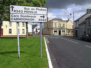
R242 in Malin | ||||
| Route information | ||||
| Length: | 15.1 km[1][2] (9.4 mi) | |||
| Major junctions | ||||
| From: |
| |||
| To: | Slievebane (or Slievebawn) | |||
| Road network | ||||
| ||||
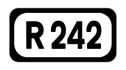
The R242 road is a regional road in Ireland. It is a road on the northern Inishowen Peninsula in County Donegal.[1] The R242 is Ireland's northernmost regional road and leads to Malin Head.[3] The road forms part of the Wild Atlantic Way.[4]
The R242 travels north from the R238 at Drumaville to Malin village. From Malin the road travels along Trawbreaga Bay before turning inland and northward. The R242 ends at the coastguard station at Slievebawn, but minor roads continue from here towards Malin Head. The R242 is 15.1 km (9.4 mi) long.[2][4]
References
- 1 2 "S.I. No. 54/2012 – Roads Act 1993 (Classification of Regional Roads) Order 2012". Government of Ireland. 28 Feb 2012. Retrieved 22 Mar 2016.
- 1 2 Google (22 Mar 2016). "R242 to R242" (Map). Google Maps. Google. Retrieved 22 Mar 2016.
- ↑ Montgomery, Bob (19 Sep 2007). "Plenty to visit on the northern coast". The Irish Times. Retrieved 1 Jun 2016.
- 1 2 "Wild Atlantic Way: Self-Drive Coastal Donegal". Fáilte Ireland. Retrieved 22 Mar 2016.
This article is issued from Wikipedia - version of the 6/2/2016. The text is available under the Creative Commons Attribution/Share Alike but additional terms may apply for the media files.