Microregion of Quirinópolis
| Quirinópolis | |
|---|---|
| Microregion | |
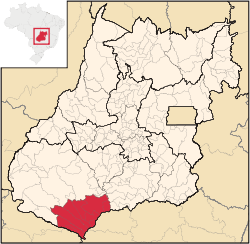 Location in Goias state | |
| Country | Brazil |
| State | Goiás |
| Mesoregion | Sul Goiano |
| Municipalities | 9 |
| Area | |
| • Total | 16,118 km2 (6,223 sq mi) |
| Population (2006) | |
| • Total | 95,094 |
| • Density | 5.9/km2 (15/sq mi) |
The Quirinópolis Microregion is a region in south Goiás state, Brazil. It includes 8 municipalities with a population of 95,094 (2007) and a total area of 16,117.60 km².
- Municipalities gaining population since 1980: Caçu, Paranaiguara, Quirinópolis, São Simão.
- Municipalities losing population since 1980: Cachoeira Alta, Itajá, Itarumã.
- Municipalities formed after 1980: Gouvelândia and Lagoa Santa.
Municipalities
The microregion consists of the following municipalities:[1]
| Municipality | Area (km²) | Inhabitants in 2007 | Population density in 2007 (inhab/km²) | Population growth rate 1996/2007 (%) |
|---|---|---|---|---|
| Cachoeira Alta | 1,659 | 8,103 | 4.90 | -0.19 |
| Caçu | 2,258 | 10,892 | 4.84 | 0.4 |
| Gouvelândia | 833 | 4,507 | 5.43 | 0.98 |
| Itajá | 2,091 | 5,409 | 2.59 | 4.18 |
| Itarumã | 3,444 | 5,338 | 1.55 | -1.00 |
| Lagoa Santa | 459 | 1,225 | 2.67 | n/a |
| Paranaiguara | 1,157 | 7,724 | 6.69 | -0.67 |
| Quirinópolis | 3,792 | 38,064 | 10.07 | 0.65 |
| São Simão | 415 | 13,832 | 33.41 | 1.11 |
Economics
| Municipality | GDP 2005 (R$1,000.00) | Corn production in 2007 (tons) | Soybean production in 2007 (tons) | Cattle 2006 (head) |
|---|---|---|---|---|
| Cachoeira Alta | 86,978 | 1,800 | n/a | 163,000 |
| Caçu | 76,642 | 1,800 | 1,960 | 211,000 |
| Gouvelândia | 42,593 | 13,750 | 11,200 | 73,000 |
| Itajá | 43,899 | 765 | 560 | 177,000 |
| Itarumã | 58,584 | 6,000 | 4,500 | 292,000 |
| Lagoa Santa | 10,357 | 1,020 | n/a | 48,000 |
| Paranaiguara | 45,758 | 1,000 | 1,120 | 110,000 |
| Quirinópolis | 284,370 | 35,400 | 25,000 | 356,000 |
| São Simão | 870,974 | 3,000 | n/a | 40,000 |
Health and education
| Municipality | MHDI 2000 | Literacy rate 2000 | Infant mortality rate 2000 |
|---|---|---|---|
| Cachoeira Alta | 0.737 | 84.4 | 28.90 |
| Caçu | 0.783 | 86.8 | 16.89 |
| Gouvelândia | 0.738 | 84.2 | 22.10 |
| Itajá | 0.747 | 84.6 | 22.10 |
| Itarumã | 0.735 | 85.3 | 28.88 |
| Lagoa Santa | n/a | n/a | n/a |
| Paranaiguara | 0.751 | 84.3 | 22.10 |
| Quirinópolis | 0.780 | 87.1 | 16.81 |
| São Simão | 0.754 | 85.1 | 28.90 |
See also
References
- ↑ Instituto Brasileiro de Geografia e Estatística, territorial division.
Coordinates: 18°26′52″S 50°27′07″W / 18.44778°S 50.45194°W
This article is issued from Wikipedia - version of the 11/1/2016. The text is available under the Creative Commons Attribution/Share Alike but additional terms may apply for the media files.