Queen Elizabeth II Reservoir
| Queen Elizabeth II Reservoir | |
|---|---|
 Queen Elizabeth II Reservoir | |
| Location | Surrey |
| Coordinates | 51°23′27″N 0°23′32″W / 51.39083°N 0.39222°WCoordinates: 51°23′27″N 0°23′32″W / 51.39083°N 0.39222°W |
| Type | reservoir |
| Basin countries | United Kingdom |
| Surface area | 127.9 ha (316 acres) |
| Average depth | 15.3 m (50 ft) |
| Max. depth | 17.8 m (58 ft) |
| Water volume | 19.5 Gl (4.3×10⁹ imp gal) |
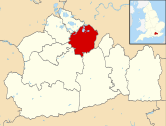
The Queen Elizabeth II Reservoir lies to the south of the River Thames and to the west of the Island Barn Reservoir. To the north are the reservoirs of Bessborough and Knight. The A3050 runs to the north of the reservoir and it is situated in Walton on Thames. It is managed by Thames Water.
The reservoir was authorised by an Act of Parliament in 1935, but construction was halted on the outbreak of World War II. Work did not begin again until 1957 and, after the works were completed by W. & C. French, it was commissioned in 1962.[1] The reservoir covers 317 acres (1.28 km2), has a mean depth of 15.3 m, a maximum depth of 17.8 m and holds 4,300 million gallons (20,000 million litres).[2]
Bewick's swans have been spotted on this reservoir.[3]
See also
References
- ↑ "Queen Elizabeth II Reservoir". Pastscape. Retrieved 14 September 2015.
- ↑ A Guide to the Industrial Archaeology of the Borough of Elmbridge
- ↑ Thames Water official website - Birdwatching
External links
| Towns, villages and neighbourhoods |
|  | ||||||||||||||||||||||||||||||
|---|---|---|---|---|---|---|---|---|---|---|---|---|---|---|---|---|---|---|---|---|---|---|---|---|---|---|---|---|---|---|---|---|
| Notable Parks | ||||||||||||||||||||||||||||||||
| Grade I Listed Churches | ||||||||||||||||||||||||||||||||
| Education | ||||||||||||||||||||||||||||||||
| Transport |
| |||||||||||||||||||||||||||||||
| Buildings and structures |
| |||||||||||||||||||||||||||||||
| Sport | ||||||||||||||||||||||||||||||||
Places listed are articles notable as settlements, arranged by post town The M25 motorway follows approximately a boundary and is included for its regional importance. | ||||||||||||||||||||||||||||||||
This article is issued from Wikipedia - version of the 9/9/2016. The text is available under the Creative Commons Attribution/Share Alike but additional terms may apply for the media files.