Qinglong Manchu Autonomous County
| Qinglong County 青龙县 ᠴᡳᠩᠯᡠᠩ ᠰᡳᠶᠠᠨ | |
|---|---|
| Autonomous county | |
青龙满族自治县 ᠴᡳᠩᠯᡠᠩ ᠮᠠᠨᠵᡠ ᠪᡝᠶᡝ ᡩᠠᠰᠠᠩᡤᠠ ᠰᡳᠶᠠᠨ Qinglong Manchu Autonomous County | |
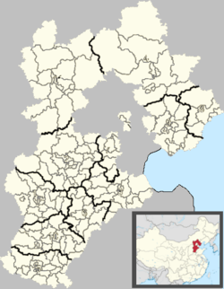 Qinglong Location in Hebei | |
| Coordinates: 40°24′N 118°57′E / 40.400°N 118.950°ECoordinates: 40°24′N 118°57′E / 40.400°N 118.950°E | |
| Country | People's Republic of China |
| Province | Hebei |
| Prefecture-level city | Qinhuangdao |
| Township-level divisions |
11 towns 14 townships |
| County seat | Qinglong (青龙镇) |
| Area | |
| • Total | 3,309 km2 (1,278 sq mi) |
| Elevation | 239 m (784 ft) |
| Population (2004) | |
| • Total | 520,000 |
| • Density | 160/km2 (410/sq mi) |
| Time zone | China Standard (UTC+8) |
| Postal code | 066500 |
| Area code(s) | 0335 |
Qinglong Manchu Autonomous County (simplified Chinese: 青龙满族自治县; traditional Chinese: 青龍滿族自治縣; pinyin: Qīnglóng Mǎnzú Zìzhì Xiàn; literally: "blue (or teal) dragon") is a Manchu autonomous county of northeastern Hebei province, China, bordering Liaoning to the north and east and located in the eastern part of the Yan Mountains. It is under the administration of Qinhuangdao City, and, as of 2004, had a population of 520,000 residing in an area of 3,309 km2 (1,278 sq mi). Bordering county-level divisions are: Lingyuan and Jianchang County (Liaoning) to the north, Liaoning's Suizhong County and Qinhuangdao city proper to the east, Qian'an and Lulong County to the south, and Kuancheng Manchu Autonomous County and Qianxi County to the west.
Administrative divisions
Qinglong administers 11 towns and 14 townships, which in turn control 396 villages:[1]
|
Towns:
|
Townships:
|
Climate
Qinglong has a monsoon-influenced, humid continental climate (Köppen Dwa), with long, cold, and very dry winters, and hot, rainy summers. Spring and autumn are short with some rainfall. The monthly 24-hour average temperature in January is −8.4 °C (16.9 °F), and 24.2 °C (75.6 °F) in July, and the annual mean is 9.25 °C (48.6 °F). The mountainous location means that diurnal temperature variation is rather large, but precipitation is enhanced: the total precipitation is 702 millimetres (27.6 in), with close to 60% of it falling in July and August alone.
| Climate data for Qinglong County (1971−2000) | |||||||||||||
|---|---|---|---|---|---|---|---|---|---|---|---|---|---|
| Month | Jan | Feb | Mar | Apr | May | Jun | Jul | Aug | Sep | Oct | Nov | Dec | Year |
| Record high °C (°F) | 12.1 (53.8) |
17.4 (63.3) |
23.7 (74.7) |
31.9 (89.4) |
36.6 (97.9) |
38.5 (101.3) |
39.0 (102.2) |
35.2 (95.4) |
33.5 (92.3) |
28.7 (83.7) |
22.4 (72.3) |
14.6 (58.3) |
39 (102.2) |
| Average high °C (°F) | −0.5 (31.1) |
2.9 (37.2) |
9.4 (48.9) |
18.6 (65.5) |
24.6 (76.3) |
28.2 (82.8) |
29.3 (84.7) |
28.6 (83.5) |
24.4 (75.9) |
17.6 (63.7) |
8.5 (47.3) |
1.8 (35.2) |
16.1 (61.0) |
| Daily mean °C (°F) | −8.4 (16.9) |
−4.6 (23.7) |
2.7 (36.9) |
11.8 (53.2) |
18.0 (64.4) |
22.0 (71.6) |
24.2 (75.6) |
22.8 (73) |
17.2 (63) |
9.8 (49.6) |
1.3 (34.3) |
−5.8 (21.6) |
9.3 (48.7) |
| Average low °C (°F) | −14.2 (6.4) |
−10.7 (12.7) |
−3.5 (25.7) |
4.9 (40.8) |
10.9 (51.6) |
15.8 (60.4) |
19.6 (67.3) |
18.1 (64.6) |
11.0 (51.8) |
3.5 (38.3) |
−4.1 (24.6) |
−11.2 (11.8) |
3.3 (38.0) |
| Record low °C (°F) | −26.3 (−15.3) |
−23.3 (−9.9) |
−16.8 (1.8) |
−9.2 (15.4) |
0.0 (32) |
6.1 (43) |
12.1 (53.8) |
5.5 (41.9) |
0.0 (32) |
−8.0 (17.6) |
−19.2 (−2.6) |
−23.9 (−11) |
−26.3 (−15.3) |
| Average precipitation mm (inches) | 2.9 (0.114) |
2.9 (0.114) |
9.7 (0.382) |
22.8 (0.898) |
45.2 (1.78) |
94.1 (3.705) |
237.5 (9.35) |
180.6 (7.11) |
61.0 (2.402) |
31.7 (1.248) |
9.3 (0.366) |
3.9 (0.154) |
701.6 (27.623) |
| Average precipitation days (≥ 0.1 mm) | 2.1 | 2.5 | 3.7 | 5.3 | 7.9 | 11.6 | 15.7 | 12.3 | 7.9 | 5.1 | 3.3 | 1.8 | 79.2 |
| Source: Weather China | |||||||||||||
References
- ↑ 2011年统计用区划代码和城乡划分代码:青龙满族自治县 (in Chinese). National Bureau of Statistics of the People's Republic of China. Retrieved 2012-07-21.
External links
| Counties |
|    | ||||||||||
|---|---|---|---|---|---|---|---|---|---|---|---|---|
Ethnic minority autonomous areas: Dong · Hui · Korean · Manchu · Miao · Mongol · Tibetan · Tujia · Uyghur · Yao · Yi · Zhuang · Other | ||||||||||||