Q'illu Urqu (Sud Lípez)
This article is about the mountain in the Sud Lípez Province, Potosí Department, Bolivia. For other uses, see Q'illu Urqu.
| Q'illu Urqu | |
|---|---|
 Q'illu Urqu Location in Bolivia | |
| Highest point | |
| Elevation | 4,526 m (14,849 ft) [1] |
| Coordinates | 21°53′03″S 66°42′17″W / 21.88417°S 66.70472°WCoordinates: 21°53′03″S 66°42′17″W / 21.88417°S 66.70472°W |
| Geography | |
| Location | Bolivia, Potosí Department, Sud Lípez Province |
| Parent range | Andes |
Q'illu Urqu (Quechua q'illu yellow, urqu mountain,[2] "yellow mountain", also spelled Khellu Orkho) is a 4,526-metre (14,849 ft) high mountain in the Andes of Bolivia. It is situated in the Potosí Department, Sud Lípez Province, San Pablo de Lípez Municipality. Q'illu Urqu lies south-west of the mountain Ch'aska Urqu and north-east of the mountain Palti Urqu. The river Qaqa Pallqa flows along its western slope.[1][3]
References
- 1 2 BIGM map 1:50,000 San Pablo de Lípez 6228-I
- ↑ Teofilo Laime Ajacopa, Diccionario Bilingüe Iskay simipi yuyayk'ancha, La Paz, 2007 (Quechua-Spanish dictionary)
- ↑ "San Pablo de Lípez". ine.gob.bo. Retrieved September 6, 2014. (unnamed)
Capital: Potosí | ||
| Provinces | 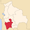 | |
| Municipalities (and seats) |
| |
This article is issued from Wikipedia - version of the 12/6/2015. The text is available under the Creative Commons Attribution/Share Alike but additional terms may apply for the media files.