Pulwama
| Pulwama | |
|---|---|
| town | |
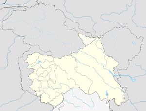 Pulwama  Pulwama Location in Jammu and Kashmir, shah faisal | |
| Coordinates: 33°53′N 74°55′E / 33.88°N 74.92°ECoordinates: 33°53′N 74°55′E / 33.88°N 74.92°E | |
| Country |
|
| States and territories of India | Jammu and Kashmir |
| District | Pulwama |
| Area | |
| • Total | 949 km2 (366 sq mi) |
| Elevation | 1,630 m (5,350 ft) |
| Population (2001) | |
| • Total | 15,521 |
| • Density | 16/km2 (42/sq mi) |
| Languages | |
| • Official | Urdu |
| Time zone | IST (UTC+5:30) |
| Sex ratio | 913 ♂/♀ |
| Literacy | 65.00% |
Pulwama (known as Panwangam in antiquity,[1] and later as Pulgam[2]) is a town and a notified area committee in Pulwama district in the Indian state of Jammu and Kashmir. It is almost 40 km (25 mi) from the summer capital of Srinagar. Pulwama is often called the "Anand of Kashmir" or "Dudha-Kul of Kashmir"[3] on account of its high milk production.
Geography
Pulwama is located at 32°53′N 74°55′E / 32.88°N 74.92°E.[4] It has an average elevation of 1,630 m (5,350 ft)).
Carving of district
District Pulwama came into being in the year 1979 in the larger interests of maintenance of law and order, closer supervision, more effective control and above all to ensure balanced development of the area. Pulwama district comprised 550 villages, which until 2007 were grouped in five (5) Tehsils viz. Shopian, Pulwama, Tral, Pampore & Awantipora. Now, again in 2007, the district has been bifurcated in two parts viz. District Shopian & District Pulwama. In District Pulwama there are eight (8) tehsils, namely Pulwama, Tral, Awantipora, Pampore, Rajpora, Shahoora, Kakpora and Aripal. The total number of villages came down to 331 with four (4) CD Blocks and part of Keller block. The reporting area of this district has been reduced to 0.61 lac Hectares from 0.98 Hectares after creation of the new Hill District, Shopian.
Agriculture
Agriculture plays an important role in the economy of the District. The agriculture products like paddy, oil seeds, fodder, saffron & milk are the main contributors to the Gross Domestic Product (GDP) of the District. Area sown more than once is about 0.30 lac hectares & the productivity of the land in the district is higher than in any other District in the State. District Pulwama is famous for saffron cultivation which is mainly grown in Karewa lands of Pampore, Kakapora and Pulwama blocks. The area under saffron cultivation during 2010-11 was 2414 hectares. Among the fruits, apple, almonds, walnut & cherry are the important one produced in this District.
Industries
This district has the state's largest cement plant viz. J&K Cements Ltd. at Khrew with a capacity of 1200 M tones cement per day. In this district two important projects have been taken up for execution during current year, namely, State Entrepreneur Development Institute and International Trade Centre at Pampore. Besides having an industrial dominance Pulwama is also considered to be the largest milk-producing district of Jammu and Kashmir. Lassipora SIDCO has various small and medium factories. Zum zum milk is produced there.
Demographics
As of 2001 India census,[5] Pulwama had a population of 15,521. Males constituted 59% of the population and females 41%. Pulwama had an average literacy rate of 62%, higher than the national average of 59.5%: male literacy was 75%, and female literacy was 43%. In Pulwama, 10% of the population was under 6 years of age.
See also
References
- ↑ Jasbir Singh. The economy of Jammu & Kashmir. Radha Krishan Anand & Co. Retrieved 2010-12-02.
The original name of Pulwama was Panwangam, which comprised four local namely, Malikpora, Dangerpora, Chatapora, Dalipora.
- ↑ Parvéz Dewân. Parvéz Dewân's Jammû, Kashmîr, and Ladâkh: Kashmîr. Manas Publications. Retrieved 2010-12-02.
The original name of Pulwama town (from which the district takes its name) was Panwangam. Over the centuries it got shortened to Pulgam. This in turn gradually changed to Pulwama.
- ↑ "Pulwama". Official website of Pulwama district.
- ↑ Falling Rain Genomics, Inc - Pulwama
- ↑ "Census of India 2001: Data from the 2001 Census, including cities, villages and towns (Provisional)". Census Commission of India. Archived from the original on 2004-06-16. Retrieved 2008-11-01.