Puigpedrós
| Puigpedrós | |
|---|---|
 | |
| Highest point | |
| Elevation | 2,912 m (9,554 ft) |
| Coordinates | 42°29′16″N 1°45′49″E / 42.48778°N 1.76361°ECoordinates: 42°29′16″N 1°45′49″E / 42.48778°N 1.76361°E |
| Geography | |
 Puigpedrós | |
| Parent range | Pyrenees |
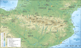
Puigpedrós is a mountain located at the border between Catalonia, Spain and the département of Pyrénées-Orientales (France).
Part of the Pyrenees, its summit has an elevation of 2,912 metres above sea level.[1]
See also
References
- ↑ "Mapa Topogràfic de Catalunya". Institut Cartogràfic de Catalunya. Retrieved May 22, 2010..
This article is issued from Wikipedia - version of the 8/8/2016. The text is available under the Creative Commons Attribution/Share Alike but additional terms may apply for the media files.