Puig Estela
| Puig Estela | |
|---|---|
 | |
| Highest point | |
| Elevation | 2,013 m (6,604 ft) |
| Coordinates | 42°17′3.49″N 2°15′14.44″E / 42.2843028°N 2.2540111°ECoordinates: 42°17′3.49″N 2°15′14.44″E / 42.2843028°N 2.2540111°E |
| Geography | |
| Location | Catalonia, Spain |
| Climbing | |
| First ascent | unknown |
| Easiest route | Portella d'Ogassa |
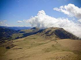
Puig Estela is a mountain of Catalonia, Spain. It has an elevation of 2,013 metres above sea level., between the villages of Ogassa and Pardines.[1]
See also
References
- ↑ "Mapa Topogràfic de Catalunya". Institut Cartogràfic de Catalunya. Retrieved May 22, 2010..
This article is issued from Wikipedia - version of the 12/6/2015. The text is available under the Creative Commons Attribution/Share Alike but additional terms may apply for the media files.