Puffin Island (Anglesey)
| Native name: <span class="nickname" ">Ynys Seiriol | |
|---|---|
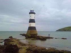
%2C_Anglesey.JPG) Puffin Island seen from Penmon Point | |
 Puffin Island | |
| Geography | |
| Location | Anglesey, Wales |
| Coordinates | 53°19′00″N 4°01′00″W / 53.31667°N 4.01667°W |
| Administration | |
|
Wales | |
| County | Anglesey |
| Additional information | |
| Uninhabited | |
Puffin Island (Welsh: Ynys Seiriol) (at SH 649 821 or 53°19′05″N 04°01′40″W / 53.31806°N 4.02778°W) is an uninhabited island off the eastern tip of Anglesey, Wales. It was formerly known as Priestholm in English and Ynys Lannog in Welsh. A hermitage was established here around the 6th century and there are remains of a 12th-century monastery on the island. The island is also a Special Protection Area for wildlife.
Geography

Puffin Island is the ninth largest island off the coast of Wales and marks the northeastern end of the Menai Strait. Puffin Island's highest point is Carboniferous limestone, at 58.5 metres (192 ft) above sea level having steep cliffs on all sides. It has an area of 0.28 square kilometres (69 acres). The island is privately owned by the Baron Hill estate.
History

The Welsh name, Ynys Seiriol, refers to Saint Seiriol. The son of Owain Ddantgwyn, a 5th-century ruler of the Kingdom of Gwynedd, and the brother of Saint Einion Frenin, a 5th- or 6th-century king in the Llŷn Peninsula, Seiriol founded and governed a clas (ecclesiastical settlement) at Penmon on the Anglesey. In later life, he abandoned his responsibilities there to establish a hermitage on the nearby island, where his remains are thought to rest.[1]
King Cadwallon ap Cadfan of Gwynedd is said to have sheltered here in around 630 when fleeing an invasion from the Kingdom of Northumbria. A monastery[2] existed on the island in the late 12th century and was mentioned by Gerald of Wales who visited the area in 1188. He claimed that, whenever there was strife within the community of monks, a plague of mice would devour all their food. Llywelyn the Great issued two charters in 1221 and 1237 confirming the Canons Regular, in possession of the island and the church and manor of Penmon on the mainland of Anglesey.
The ruins of several ecclesiastical buildings are visible on the island, including the remains of a 12th century church, which has a Grade I heritage listing. The central tower and the foundations of the nave remain. The remains of the chancel and south trancept have been covered by a 19th-century cottage and building.[3]
Much later a telegraph station was built on the north-eastern tip of the island.[4] It is now disused.
Wildlife
The island is a Special Protection Area[5] (SPA), particularly because of its great cormorant colony of over 750 pairs, making it one of the largest colonies in the British Isles. It also has good numbers of guillemot, razorbill, cormorant ("shag") and kittiwake nesting, and in recent years small numbers of common eider and black guillemot. The Atlantic puffins from which the island gets its modern English name bred in considerable numbers at one time, with up to 2000 pairs recorded. The brown rat was introduced accidentally to the island, probably in the late 19th century and reduced this population to a very few pairs. A programme of poisoning these rats started in 1998 by the Countryside Council for Wales appears to have eradicated them, and the Puffin population has shown an increase since that date.
At one time the island was heavily grazed by rabbits, but these were wiped out by an outbreak of myxomatosis, leading to the growth of dense vegetation, particularly common elder (Sambucus nigra).
The strong currents around the island provide for an abundance of marine life, particularly on the north coast where the depths reach 15 metres (8 fathoms). Many people enjoy fishing trips departing from Beaumaris in these waters, catching mainly mackerel, but many other species are caught. Pleasure cruises are also available from Easter to October to view the island, its seal colony and birdlife.
There is one identified shipwreck, a steamship named The Pioneer, which ran ashore in 1878 with a cargo of iron bars when the tow lines to it broke following its rescue from engine failure near The Skerries.[6]
References
| Wikimedia Commons has media related to Puffin Island (Ynys Seiriol). |
- ↑ Topham, Simon. "Ynys Seiriol". Mysterious Britain and Ireland. Retrieved 18 Nov 2014.
- ↑ "Cell of Penmon Priory on Priestholm Island". Coflein Database Record. Royal Commission on the Ancient and Historical Monuments of Wales. Retrieved 28 November 2016.
- ↑ Remains of monastic settlement including tower and walls, Llangoed, British Listed Buildings. Retrieved 20 March 2016.
- ↑ Faster Than The Wind, The Liverpool to Holyhead Telegraph, Frank Large, an avid publication ISBN 0-9521020-9-9
- ↑ Site description from the UK SPA network
- ↑ Holden, Chris (2008). Underwater Guide to North Wales Vol. 2. Calgo Publications. pp. 158–167. ISBN 978-0-9545066-1-2.
Coordinates: 53°19′07″N 4°01′46″W / 53.31854°N 4.02958°W