Priestland
Coordinates: 55°36′32″N 4°15′32″W / 55.609°N 4.259°W
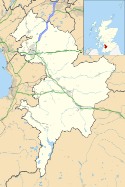
Priestland is a village in East Ayrshire, Scotland. It has a population of 121 (Census 2001) and lies on the A71, around two miles west of Loudoun Hill, ten miles east of Kilmarnock and twenty miles south of Glasgow. It is situated in a valley through which the River Irvine runs and alongside the burghs of Galston, Newmilns and Darvel (with which it borders), forms an area known as the Upper Irvine Valley (locally referred to as The Valley).
| Wikimedia Commons has media related to Priestland, East Ayrshire. |
This article is issued from Wikipedia - version of the 1/24/2016. The text is available under the Creative Commons Attribution/Share Alike but additional terms may apply for the media files.