Pratt's Bottom

Coordinates: 51°20′23″N 0°06′46″E / 51.3397°N 0.1128°E
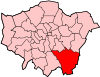
Pratt's Bottom is a village now in the London Borough of Bromley, but historically part of Kent. It has frequently been noted on lists of unusual place names.[1]
It is a small village, consisting of a main road (Rushmore Hill) on which is situated a school, a village shop (the post office was closed as part of the widespread branch closures of June 2008) and the Bulls Head pub, two small churches and a few side roads. There is a village hall behind the green.
History
A "bottom" in this context means a valley or hollow, and the Pratts were a noble family once seated in the area.[2] Pratt's Bottom formed part of the ancient, and later civil, parish of Chelsfield in Kent[3] and was part of the Bromley Rural District from 1894.[3] The parish was abolished in 1934 and the village became part of Orpington Urban District.[4] In 1965 it was transferred to Greater London, to form part of the London Borough of Bromley.[4]
A tollgate stood in the village for many years. The turnpike cottage was demolished in the 1930s but is still seen as emblematic of the village, so much so that it is the basis of the recent village sign placed on the green. Sue Short has written a book about the history of the village titled Pratts Bottom: A Journey Through Life.[5]
Pratt's Bottom was declared to be the 'sister city' of Wellington, New Zealand in 2009 by then-Mayor, Kerry Prendergast .
Transport
Pratts Bottom is served by Transport for London bus routes R5 and R10 with services to Orpington via Green Street Green and to Knockholt, as well as Arriva Kent route 402 to Bromley via Farnborough and to Tunbridge Wells via Sevenoaks. The nearest rail link to Pratts Bottom is at Knockholt station.
References
- ↑ Lyall, Sarah (22 January 2009). "No Snickering: That Road Sign Means Something Else". The New York Times. Retrieved 13 July 2014.
- ↑ Mills, A., Oxford Dictionary of London Place Names, (2001)
- 1 2 Vision of Britain - Chelsfield parish (historic boundaries)
- 1 2 Vision of Britain - Orpington parish
- ↑ Short, Sue (2009). Pratts Bottom: A Journey Through Life. BPR Publishers. ISBN 978-0-9554336-1-0.
External links
![]() Media related to Pratt's Bottom at Wikimedia Commons
Media related to Pratt's Bottom at Wikimedia Commons