Préaux, Mayenne
| Préaux | |
|---|---|
|
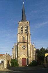
The church of Saint-Martin, in Préaux | |
 Préaux | |
|
Location within Pays de la Loire region  Préaux | |
| Coordinates: 47°56′12″N 0°27′54″W / 47.9367°N 0.465°WCoordinates: 47°56′12″N 0°27′54″W / 47.9367°N 0.465°W | |
| Country | France |
| Region | Pays de la Loire |
| Department | Mayenne |
| Arrondissement | Château-Gontier |
| Canton | Grez-en-Bouère |
| Government | |
| • Mayor (2001–2008) | Roland Foucault |
| Area1 | 9.58 km2 (3.70 sq mi) |
| Population (2006)2 | 170 |
| • Density | 18/km2 (46/sq mi) |
| Time zone | CET (UTC+1) |
| • Summer (DST) | CEST (UTC+2) |
| INSEE/Postal code | 53184 / 53340 |
| Elevation |
47–82 m (154–269 ft) (avg. 110 m or 360 ft) |
|
1 French Land Register data, which excludes lakes, ponds, glaciers > 1 km² (0.386 sq mi or 247 acres) and river estuaries. 2 Population without double counting: residents of multiple communes (e.g., students and military personnel) only counted once. | |
Préaux is a commune in the Mayenne department in north-western France.
Geography
The Vaige flows southeastwards through the middle of the commune and forms part of its eastern border.
See also
| Wikimedia Commons has media related to Préaux (Mayenne). |
This article is issued from Wikipedia - version of the 3/15/2016. The text is available under the Creative Commons Attribution/Share Alike but additional terms may apply for the media files.