Potirendaba
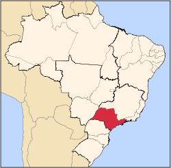
Potirendaba is a municipality in the state of São Paulo, Brazil. The city has 15,449 inhabitants (IBGE/2010) and an area of 342.4 km².[1]
Potirendaba belongs to the Microregion and Mesoregion of São José do Rio Preto.
The name comes from the Tupi language and means "Land of flowers"
History
There are various versions about the foundation and origin of Potirendaba. One of the versions tells that Manoel Ponciano had, around 1820, a farm in the region. In 1908, José Contador, a salesman, bought parts of the Três Rios farm, that belonged to Manoel Ponciano. At the time, the owners of the land were the Siqueira family, José Contador, João Francisco Pinto and the Manfredini family. A village was created with the time.
Another version tells that the brothers José and Joaquim Gonçalves de Souza were the first to arrive.
The creation of the city started in 1905, with the distribution of lands between the heirs of João Antônio de Siqueira.
In December, 1919, Potirendaba was established as a district of São José do Rio Preto. The district was elevated to city in December 26, 1925.[2]
Demographics
All data from SEADE[3] and IBGE
- Population: 15,449 (IBGE/2010)
- Area: 342.4 km² (166.5 sq mi)
- Population density: 45.12/km² (2,451.5/sq mi)
- Urbanization: 89.9% (2010)
- Sex ratio (Males to Females): 103.1 (2011)
- Birth rate: 14.89/1,000 inhab. (2009)
- Infant mortality: 8.81/1,000 births (2009)
- Homicide rate: 8.9/100 thousand ppl
- HDI: 0.805 (UNDP/2000)
Economy
The Tertiary sector is the economic basis of Potirendaba. Commerce, services and administration corresponds to 59.2% of the city GDP. Industry is 27.2% of the GDP. The Primary sector is relevant, with 13.4%.[3]
External links
References
|
|---|
|
|
|
|
|
| |
|---|
| Capital | |
|---|
| 1,000,000+ | |
|---|
| 500,000+ | |
|---|
| 200,000+ | |
|---|
| 100,000+ | |
|---|
|
|
|
| |
|---|
| São José do Rio Preto |
|---|
| Auriflama | |
|---|
| Catanduva | |
|---|
| Fernandópolis | |
|---|
| Jales | |
|---|
| Nhandeara | |
|---|
| Novo Horizonte | |
|---|
| São José do Rio Preto | |
|---|
| Votuporanga | |
|---|
|
|
|
|
|
|---|
|
|
|
| Araçatuba |
|---|
| Andradina | |
|---|
| Araçatuba | |
|---|
| Birigui | |
|---|
|
| |
|
|
|
|
|
| Bauru |
|---|
| Avaré | |
|---|
| Bauru | |
|---|
| Botucatu | |
|---|
| Jaú | |
|---|
| Lins | |
|---|
|
|
|
| Campinas |
|---|
| Amparo | |
|---|
| Campinas | |
|---|
| Mogi Mirim | |
|---|
| Pirassununga | |
|---|
| São João da Boa Vista | |
|---|
|
|
|
| Itapetininga |
|---|
| Capão Bonito | |
|---|
| Itapetininga | |
|---|
| Itapeva | |
|---|
| Tatuí | |
|---|
|
|
|
|
|
| Macro Metropolitana Paulista |
|---|
| Bragança Paulista | |
|---|
| Jundiaí | |
|---|
| Piedade | |
|---|
| Sorocaba | |
|---|
|
|
|
|
|
| Metropolitana de São Paulo |
|---|
| Franco da Rocha | |
|---|
| Guarulhos | |
|---|
| Itapecerica da Serra | |
|---|
| Mogi das Cruzes | |
|---|
| Osasco | |
|---|
| Santos | |
|---|
| São Paulo | |
|---|
|
|
|
| Piracicaba |
|---|
| Limeira | |
|---|
| Piracicaba | |
|---|
| Rio Claro | |
|---|
|
|
|
| Presidente Prudente |
|---|
| Adamantina | |
|---|
| Dracena | |
|---|
| Presidente Prudente | |
|---|
|
|
|
| Ribeirão Preto |
|---|
| Barretos | |
|---|
| Batatais | |
|---|
| Franca | |
|---|
| Ituverava | |
|---|
| Jaboticabal | |
|---|
| Ribeirão Preto | |
|---|
| São Joaquim da Barra | |
|---|
|
|
|
| São José do Rio Preto |
|---|
| Auriflama | |
|---|
| Catanduva | |
|---|
| Fernandópolis | |
|---|
| Jales | |
|---|
| Nhandeara | |
|---|
| Novo Horizonte | |
|---|
| São José do Rio Preto | |
|---|
| Votuporanga | |
|---|
|
|
|
| Vale do Paraíba Paulista |
|---|
| Bananal | |
|---|
| Campos do Jordão | |
|---|
| Caraguatatuba | |
|---|
| Guaratinguetá | |
|---|
| Paraibuna/Paraitinga | |
|---|
| São José dos Campos | |
|---|
|
|