Portmagee
| Portmagee An Caladh | |
|---|---|
| Village | |
|
Portmagee | |
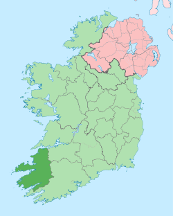
 Portmagee Location in Ireland | |
| Coordinates: 51°53′08″N 10°21′58″W / 51.885604°N 10.366116°WCoordinates: 51°53′08″N 10°21′58″W / 51.885604°N 10.366116°W | |
| Country | Ireland |
| Province | Munster |
| County | County Kerry |
| Population (2011) | |
| • Total | 390 (district) |
| Time zone | WET (UTC+0) |
| • Summer (DST) | IST (WEST) (UTC-1) |
| Irish Grid Reference | V370730 |

Portmagee (Irish: An Caladh, meaning "The Harbour")[1] is a village in County Kerry, Ireland. The village is located on the Iveragh peninsula south of Valentia Island. The name in Irish means 'the ferry', referring to its purpose as a crossing point to the island. Access to Valentia Island is now via a bridge from Portmagee. The bridge is called the Maurice O'Neill Memorial Bridge. The bridge was built in 1970 and named in memory of a young farmer captured and judged by a military court before being executed in 1942.
Name
The name Portmagee (Port Magee and Magee's Port as it was formerly known) comes from Captain Theobald Magee, a notorious 18th-century smuggler.[2] Having served in the army of King James as an officer, Magee 'retired' to a life of merchant shipping between France, Portugal and Ireland.[3] Thanks to the intricately chiselled coast around the South West, his trade in contraband spirits, textiles and tea and tobacco was extremely hard to police and therefore very profitable. He married Bridget Morgell,[3] the widow of a rich Dingle merchant and also the daughter of the then representative for Dingle, Thomas Crosbie. There is some suspicion that Magee's death in a Lisbon monastery was due to some exile imposed by the powerful MP. However, his wife and sons continued the family business of smuggling.
Tourism
In December 2012, Portmagee was awarded the Fáilte Ireland National Tourism Town Award, the first town to be awarded the accolade.[2]
Places of interest

.jpg)
The village serves as a departure point for tourists travelling to visit 'Skellig Michael', an island off the coast featuring a 6th-century monastic settlement. Skellig Michael (from Sceilig Mhichíl in the Irish language, meaning Michael's rock), also known as Great Skellig, is a steep rocky island in the Atlantic Ocean about 9 miles (14.5 kilometres) from the coast of County Kerry. It is the larger of the two Skellig Islands. Probably founded in the 7th century, for 600 years the island was a centre of monastic life for Irish Christian monks. The Gaelic monastery, which is situated almost at the summit of the 230-metre-high rock became a UNESCO World Heritage Site in 1996.[4] It is one of Europe's better known but least accessible monastic sites. Since the extreme remoteness of Skellig Michael has until recently discouraged visitors, the site is exceptionally well preserved. The very spartan conditions inside the monastery illustrate the ascetic lifestyle practiced by early Irish Christians. The monks lived in stone 'beehive' huts (clochans), perched above nearly vertical cliff walls.
See also
References
- ↑ "An Caladh". logainm.ie. Retrieved 8 December 2012.
- 1 2 McGreevy, Ronan; Anne Lucey (8 December 2012). "Tiny Kerry fishing village nets State's first 'tourism town award'". Irish Times. Retrieved 8 December 2012.
- 1 2 Pochin Mould, Daphne Desirée Charlotte (1978). Valentia: portrait of an island. Blackwater Press. p. 53.
- ↑ Brockman, Norbert (2011). Encyclopedia of Sacred Places, Volume 1. ABC-CLIO. p. 521. ISBN 9781598846546.
External links
| Wikivoyage has a travel guide for Portmagee. |
| Wikimedia Commons has media related to Portmagee. |
- Portmagee Local Area Plan
- Portmagee Info and Map
- Poem by Brendan O'Neill - Landing Mackerel on the Pier Head at Portmagee