Port of Saint John
| Port of Saint John | |
|---|---|
|
Cruise ship in port. | |
| Location | |
| Country | Canada |
| Location | Saint John, New Brunswick |
| Coordinates | Coordinates: 45°16′47″N 66°03′46″W / 45.2796°N 66.0628°W |
| Details | |
| Opened | Eighteenth century |
| Size | 45 hectares |
| Available berths | 13 |
| President and CEO | Jim Quinn |
| Statistics | |
| Annual cargo tonnage | 30.5 million metric revenue tons (FY2010)[1] |
| Annual container volume | 46,303 twenty-foot equivalent units (TEU) (FY2010) |
| Passenger traffic | 200,000 passengers (FY 2010) [1] |
| Annual revenue | CDN$13.7 million (FY 2009)[2] |
| Net income | CDN$0.773 million (FY 2010) |
|
Website www | |

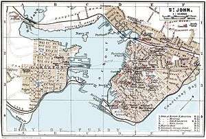
The Port of Saint John is a port complex that occupies 45 hectares (110 acres) of land along 3,900 m (12,800 ft) of waterfront of the Saint John Harbour at the mouth of the Saint John River in the city of Saint John, New Brunswick, Canada.[3] The Port of Saint John, with facilities on both sides of the river, is noted for its extreme tidal range and river currents. Because of the semi-diurnal tides and the river influence, slack water occurs at approximately half tide and not at high or low water as at most other ports.[4]
The port is administered by the Saint John Port Authority, a federal agency. Major products shipped through the port include oil, forest products and potash.
History

The location was first visited by Samuel de Champlain on his voyage of discovery to the New World in 1604, who described the Saint John River as “one of the largest and deepest we had yet seen” and who was advised by his Mi’kmaq guides that the river provided a route to the Saint Lawrence River valley with only a short portage.[5] Because of its strategic location, it became the site of a French stronghold known as Fort La Tour. Though the fort was sacked in 1645, the river remained an important trade route for French, English and First Nations traders throughout the 17th and 18th centuries.
The port did not begin to develop in earnest until the influx of United Empire Loyalists in 1783. It developed rapidly as a result of timber trade and shipbuilding. Saint John became the province's leading industrial centre during the 19th century with much of the shipbuilding industry being concentrated on Courtney Bay outside the main harbour area. One of the best known ships built in Saint John was the Marco Polo (1851) which became renowned for its speed.
The Irish potato famine of 1845–1849 saw a large immigrant influx, and to handle the new arrivals, the government constructed a quarantine station and hospital on Partridge Island at the mouth of the harbour. The immigration station continued to operate for many decades. In 1859, Partridge Island also became known as the site of the first successful demonstration of an automated steam-powered foghorn, invented by the Scotsman Robert Foulis who had settled in the city. The foghorn is "ranked by historians as one of the most outstanding in the development of navigation aids."[6]
For many years, the Port prospered as the winter port for Montreal. In 1889 the Canadian Pacific Railway opened a line across the state of Maine from Montreal to Saint John and transferred the majority of its trans-Atlantic passenger and cargo shipping to the port during the winter months.
During the First World War, the Port of Saint John became a trans-shipment point for the British Empire's war effort. It had less importance during World War II as the navy focus had been consolidated in Halifax.
The port suffered a decline following the opening of the St. Lawrence Seaway and the introduction of icebreaker services in the Seaway in the 1960s. In 1994 CPR left Saint John when it sold the line to shortline operator New Brunswick Southern Railway. The Canadian National Railway still services Saint John with a secondary mainline from Moncton.
Port facilities
There are several marine facilities situated on either side of the harbour.
The west side of the harbour includes:
- the Lower West Terminal, for dry bulk and liquid bulk
- the American Iron and Metals Terminal, for dry bulk
- inter-provincial ferry terminal, operated by Bay Ferries for passenger and vehicle ferry service to Digby, Nova Scotia
- the Rodney Container Terminal, for container, dry bulk, break bulk and project cargo (operated by Logistec Stevedoring, formerly operated by BrunTerm)
- the Navy Island Terminal, for container, dry bulk, break bulk and project cargo (formerly operated by ForTerm)
The east side of the harbour includes:
- HMCS Brunswicker, a Royal Canadian Navy reserve unit
- Canadian Coast Guard Station Saint John, a search and rescue station operating the lifeboat CCGS Courtney Bay
- the Long Wharf Terminal, for dry bulk, break bulk and project cargo
- the Pugsley Terminal, for dry bulk, break bulk and project cargo
- the Marco Polo Cruise Terminal[3][7]
- the Diamond Jubilee Cruise Terminal
- the Lower Cove Terminal, for dry bulk, break bulk and project cargo
- the Barrack Point Potash Terminal, operated by Potash Corporation of Saskatchewan (formerly operated by PotaCan)
- the Irving Oil Refinery Terminal, operated by Irving Oil
- the Canaport crude oil receiving terminal, handling supertankers for Irving Oil at Mispec Point, located 9 kilometres southeast of the city
- the Canaport LNG liquified natural gas receiving terminal, located adjacent to the Canaport crude oil terminal[8]
Former facilities:
- the former Canadian Coast Guard Base Saint John property on the east side, undergoing redevelopment as Fundy Quay
- the former Saint John Shipbuilding property on the east side, currently vacant
- the former Lantic Sugar property on the east side, razed and currently vacant
- the former Intercolonial Railway grain elevator on the west side, razed and currently vacant
- the former Canadian Pacific Railway grain elevator on the west side, razed and currently vacant

See also
Further reading
- Frederick William Wallace, The Romance of a Great Port: The Story of Saint John, New Brunswick (1935)
References
- 1 2 Press Release, “Port of Saint John Exceeds 30 Million Metric Tonnes of Cargo in Single Year”, January 2011
- ↑ 2009 Annual Report, p.10
- 1 2 Port of Saint John, Port Facilities
- ↑ Port of Saint John, Port Conditions
- ↑ David Hackett Fischer, Champlain’s Dream, Knopf, 2008, p. 166
- ↑ Dictionary of Canadian Biography, "Robert Foulis"
- ↑ Marco Polo Cruise Terminal
- ↑ Canaport LNG
| Wikimedia Commons has media related to Port of Saint John. |
| Major ports | |
|---|---|
| Prominent ports | |
| Other ports | |