Port Costa, California
| Port Costa | |
|---|---|
| Census-designated place | |
|
Heritage advertisement for Port Costa Flour | |
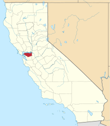
 Location in Contra Costa County and the state of California | |
 Port Costa Location in the United States | |
| Coordinates: 38°02′47″N 122°11′00″W / 38.04639°N 122.18333°WCoordinates: 38°02′47″N 122°11′00″W / 38.04639°N 122.18333°W | |
| Country |
|
| State |
|
| County | Contra Costa |
| Government | |
| • County Board |
District V: Federal Glover |
| • State Senate | Bill Dodd (D)[1] |
| • State Assembly | Tim Grayson (D)[2] |
| • U. S. Congress | Mike Thompson (D)[3] |
| Area[4] | |
| • Total | 0.158 sq mi (0.410 km2) |
| • Land | 0.158 sq mi (0.410 km2) |
| • Water | 0 sq mi (0 km2) 0% |
| Elevation[5] | 16 ft (5 m) |
| Population (2010) | |
| • Total | 190 |
| • Density | 1,200/sq mi (460/km2) |
| Time zone | PST (UTC-8) |
| • Summer (DST) | PDT (UTC-7) |
| ZIP code | 94569 |
| Area code | 510 |
| FIPS code | 06-58226 |
| GNIS feature IDs | 230948, 2409091 |
| [5] | |

Port Costa is a census-designated place (CDP) in Contra Costa County, California, United States. The population was 190 at the 2010 census.
Geography
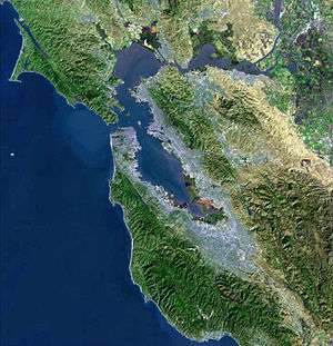
According to the United States Census Bureau, the CDP has a total area of 0.16 square miles (0.41 km2), all of it land. Port Costa is surrounded by rolling hills grazed by cattle and managed by East Bay Regional Park District. Carquinez Strait Regional Shoreline stretches from Crockett through Port Costa and to Martinez. Big Bull Valley Creek runs along McEwen Road into a historic reservoir just above the town, then it runs in an underground pipe culvert beneath the town to the Carquinez Strait.[6]
History
.JPG)
Port Costa was founded in 1879 as a landing for the railroad ferry Solano, owned and operated by the Central Pacific Railroad.[7] This put Port Costa on the main route of the transcontinental railroad.[7] The Solano, later joined by the Contra Costa, carried entire trains across the Carquinez Strait from Benicia to Port Costa,[7] from whence they continued on to the Oakland Pier.[7] For a time, it was also the United States' busiest wheat-shipping port and had a reputation as a colorful, sometimes violent community.
After California's wheat output dropped in the early 20th Century and especially, after the Southern Pacific (which took over the operations of the Central Pacific) constructed a railroad bridge at Martinez in 1930 to replace the ferry crossing, Port Costa lost population and importance.[7] Bill Rich was an influential property owner and raconteur. Since the late 1960s, it has mainly been a small shopping venue for antique hunters and a gathering place for bikers and motorcyclists.
Port Costa's first post office was established in 1881.[8]
Demographics
2010
The 2010 United States Census[9] reported that Port Costa had a population of 190. The population density was 1,200.1 people per square mile (463.3/km²). The racial makeup of Port Costa was 172 (90.5%) White, 2 (1.1%) African American, 2 (1.1%) Native American, 7 (3.7%) Asian, and 7 (3.7%) from two or more races. Hispanic or Latino of any race were 10 persons (5.3%).
The Census reported that 100% of the population lived in households.
There were 99 households, out of which 15 (15.2%) had children under the age of 18 living in them, 37 (37.4%) were opposite-sex married couples living together, 4 (4.0%) had a female householder with no husband present, 5 (5.1%) had a male householder with no wife present. There were 10 (10.1%) unmarried opposite-sex partnerships, and 3 (3.0%) same-sex married couples or partnerships. 42 households (42.4%) were made up of individuals and 9 (9.1%) had someone living alone who was 65 years of age or older. The average household size was 1.92. There were 46 families (46.5% of all households); the average family size was 2.61.
The population was spread out with 19 people (10.0%) under the age of 18, 13 people (6.8%) aged 18 to 24, 38 people (20.0%) aged 25 to 44, 80 people (42.1%) aged 45 to 64, and 40 people (21.1%) who were 65 years of age or older. The median age was 52.5 years. For every 100 females there were 97.9 males. For every 100 females age 18 and over, there were 101.2 males.
There were 110 housing units at an average density of 694.8 per square mile (268.3/km²), of which 53 (53.5%) were owner-occupied, and 46 (46.5%) were occupied by renters. The homeowner vacancy rate was 5.4%; the rental vacancy rate was 2.1%. 118 people (62.1% of the population) lived in owner-occupied housing units and 72 people (37.9%) lived in rental housing units.
2000
As of the census[10] of 2000, there were 232 people, 108 households, and 60 families residing in the CDP. The population density was 342.1 people per square mile (131.7/km²). There were 115 housing units at an average density of 169.6 per square mile (65.3/km²). The racial makeup of the CDP was 90.95% White, 0% Black,1.29% Native American, 1.29% Asian, 1.72% from other races, and 4.74% from two or more races. 6.90% of the population were Hispanic or Latino of any race.
There were 108 households out of which 20.4% had children under the age of 18 living with them, 46.3% were married couples living together, 3.7% had a female householder with no husband present, and 44.4% were non-families. 34.3% of all households were made up of individuals and 8.3% had someone living alone who was 65 years of age or older. The average household size was 2.15 and the average family size was 2.80.
In the CDP the population was spread out with 15.5% under the age of 18, 4.7% from 18 to 24, 28.0% from 25 to 44, 37.5% from 45 to 64, and 14.2% who were 65 years of age or older. The median age was 46 years. For every 100 females there were 121.0 males. For every 100 females age 18 and over, there were 110.8 males.
The median income for a household in the CDP was $61,429, as was the median income for a family. Males had a median income of $40,769 versus $58,000 for females. The per capita income for the CDP was $33,563. About 9.7% of families and 10.7% of the population were below the poverty line, including 27.9% of those under the age of eighteen and none of those sixty five or over.
100% of the residents speak English.[11]
Notes
- ↑ "Senators". State of California. Retrieved April 1, 2013.
- ↑ "Members Assembly". State of California. Retrieved April 1, 2013.
- ↑ "California's 5th Congressional District - Representatives & District Map". Civic Impulse, LLC. Retrieved March 9, 2013.
- ↑ "2010 Census U.S. Gazetteer Files – Places – California". United States Census Bureau.
- 1 2 "Port Costa". Geographic Names Information System. United States Geological Survey.
- ↑ U.S. Geological Survey Geographic Names Information System: Big Bull Valley
- 1 2 3 4 5 Images of America: Richmond, by Donald Bastin, Arcadia Publishing (SC), November 2003
- ↑ Durham, David L. (1998). California's Geographic Names: A Gazetteer of Historic and Modern Names of the State. Clovis, Calif.: Word Dancer Press. p. 684. ISBN 1-884995-14-4.
- ↑ "2010 Census Interactive Population Search: CA - Port Costa CDP". U.S. Census Bureau. Retrieved July 12, 2014.
- ↑ "American FactFinder". United States Census Bureau. Retrieved 2008-01-31.
- ↑ MLA Data Center, 10-21-07
External links
| Bodies of water |
|  |
|---|---|---|
| Counties | ||
| Major cities | ||
| Cities and towns 100k–250k | ||
| Cities and towns 50k–99k | ||
| Cities and towns 25k-50k | ||
| Cities and towns 10k–25k |
| |
| Sub-regions | ||
 |
Carquinez Strait | | ||
| Crockett | |
Martinez | ||
| ||||
| | ||||
| Franklin Canyon |