Poplar Bluff Township, Butler County, Missouri
| Poplar Bluff Township | |
|---|---|
| Township | |
 | |
| Coordinates: 36°45′31″N 090°23′51″W / 36.75861°N 90.39750°WCoordinates: 36°45′31″N 090°23′51″W / 36.75861°N 90.39750°W | |
| Country | United States |
| State | Missouri |
| County | Butler |
| Area | |
| • Total | 138.92 sq mi (359.81 km2) |
| • Land | 138.7 sq mi (359.24 km2) |
| • Water | 0.22 sq mi (0.57 km2) 0.16% |
| Elevation[1] | 364 ft (111 m) |
| Population (2000) | |
| • Total | 24,929 |
| • Density | 179.7/sq mi (69.4/km2) |
| FIPS code | 29-59114[2] |
| GNIS feature ID | 0766356 |
Poplar Bluff Township is one of ten townships in Butler County, Missouri, USA. As of the 2000 census, its population was 24,929.
Geography
Poplar Bluff Township covers an area of 138.92 square miles (359.8 km2) and contains one incorporated settlement, Poplar Bluff (the county seat). It contains seventeen cemeteries: Ashcraft, Black Creek, Carpenter Bend, Dooley, Friendship, Green Hill, Hvam, Marble Hill, Melton, Memorial Gardens, Morocco, Oak Hill, Podesva, Sacred Heart, Shadle, Sheppard and Woodlawn.
Carpenter Lake is within this township. The streams of Agee Creek, Black Creek, Black River, Buck Creek, Dobbs Creek, Harwell Creek, Hickory Creek, Hoedapp Creek, Indian Creek, Lewis Creek, Mill Creek, Pike Creek and Pike Slough run through this township.
Transportation
Poplar Bluff Township contains three airports or landing strips: Earl Fields Memorial Airport, Hayes Field and Lucy Lee Hospital Heliport.
References
- ↑ "US Board on Geographic Names". United States Geological Survey. 2007-10-25. Retrieved 2008-01-31.
- ↑ "American FactFinder". United States Census Bureau. Retrieved 2008-01-31.
External links
Municipalities and communities of Butler County, Missouri, United States | ||
|---|---|---|
| Cities | 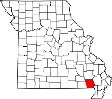 | |
| Townships | ||
| CDP | ||
| Other unincorporated communities | ||
| Ghost town | ||
| Footnotes | ‡This populated place also has portions in an adjacent county or counties | |