Pearl Beach, St. Clair County, Michigan
| Pearl Beach, Michigan | |
|---|---|
| Census-designated place (CDP) & Unincorporated community | |
 Location of Pearl Beach, Michigan | |
| Coordinates: 42°37′26″N 82°35′24″W / 42.62389°N 82.59000°WCoordinates: 42°37′26″N 82°35′24″W / 42.62389°N 82.59000°W | |
| Country | United States |
| State | Michigan |
| County | St. Clair |
| Area | |
| • Total | 3.1 sq mi (8.0 km2) |
| • Land | 2.1 sq mi (5.5 km2) |
| • Water | 1.0 sq mi (2.5 km2) |
| Elevation | 577 ft (176 m) |
| Population (2000) | |
| • Total | 3,224 |
| • Density | 1,514.7/sq mi (584.8/km2) |
| Time zone | Eastern (EST) (UTC-5) |
| • Summer (DST) | EDT (UTC-4) |
| ZIP code | 48001 (Algonac) |
| FIPS code | 26-63200[1] |
| GNIS feature ID | 1624814[2] |
Pearl Beach is an unincorporated community in St. Clair County in the U.S. state of Michigan and a Census-designated place (CDP) used for statistical purposes. The population was 3,224 at the 2000 census.
Unincorporated communities
- Pearl Beach is at Pearl Beach Boulevard and M-29 (Elevation: 581 ft./177 m.)[3]
- Pointe aux Tremble is located in towards the center of the CDP area, east of Pearl Beach community on M-29 west of Island Drive (42°N 82°W / 42°N 82°W). (Elevation: 577 ft./176 m.)[4]
Geography
According to the United States Census Bureau, the community has a total area of 3.1 square miles (8.0 km2), of which 2.1 square miles (5.4 km2) is land and 0.9 square miles (2.3 km2) (30.84%) is water. The CDP consists of a narrow strip along the north side of the North Channel of the St. Clair River from the western border of Algonac to the easternmost point of land where the North Channel flows into Anchor Bay. M-29 runs through the area, following the contour of the North Channel. Despite its name, there is in fact NO beach in Pearl Beach.
Demographics
As of the census[1] of 2000, there were 3,224 people, 1,395 households, and 980 families residing in the community. The population density was 1,514.7 per square mile (584.4/km²). There were 1,560 housing units at an average density of 732.9 per square mile (282.8/km²). The racial makeup of the community was 98.17% White, 0.40% Native American, 0.16% Asian, 0.34% from other races, and 0.93% from two or more races. Hispanic or Latino of any race were 0.62% of the population.
There were 1,395 households out of which 20.1% had children under the age of 18 living with them, 62.9% were married couples living together, 4.3% had a female householder with no husband present, and 29.7% were non-families. 24.8% of all households were made up of individuals and 11.1% had someone living alone who was 65 years of age or older. The average household size was 2.31 and the average family size was 2.76.
In the community the population was spread out with 17.4% under the age of 18, 6.1% from 18 to 24, 23.9% from 25 to 44, 36.2% from 45 to 64, and 16.4% who were 65 years of age or older. The median age was 46 years. For every 100 females there were 106.4 males. For every 100 females age 18 and over, there were 102.7 males.
The median income for a household in the community was $55,186, and the median income for a family was $68,583. Males had a median income of $58,542 versus $28,811 for females. The per capita income for the community was $32,320. About 0.6% of families and 3.2% of the population were below the poverty line, including 2.9% of those under age 18 and 5.2% of those age 65 or over.
References
- 1 2 "American FactFinder". United States Census Bureau. Retrieved 2008-01-31.
- ↑ "US Board on Geographic Names". United States Geological Survey. 2007-10-25. Retrieved 2008-01-31.
- ↑ U.S. Geological Survey Geographic Names Information System: Pointe aux Tremble, Michigan & GNIS in Google Map
- ↑ U.S. Geological Survey Geographic Names Information System: Pointe aux Tremble, Michigan & GNIS in Google Map
Municipalities and communities of St. Clair County, Michigan, United States | ||
|---|---|---|
| Cities | 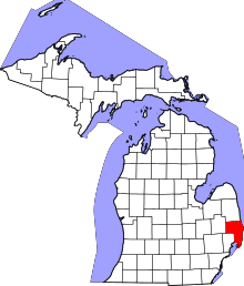 | |
| Villages | ||
| Charter townships | ||
| General law townships | ||
| CDP | ||
| Other unincorporated communities |
| |
| Footnotes | ‡This populated place also has portions in an adjacent county or counties | |