Podporozhye, Leningrad Oblast
| Podporozhye (English) Подпорожье (Russian) | |
|---|---|
| - Town[1] - | |
|
| |
.svg.png) Location of Leningrad Oblast in Russia | |
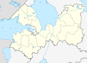 Podporozhye | |
|
| |
.gif) |
|
|
| |
| Administrative status (as of June 2013) | |
| Country | Russia |
| Federal subject | Leningrad Oblast[1] |
| Administrative district | Podporozhsky District[1] |
| Settlement municipal formation | Podporozhskoye Settlement Municipal Formation[1] |
| Administrative center of | Podporozhsky District,[1] Podporozhskoye Settlement Municipal Formation[1] |
| Municipal status (as of May 2010) | |
| Municipal district | Podporozhsky Municipal District[2] |
| Urban settlement | Podporozhskoye Urban Settlement[2] |
| Administrative center of | Podporozhsky Municipal District,[2] Podporozhskoye Urban Settlement[2] |
| Statistics | |
| Population (2010 Census) | 18,733 inhabitants[3] |
| Time zone | MSK (UTC+03:00)[4] |
| Town status since | June 28, 1956[5] |
| Postal code(s)[6] | 187780-187783, 187789, 187799 |
| Podporozhye on Wikimedia Commons | |
Podporozhye (Russian: Подпоро́жье; Veps: Kos’kenaluine) is a town and the administrative center of Podporozhsky District in Leningrad Oblast, Russia, located on the Svir River 285 kilometers (177 mi) northeast of St. Petersburg. Population: 18,733 (2010 Census);[3] 20,312 (2002 Census);[7] 23,295 (1989 Census).[8]
History
In the early 18th century, Peter the Great ordered the resettlement of peasants from the Msta River to the current location of Podporozhye to organize navigation along the Svir River, known for its nearly impassable rapids.[9] In the late 19th century, these minor settlements next to the Svir rapids (Sigovets and Medvedets) received the name of Podporozhye (literally, "under the rapids"). By the beginning of the 20th century, Podporozhye was a village and a part of Lodeynopolsky Uyezd in Olonets Governorate.[10] In 1922, Olonets Governorate was abolished and Lodeynopolsky Uyezd was transferred to Petrograd Governorate (later Leningrad Oblast).[10]
On August 1, 1927, the uyezds in Leningrad Oblast were abolished and Podporozhsky District with the administrative center in Podporozhye was established.[10] It was a part of Lodeynoye Pole Okrug of Leningrad Oblast.[5] In 1932, the administrative center of the district was moved to the selo of Vazhiny.[5] In 1936, the construction of the Upper Svir Hydroelectric Station, launched in 1952, began. On July 5, 1937, Podporozhye was transformed into a work settlement and on September 11, 1937, the district's administrative center was moved back to Podroporozhye.[5] Between 1941 and 1944, during World War II, Podporozhye was occupied by Finnish troops.[5] On June 28, 1956, Podporozhye was granted town status.[5]
Administrative and municipal status
Within the framework of administrative divisions, Podporozhye serves as the administrative center of Podporozhsky District.[1] As an administrative division, it is, together with thirteen rural localities, incorporated within Podporozhsky District as Podporozhskoye Settlement Municipal Formation.[1] As a municipal division, Podporozhskoye Settlement Municipal Formation is incorporated within Podporozhsky Municipal District as Podporozhskoye Urban Settlement.[2]
Economy
Industry
.JPG)
There are enterprises of construction, as well as food industry, in Podporozhye.[11] The Upper Svir Hydroelectric Station is located in Podporozhye.
Transportation
The railway connecting St. Petersburg and Murmansk passes Podporozhye.
A paved road connecting Lodeynoye Pole with Vytegra in Vologda Oblast passes Podporozhye as well. There are also local roads.
The Svir River is navigable and is a part of the Volga–Baltic Waterway, connecting the basins of the Volga and the Neva Rivers. There is regular cruise and cargo traffic along the waterway.
Culture and recreation
The district contains two cultural heritage monuments of local significance, which are the Upper Svir Hydroelectric Station and a monument to soldiers fallen in World War II.[12]
Podporozhye hosts the Podporozhye District Museum, which displays collections of local interest.[13]
Twin towns and sister cities
Podporozhye is twinned with:
References
Notes
- 1 2 3 4 5 6 7 8 Oblast Law #32-oz
- 1 2 3 4 5 Law #51-oz
- 1 2 Russian Federal State Statistics Service (2011). "Всероссийская перепись населения 2010 года. Том 1" [2010 All-Russian Population Census, vol. 1]. Всероссийская перепись населения 2010 года (2010 All-Russia Population Census) (in Russian). Federal State Statistics Service. Retrieved June 29, 2012.
- ↑ Правительство Российской Федерации. Федеральный закон №107-ФЗ от 3 июня 2011 г. «Об исчислении времени», в ред. Федерального закона №271-ФЗ от 03 июля 2016 г. «О внесении изменений в Федеральный закон "Об исчислении времени"». Вступил в силу по истечении шестидесяти дней после дня официального опубликования (6 августа 2011 г.). Опубликован: "Российская газета", №120, 6 июня 2011 г. (Government of the Russian Federation. Federal Law #107-FZ of June 31, 2011 On Calculating Time, as amended by the Federal Law #271-FZ of July 03, 2016 On Amending Federal Law "On Calculating Time". Effective as of after sixty days following the day of the official publication.).
- 1 2 3 4 5 6 Подпорожский район (август 1927 г. - февраль 1963 г., январь 1965 г.) (in Russian). Система классификаторов исполнительных органов государственной власти Санкт-Петербурга. Retrieved March 10, 2014.
- ↑ Почта России. Информационно-вычислительный центр ОАСУ РПО. (Russian Post). Поиск объектов почтовой связи (Postal Objects Search) (Russian)
- ↑ Russian Federal State Statistics Service (May 21, 2004). "Численность населения России, субъектов Российской Федерации в составе федеральных округов, районов, городских поселений, сельских населённых пунктов – районных центров и сельских населённых пунктов с населением 3 тысячи и более человек" [Population of Russia, Its Federal Districts, Federal Subjects, Districts, Urban Localities, Rural Localities—Administrative Centers, and Rural Localities with Population of Over 3,000] (XLS). Всероссийская перепись населения 2002 года [All-Russia Population Census of 2002] (in Russian). Retrieved August 9, 2014.
- ↑ Demoscope Weekly (1989). "Всесоюзная перепись населения 1989 г. Численность наличного населения союзных и автономных республик, автономных областей и округов, краёв, областей, районов, городских поселений и сёл-райцентров" [All Union Population Census of 1989: Present Population of Union and Autonomous Republics, Autonomous Oblasts and Okrugs, Krais, Oblasts, Districts, Urban Settlements, and Villages Serving as District Administrative Centers]. Всесоюзная перепись населения 1989 года [All-Union Population Census of 1989] (in Russian). Институт демографии Национального исследовательского университета: Высшая школа экономики [Institute of Demography at the National Research University: Higher School of Economics]. Retrieved August 9, 2014.
- ↑ Энциклопедия Города России. Moscow: Большая Российская Энциклопедия. 2003. p. 359. ISBN 5-7107-7399-9.
- 1 2 3 Лодейнопольский уезд (in Russian). Система классификаторов исполнительных органов государственной власти Санкт-Петербурга. Retrieved March 11, 2014.
- ↑ Информация о социально-экономической ситуации за 1 полугодие 2012 года (in Russian). Администрация МО "Подпорожский муниципальный район Ленинградской области". Retrieved November 24, 2012.
- ↑ Памятники истории и культуры народов Российской Федерации (in Russian). Russian Ministry of Culture. Retrieved 2 June 2016.
- ↑ Подпорожский краеведческий музей (in Russian). Российская сеть культурного наследия. Retrieved November 27, 2012.
Sources
- Законодательное собрание Ленинградской области. Областной закон №32-оз от 15 июня 2010 г. «Об административно-территориальном устройстве Ленинградской области и порядке его изменения», в ред. Областного закона №23-оз от 8 мая 2014 г. «Об объединении муниципальных образований "Приморское городское поселение" Выборгского района Ленинградской области и "Глебычевское сельское поселение" Выборгского района Ленинградской области и о внесении изменений в отдельные Областные законы». Вступил в силу со дня официального опубликования. Опубликован: "Вести", №112, 23 июня 2010 г. (Legislative Assembly of Leningrad Oblast. Oblast Law #32-oz of June 15, 2010 On the Administrative-Territorial Structure of Leningrad Oblast and on the Procedures for Its Change, as amended by the Oblast Law #23-oz of May 8, 2014 On Merging the Municipal Formations of "Primorskoye Urban Settlement" in Vyborgsky District of Leningrad Oblast and "Glebychevskoye Rural Settlement" in Vyborgsky District of Leningrad Oblast and on Amending Various Oblast Laws. Effective as of the day of the official publication.).
- Законодательное собрание Ленинградской области. Областной закон №51-оз от 1 сентября 2004 г. «Об установлении границ и наделении соответствующим статусом муниципального образования Подпорожский муниципальный район и муниципальных образований в его составе», в ред. Областного закона №17-оз от 6 мая 2010 г «О внесении изменений в некоторые областные законы в связи с принятием федерального закона "О внесении изменений в отдельные законодательные акты Российской Федерации в связи с совершенствованием организации местного самоуправления"». Вступил в силу через 10 дней со дня официального опубликования (24 сентября 2004 г.). Опубликован: "Вестник Правительства Ленинградской области", №27, 14 сентября 2004 г. (Legislative Assembly of Leningrad Oblast. Oblast Law #51-oz of September 1, 2004 On Establishing the Borders of and Granting an Appropriate Status to the Municipal Formation of Podporozhsky Municipal District and to the Municipal Formations Comprised By It, as amended by the Oblast Law #17-oz of May 6, 2010 On Amending Various Oblast Laws Due to the Adoption of the Federal Law "On Amending Various Legislative Acts of the Russian Federation Due to the Improvement of the Organization of the Local Self-Government". Effective as of after 10 days from the day of the official publication (September 24 2004).).
Administrative center: none | |||
| Cities and towns |
| ||
| Districts | |||