Plum Coulee
Plum Coulee is an unincorporated urban community in the Municipality of Rhineland within the Canadian province of Manitoba that held town status prior to January 1, 2015. It is west of Altona, one hour southwest of Winnipeg and half an hour from the United States border. It is also the former home to the Plum Coulee Xpress hockey club. What's special about this little town is that it has its own man made beach located right in town. Philanthropist Saidye Bronfman was born in Plum Coulee.
Development
Plum Coulee's population of 800 is growing through land development. Working with local land owners, the former Town of Plum Coulee developed a long range zoning plan that can accommodate new industrial partners, commercial ventures, and private residents.
Climate
Plum Coulee has the hottest daytime temperatures in Manitoba. Summers are hot and winters are similar to other cities in the Canadian Prairies. There are 21 inches of precipitation annually.
| Climate data for Plum Coulee, MB (1971-2000 Normals) | |||||||||||||
|---|---|---|---|---|---|---|---|---|---|---|---|---|---|
| Month | Jan | Feb | Mar | Apr | May | Jun | Jul | Aug | Sep | Oct | Nov | Dec | Year |
| Record high °C (°F) | 8.3 (46.9) |
14 (57) |
18 (64) |
36 (97) |
38 (100) |
38.5 (101.3) |
39.4 (102.9) |
40 (104) |
38.5 (101.3) |
34 (93) |
25.5 (77.9) |
15 (59) |
40 (104) |
| Average high °C (°F) | −11.5 (11.3) |
−7.1 (19.2) |
−0.3 (31.5) |
10.8 (51.4) |
20.1 (68.2) |
24.2 (75.6) |
26.6 (79.9) |
26.2 (79.2) |
19.9 (67.8) |
11.8 (53.2) |
−0.2 (31.6) |
−8.4 (16.9) |
9.3 (48.7) |
| Daily mean °C (°F) | −16.3 (2.7) |
−12 (10) |
−4.9 (23.2) |
4.8 (40.6) |
13 (55) |
17.8 (64) |
20 (68) |
19.2 (66.6) |
13.4 (56.1) |
6.2 (43.2) |
−4.4 (24.1) |
−12.9 (8.8) |
3.7 (38.7) |
| Average low °C (°F) | −21.1 (−6) |
−16.9 (1.6) |
−9.4 (15.1) |
−1.3 (29.7) |
5.9 (42.6) |
11.3 (52.3) |
13.4 (56.1) |
12.1 (53.8) |
6.9 (44.4) |
0.6 (33.1) |
−8.6 (16.5) |
−17.4 (0.7) |
−2 (28) |
| Record low °C (°F) | −37.8 (−36) |
−40.5 (−40.9) |
−32.8 (−27) |
−23.3 (−9.9) |
−10 (14) |
−1.1 (30) |
2.5 (36.5) |
−1 (30) |
−6.5 (20.3) |
−20 (−4) |
−36.5 (−33.7) |
−37.5 (−35.5) |
−40.5 (−40.9) |
| Average precipitation mm (inches) | 20.8 (0.819) |
19 (0.75) |
25.8 (1.016) |
32.2 (1.268) |
62.3 (2.453) |
87.4 (3.441) |
75.8 (2.984) |
69.5 (2.736) |
53 (2.09) |
40 (1.57) |
25.8 (1.016) |
22 (0.87) |
533.6 (21.008) |
| Source: Environment Canada[1] | |||||||||||||
Neighbouring communities
 |
Roland | | ||
| Winkler | |
Altona | ||
| ||||
| | ||||
| United States border |
References
- ↑ "Canadian Climate Normals 1971–2000". Environment Canada. Retrieved 25 Augaust 2012. Check date values in:
|access-date=(help)
External links
- Former Town of Plum Coulee
- Village of Plum Coulee 2006 Community Profile
- Map of Plum Coulee at Statcan
Coordinates: 49°11′28″N 97°45′38″W / 49.19111°N 97.76056°W
| Cities | 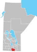 | |
|---|---|---|
| Towns | ||
| Rural municipalities | ||
| Unincorporated communities | ||