Plounéour-Ménez
| Plounéour-Ménez Plouneour-Menez | |
|---|---|
|
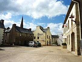
The town hall square, in Plounéour-Ménez | |
 Plounéour-Ménez | |
|
Location within Brittany region  Plounéour-Ménez | |
| Coordinates: 48°26′24″N 3°53′23″W / 48.4400°N 3.8897°WCoordinates: 48°26′24″N 3°53′23″W / 48.4400°N 3.8897°W | |
| Country | France |
| Region | Brittany |
| Department | Finistère |
| Arrondissement | Morlaix |
| Canton | Saint-Thégonnec |
| Intercommunality | Morlaix |
| Government | |
| • Mayor (2014–2020) | Jean-Michel Parcheminal |
| Area1 | 51.74 km2 (19.98 sq mi) |
| Population (2008)2 | 1,212 |
| • Density | 23/km2 (61/sq mi) |
| Time zone | CET (UTC+1) |
| • Summer (DST) | CEST (UTC+2) |
| INSEE/Postal code | 29202 / 29410 |
| Elevation | 124–387 m (407–1,270 ft) |
|
1 French Land Register data, which excludes lakes, ponds, glaciers > 1 km² (0.386 sq mi or 247 acres) and river estuaries. 2 Population without double counting: residents of multiple communes (e.g., students and military personnel) only counted once. | |
Plounéour-Ménez (Breton: Plouneour-Menez) is a commune in the Finistère department of Brittany in north-western France.
Population
Inhabitants of Plounéour-Ménez are called in French Énéouriens.
| Historical population | ||
|---|---|---|
| Year | Pop. | ±% |
| 1793 | 3,301 | — |
| 1800 | 3,030 | −8.2% |
| 1806 | 3,437 | +13.4% |
| 1821 | 3,971 | +15.5% |
| 1831 | 4,127 | +3.9% |
| 1836 | 4,172 | +1.1% |
| 1841 | 4,246 | +1.8% |
| 1846 | 3,973 | −6.4% |
| 1851 | 3,988 | +0.4% |
| 1856 | 3,942 | −1.2% |
| 1861 | 3,928 | −0.4% |
| 1866 | 3,976 | +1.2% |
| 1872 | 3,186 | −19.9% |
| 1876 | 3,194 | +0.3% |
| 1881 | 3,088 | −3.3% |
| 1886 | 3,097 | +0.3% |
| 1891 | 3,067 | −1.0% |
| 1896 | 2,929 | −4.5% |
| 1901 | 2,914 | −0.5% |
| 1906 | 2,898 | −0.5% |
| 1911 | 2,777 | −4.2% |
| 1921 | 2,419 | −12.9% |
| 1926 | 2,284 | −5.6% |
| 1931 | 2,143 | −6.2% |
| 1936 | 2,006 | −6.4% |
| 1946 | 1,905 | −5.0% |
| 1954 | 1,669 | −12.4% |
| 1962 | 1,515 | −9.2% |
| 1968 | 1,396 | −7.9% |
| 1975 | 1,208 | −13.5% |
| 1982 | 1,211 | +0.2% |
| 1990 | 1,100 | −9.2% |
| 1999 | 1,195 | +8.6% |
| 2008 | 1,212 | +1.4% |
See also
- Communes of the Finistère department
- Parc naturel régional d'Armorique
- Roland Doré sculptor Sculpture in local church
- Plounéour-Ménez Parish close
References
- Mayors of Finistère Association (French)
External links
| Wikimedia Commons has media related to Plounéour-Ménez. |
This article is issued from Wikipedia - version of the 2/11/2016. The text is available under the Creative Commons Attribution/Share Alike but additional terms may apply for the media files.