Playhatch
| Playhatch | |
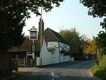
 View of the road through Playhatch |
|
 Playhatch |
|
| OS grid reference | SU7476 |
|---|---|
| Civil parish | Eye & Dunsden |
| District | South Oxfordshire |
| Shire county | Oxfordshire |
| Region | South East |
| Country | England |
| Sovereign state | United Kingdom |
| Post town | Reading |
| Postcode district | RG4 |
| Dialling code | 0118 |
| Police | Thames Valley |
| Fire | Oxfordshire |
| Ambulance | South Central |
| EU Parliament | South East England |
| UK Parliament | Henley |
| Website | Eye & Dunsden Parish Council |
|
|
Coordinates: 51°28′58″N 0°55′59″W / 51.4828°N 0.9331°W
Playhatch (or Play Hatch) is a hamlet in the civil parish of Eye & Dunsden in South Oxfordshire, England, about 2 miles (3.2 km) northeast of Reading, Berkshire.
Overview
Before 1866, Playhatch formed part of the Oxfordshire section of Sonning civil parish.
Berry Brook starts close to the Redgrave-Pinsent Rowing Lake to the southwest, running northeast through the River Thames floodplain past Playhatch, under the B478 Playhatch Road near the Sonning Works, before joining the river at Hallsmead Ait.
Amenities
The Shoulder of Mutton public house at Playhatch.
The hamlet has three public houses:
- The Crown, a 16th-century coaching inn[1]
- The Flowing Spring, controlled by Fuller's Brewery[2]
- The Shoulder of Mutton[3]
Just south of the hamlet is the Redgrave-Pinsent Rowing Lake.
See also
References
External links
-
 Media related to Playhatch at Wikimedia Commons

This article is issued from Wikipedia - version of the 8/25/2015. The text is available under the Creative Commons Attribution/Share Alike but additional terms may apply for the media files.