Platte Township, Buchanan County, Missouri
| Platte Township | |
|---|---|
| Township | |
 | |
| Coordinates: 39°35′44″N 094°38′58″W / 39.59556°N 94.64944°WCoordinates: 39°35′44″N 094°38′58″W / 39.59556°N 94.64944°W | |
| Country | United States |
| State | Missouri |
| County | Buchanan |
| Area | |
| • Total | 30.77 sq mi (79.69 km2) |
| • Land | 30.76 sq mi (79.66 km2) |
| • Water | 0.01 sq mi (0.03 km2) 0.04% |
| Elevation[1] | 899 ft (274 m) |
| Population (2000) | |
| • Total | 416 |
| • Density | 13.5/sq mi (5.2/km2) |
| FIPS code | 29-58124[2] |
| GNIS feature ID | 0766343 |
Platte Township is one of twelve townships in Buchanan County, Missouri, USA. As of the 2000 census, its population was 416.
Platte Township was established in 1839, taking its name from the Platte River.[3]
Geography
Platte Township covers an area of 30.77 square miles (79.7 km2) and contains no incorporated settlements. It contains six cemeteries: Allen, Frazier, Hebron, Number 6, Tobin and Witts.
The streams of Belcher Branch, Castile Creek, Crabapple Branch, DeMoss Branch, Frazier Branch, Jenkins Branch, Malden Creek and Wolfpen Creek run through this township.
References
- ↑ "US Board on Geographic Names". United States Geological Survey. 2007-10-25. Retrieved 2008-01-31.
- ↑ "American FactFinder". United States Census Bureau. Retrieved 2008-01-31.
- ↑ "Buchanan County Place Names, 1928–1945 (archived)". The State Historical Society of Missouri. Retrieved 4 September 2016.
External links
Municipalities and communities of Buchanan County, Missouri, United States | ||
|---|---|---|
| Cities | 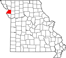 | |
| Villages | ||
| Townships | ||
| Unincorporated communities | ||
| Footnotes | ‡This populated place also has portions in an adjacent county or counties | |
This article is issued from Wikipedia - version of the 9/5/2016. The text is available under the Creative Commons Attribution/Share Alike but additional terms may apply for the media files.