Plainville, Ohio
| Plainville, Ohio | |
|---|---|
| Census-designated place | |
 Plainville, Ohio | |
| Coordinates: 39°8′31″N 84°21′35″W / 39.14194°N 84.35972°WCoordinates: 39°8′31″N 84°21′35″W / 39.14194°N 84.35972°W | |
| Country | United States |
| State | Ohio |
| County | Hamilton |
| Area | |
| • Total | 0.08 sq mi (0.2 km2) |
| • Land | 0.08 sq mi (0.2 km2) |
| • Water | 0 sq mi (0 km2) |
| Elevation[1] | 499 ft (152 m) |
| Population (2010) | |
| • Total | 87 |
| • Density | 1,100/sq mi (440/km2) |
| Time zone | Eastern (EST) (UTC-5) |
| • Summer (DST) | EDT (UTC-4) |
| FIPS code | 39-63072[2] |
| GNIS feature ID | 1056477[1] |
Plainville is a census-designated place (CDP) in Hamilton County, Ohio, United States.[3] The population was 87 at the 2010 census, with 100% being Caucasian and 89.7% being over the age of 18.[4]
Geography
Plainville is located at 39°8′31″N 84°21′35″W / 39.14194°N 84.35972°W[5] in a valley on the banks of the Little Miami River, opposite Newtown and adjacent to Mariemont and Indian Hill. Plainville is part of the Greater Cincinnati area and the Mariemont City School District.[6][7] Many of the residences and structures are from the 19th century, and the old Plainville School which was built in 1910 and closed in 1957 still stands on Walton Creek Road and now serves as the home theater for the Mariemont Players theater troupe.[8]
According to the United States Census Bureau, the CDP has a total area of 0.077 square miles (0.2 km2), all land.[9]
References
- 1 2 "US Board on Geographic Names". United States Geological Survey. 2007-10-25. Retrieved 2008-01-31.
- ↑ "American FactFinder". United States Census Bureau. Retrieved 2008-01-31.
- ↑ U.S. Geological Survey Geographic Names Information System: Plainville, Ohio
- ↑ "Profile of General Population and Housing Characteristics: 2010 Demographic Profile Data (DP-1): Plainville CDP, Ohio". U.S. Census Bureau, American Factfinder. Retrieved November 14, 2012.
- ↑ "US Gazetteer files: 2010, 2000, and 1990". United States Census Bureau. 2011-02-12. Retrieved 2011-04-23.
- ↑ District profile, Mariemont City Schools
- ↑ "http://censusviewer.com/city/OH/Plainville"
- ↑ http://www.oldohioschools.com/hamilton_county.htm
- ↑ "Geographic Identifiers: 2010 Demographic Profile Data (G001): Plainville CDP, Ohio". U.S. Census Bureau, American Factfinder. Retrieved November 14, 2012.
Municipalities and communities of Hamilton County, Ohio, United States | ||
|---|---|---|
| Cities | 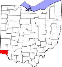 | |
| Villages | ||
| Townships | ||
| CDPs |
| |
| Other unincorporated communities | ||
| Footnotes | ‡This populated place also has portions in an adjacent county or counties | |