Plains Township, Luzerne County, Pennsylvania
| Plains Township, Pennsylvania | |
|---|---|
| Township | |
|
SS Peter and Paul Catholic Church | |
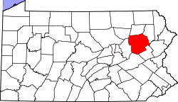
 Map of Luzerne County, Pennsylvania Highlighting Plains Township | |
 Map of Luzerne County, Pennsylvania | |
| Country | United States |
| State | Pennsylvania |
| County | Luzerne |
| Settled | 1762 |
| Incorporated | 1851 |
| Area | |
| • Total | 13.2 sq mi (34.1 km2) |
| • Land | 12.9 sq mi (33.4 km2) |
| • Water | 0.3 sq mi (0.7 km2) |
| Population (2010) | |
| • Total | 9,961 |
| • Density | 760/sq mi (290/km2) |
| Time zone | Eastern (EST) (UTC-5) |
| • Summer (DST) | EDT (UTC-4) |
| Website |
www |

Plains Township is a township in Luzerne County, Pennsylvania, United States, on the outskirts of the city of Wilkes-Barre. The population was 9,961 at the 2010 census.[1] Plains Township is the location of Pennsylvania's first casino, Mohegan Sun at Pocono Downs. It is also the birthplace of Chicago White Sox hall of famer Ed Walsh and LTG John J. Yeosock a United States Army general who commanded the 3rd U.S. Army during Operation Desert Shield and Operation Desert Storm.
Geography
According to the United States Census Bureau, the township has a total area of 13.2 square miles (34.1 km2), of which 12.9 square miles (33.4 km2) is land and 0.27 square miles (0.7 km2), or 1.95%, is water. It extends from the Susquehanna River in the northwest to the north slope of Wyoming Mountain in the southeast. Its villages include Hilldale, Hudson, Llewellyn Corners (also in Bear Creek Township), Midvale, Plains, Plainsville, and Westminster.
Plains Township's numbered routes include Interstate 81, Route 115, Route 309, and Route 315. Interstate 476 crosses the eastern portion of Plains Township between the Wilkes-Barre and Wyoming Valley interchanges with Routes 115 and 315, respectively. Main Street and River Street cross the populous northwestern portion of the township between Wilkes-Barre and Pittston. Route 309 follows the Cross Valley Expressway from the junction of I-81 and PA-115 to the West Side communities and also has an interchange with River Street in the township.
Neighboring municipalities
- Wilkes-Barre (southwest)
- Kingston (west)
- Forty Fort (west)
- Wyoming (north)
- Jenkins Township (north and northeast)
- Laflin (northeast)
- Bear Creek Township (southeast)
- Laurel Run (south)
- Wilkes-Barre Township (south)
Demographics
As of the census[2] of 2000, there were 10,906 people, 4,556 households, and 2,870 families residing in the township. The population density was 822.1 people per square mile (317.3/km2). There were 5,007 housing units at an average density of 377.4/sq mi (145.7/km2). The racial makeup of the township was 98.33% White, 0.48% African American, 0.03% Native American, 0.80% Asian, 0.09% from other races, and 0.28% from two or more races. Hispanic or Latino of any race were 0.51% of the population.
There were 4,556 households, out of which 23.5% had children under the age of 18 living with them, 48.4% were married couples living together, 10.5% had a female householder with no husband present, and 37.0% were non-families. 33.1% of all households were made up of individuals, and 16.1% had someone living alone who was 65 years of age or older. The average household size was 2.26 and the average family size was 2.89.
In the township the population was spread out, with 17.6% under the age of 18, 6.4% from 18 to 24, 26.0% from 25 to 44, 25.6% from 45 to 64, and 24.4% who were 65 years of age or older. The median age was 45 years. For every 100 females there were 93.8 males. For every 100 females age 18 and over, there were 90.1 males.
The median income for a household in the township was $36,603, and the median income for a family was $46,549. Males had a median income of $34,076 versus $25,880 for females. The per capita income for the township was $19,712. About 6.9% of families and 8.3% of the population were below the poverty line, including 11.1% of those under age 18 and 9.5% of those age 65 or over.

 Wilkes-Barre Area CTC
References
- ↑ "Profile of General Population and Housing Characteristics: 2010 Demographic Profile Data (DP-1): Plains township, Luzerne County, Pennsylvania". U.S. Census Bureau, American Factfinder. Retrieved April 18, 2012.
- ↑ "American FactFinder". United States Census Bureau. Retrieved 2008-01-31.
External links
Municipalities and communities of Luzerne County, Pennsylvania, United States | ||
|---|---|---|
| Cities | | |
| Boroughs |
| |
| Townships | ||
| CDPs | ||
| Unincorporated communities |
| |
| Footnotes | ‡This populated place also has portions in an adjacent county or counties | |
Coordinates: 41°16′00″N 75°44′29″W / 41.26667°N 75.74139°W