Plaffeien
| Plaffeien | ||
|---|---|---|
|
Plaffeien village | ||
| ||
 Plaffeien | ||
|
Location of Plaffeien 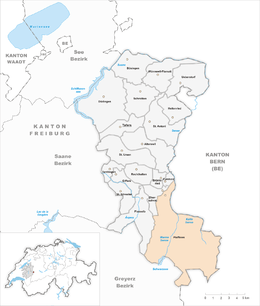 | ||
| Coordinates: 46°44′N 7°17′E / 46.733°N 7.283°ECoordinates: 46°44′N 7°17′E / 46.733°N 7.283°E | ||
| Country | Switzerland | |
| Canton | Fribourg | |
| District | Sense | |
| Government | ||
| • Mayor | Gemeindeammann | |
| Area[1] | ||
| • Total | 59.28 km2 (22.89 sq mi) | |
| Elevation | 856 m (2,808 ft) | |
| Population (Dec 2015[2]) | ||
| • Total | 1,982 | |
| • Density | 33/km2 (87/sq mi) | |
| Postal code | 1716 | |
| SFOS number | 2299 | |
| Localities | Schwarzsee | |
| Surrounded by | Boltigen (BE), Cerniat, Charmey (Gruyère), Guggisberg (BE), Jaun, Oberschrot, Oberwil im Simmental (BE), Plasselb, Zumholz | |
| Twin towns | Kasterlee (Belgium) | |
| Website |
www SFSO statistics | |


Plaffeien (French: Planfayon)is a municipality in the district of Sense in the canton of Fribourg in Switzerland. It is one of the municipalities with a large majority of German speakers in the mostly French speaking Canton of Fribourg.
History
Plaffeien is first mentioned in 1148 as Planfeiun. In 1339 it was mentioned as Blanfeyen.[3]
Geography

Plaffeien has an area of 59.28 km2 (22.89 sq mi).[1] Of this area, 28.55 km2 (11.02 sq mi) or 48.2% is used for agricultural purposes, while 22.66 km2 (8.75 sq mi) or 38.2% is forested. Of the rest of the land, 1.72 km2 (0.66 sq mi) or 2.9% is settled (buildings or roads), 0.95 km2 (0.37 sq mi) or 1.6% is either rivers or lakes and 5.53 km2 (2.14 sq mi) or 9.3% is unproductive land.[4]
Of the built up area, housing and buildings made up 1.4% and transportation infrastructure made up 1.1%. Out of the forested land, 33.7% of the total land area is heavily forested and 4.4% is covered with orchards or small clusters of trees. Of the agricultural land, 10.1% is pastures and 37.8% is used for alpine pastures. Of the water in the municipality, 0.5% is in lakes and 1.1% is in rivers and streams. Of the unproductive areas, 5.4% is unproductive vegetation and 3.9% is too rocky for vegetation.[4]
The municipality is located in the Sense district. The village of Plaffeien is located about 12 km (7.5 mi) south-east of Fribourg. In addition to the village, the municipality includes the Muscherenschlund valley, the Schwarzsee valley and the peak of the Schafberg at an elevation of 2,235 m (7,333 ft) above sea level.
Coat of arms
The blazon of the municipal coat of arms is Sable a Bar Argent.[5]
Demographics


Plaffeien has a population (as of December 2015) of 1,982.[6] As of 2008, 6.2% of the population are resident foreign nationals.[7] Over the last 10 years (2000–2010) the population has changed at a rate of -3.5%. Migration accounted for -0.1%, while births and deaths accounted for -0.3%.[8]
Most of the population (as of 2000) speaks German (1,774 or 91.5%) as their first language, Albanian is the second most common (76 or 3.9%) and French is the third (50 or 2.6%). There are 4 people who speak Italian and 1 person who speaks Romansh.[9]
As of 2008, the population was 50.8% male and 49.2% female. The population was made up of 900 Swiss men (46.8% of the population) and 77 (4.0%) non-Swiss men. There were 893 Swiss women (46.5%) and 52 (2.7%) non-Swiss women.[10] Of the population in the municipality, 899 or about 46.4% were born in Plaffeien and lived there in 2000. There were 588 or 30.3% who were born in the same canton, while 244 or 12.6% were born somewhere else in Switzerland, and 162 or 8.4% were born outside of Switzerland.[9]
As of 2000, children and teenagers (0–19 years old) make up 25.4% of the population, while adults (20–64 years old) make up 60.7% and seniors (over 64 years old) make up 13.9%.[8]
As of 2000, there were 852 people who were single and never married in the municipality. There were 875 married individuals, 123 widows or widowers and 88 individuals who are divorced.[9]
As of 2000, there were 799 private households in the municipality, and an average of 2.4 persons per household.[8] There were 275 households that consist of only one person and 60 households with five or more people. In 2000, a total of 773 apartments (66.2% of the total) were permanently occupied, while 319 apartments (27.3%) were seasonally occupied and 76 apartments (6.5%) were empty.[11] As of 2009, the construction rate of new housing units was 4.2 new units per 1000 residents.[8] The vacancy rate for the municipality, in 2010, was 0.56%.[8]
The historical population is given in the following chart:[3][12]

Heritage sites of national significance
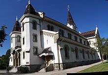
The Maria Geburt parish church is listed as a Swiss heritage site of national significance. The entire village of Plaffeien, which is shared between Oberschrot and Plaffeien, is part of the Inventory of Swiss Heritage Sites.[13]
Twin Town
Plaffeien is twinned with the town of Kasterlee, Belgium.[14]
Politics
In the 2011 federal election the most popular party was the SVP which received 36.3% of the vote. The next three most popular parties were the CVP (18.5%), the SPS (12.1%) and the FDP (11.5%).[15]
The SVP gained an additional 6.4% of the vote from the 2007 Federal election (30.0% in 2007 vs 36.3% in 2011). The CVP lost popularity (27.0% in 2007), the SPS moved from below fourth place in 2007 to third and the FDP retained about the same popularity (14.0% in 2007). A total of 597 votes were cast in this election, of which 6 or 1.0% were invalid.[16]
Economy
As of 2010, Plaffeien had an unemployment rate of 1.7%. As of 2008, there were 86 people employed in the primary economic sector and about 41 businesses involved in this sector. 311 people were employed in the secondary sector and there were 22 businesses in this sector. 589 people were employed in the tertiary sector, with 80 businesses in this sector.[8] There were 969 residents of the municipality who were employed in some capacity, of which females made up 38.7% of the workforce.
In 2008 the total number of full-time equivalent jobs was 802. The number of jobs in the primary sector was 62, all of which were in agriculture. The number of jobs in the secondary sector was 289 of which 220 or (76.1%) were in manufacturing and 69 (23.9%) were in construction. The number of jobs in the tertiary sector was 451. In the tertiary sector; 159 or 35.3% were in wholesale or retail sales or the repair of motor vehicles, 43 or 9.5% were in the movement and storage of goods, 89 or 19.7% were in a hotel or restaurant, 1 was in the information industry, 16 or 3.5% were the insurance or financial industry, 25 or 5.5% were technical professionals or scientists, 50 or 11.1% were in education and 22 or 4.9% were in health care.[17]
In 2000, there were 474 workers who commuted into the municipality and 491 workers who commuted away. The municipality is a net exporter of workers, with about 1.0 workers leaving the municipality for every one entering.[18] Of the working population, 9% used public transportation to get to work, and 60.4% used a private car.[8]
Religion
_97.jpg)
From the 2000 census, 1,528 or 78.8% were Roman Catholic, while 167 or 8.6% belonged to the Swiss Reformed Church. Of the rest of the population, there were 13 members of an Orthodox church (or about 0.67% of the population), and there were 11 individuals (or about 0.57% of the population) who belonged to another Christian church. There were 84 (or about 4.33% of the population) who were Islamic. There were 2 individuals who belonged to another church. 81 (or about 4.18% of the population) belonged to no church, are agnostic or atheist, and 57 individuals (or about 2.94% of the population) did not answer the question.[9]
Weather
Plaffeien has an average of 141.3 days of rain or snow per year and on average receives 1,249 mm (49.2 in) of precipitation. The wettest month is August during which time Plaffeien receives an average of 155 mm (6.1 in) of rain or snow. During this month there is precipitation for an average of 12.9 days. The month with the most days of precipitation is May, with an average of 15.5, but with only 138 mm (5.4 in) of rain or snow. The driest month of the year is February with an average of 60 mm (2.4 in) of precipitation over 9.9 days.[19]
Weather
| Climate data for Plaffeien | |||||||||||||
|---|---|---|---|---|---|---|---|---|---|---|---|---|---|
| Month | Jan | Feb | Mar | Apr | May | Jun | Jul | Aug | Sep | Oct | Nov | Dec | Year |
| Average high °C (°F) | 1.1 (34) |
2.3 (36.1) |
4.9 (40.8) |
8.5 (47.3) |
13 (55) |
16.5 (61.7) |
19.2 (66.6) |
18.3 (64.9) |
15.5 (59.9) |
11.2 (52.2) |
5.5 (41.9) |
2.1 (35.8) |
9.8 (49.6) |
| Daily mean °C (°F) | −2 (28) |
−1 (30) |
1.2 (34.2) |
4.4 (39.9) |
8.7 (47.7) |
12.2 (54) |
14.7 (58.5) |
14.1 (57.4) |
11.4 (52.5) |
7.3 (45.1) |
2.2 (36) |
−0.9 (30.4) |
6 (43) |
| Average low °C (°F) | −4.6 (23.7) |
−3.9 (25) |
−1.8 (28.8) |
1 (34) |
4.9 (40.8) |
8 (46) |
10.3 (50.5) |
10.2 (50.4) |
7.7 (45.9) |
3.9 (39) |
−0.8 (30.6) |
−3.7 (25.3) |
2.6 (36.7) |
| Average precipitation mm (inches) | 70 (2.76) |
60 (2.36) |
78 (3.07) |
101 (3.98) |
138 (5.43) |
153 (6.02) |
134 (5.28) |
155 (6.1) |
107 (4.21) |
89 (3.5) |
88 (3.46) |
76 (2.99) |
1,249 (49.17) |
| Average precipitation days | 10.9 | 9.9 | 12.5 | 12.9 | 15.5 | 13.9 | 12 | 12.9 | 9.7 | 9.2 | 10.5 | 11.4 | 141.3 |
| Source: MeteoSchweiz [19] | |||||||||||||
Education
In Plaffeien about 586 or (30.2%) of the population have completed non-mandatory upper secondary education, and 125 or (6.4%) have completed additional higher education (either university or a Fachhochschule). Of the 125 who completed tertiary schooling, 72.0% were Swiss men, 19.2% were Swiss women, 8.0% were non-Swiss men.[9]
The Canton of Fribourg school system provides one year of non-obligatory Kindergarten, followed by six years of Primary school. This is followed by three years of obligatory lower Secondary school where the students are separated according to ability and aptitude. Following the lower Secondary students may attend a three or four year optional upper Secondary school. The upper Secondary school is divided into gymnasium (university preparatory) and vocational programs. After they finish the upper Secondary program, students may choose to attend a Tertiary school or continue their apprenticeship.[20]
During the 2010-11 school year, there were a total of 659 students attending 38 classes in Plaffeien. A total of 283 students from the municipality attended any school, either in the municipality or outside of it. There were 3 kindergarten classes with a total of 57 students in the municipality. The municipality had 12 primary classes and 200 students. During the same year, there were 23 lower secondary classes with a total of 402 students. There were no upper Secondary classes or vocational classes, but there were 15 upper Secondary students and 46 upper Secondary vocational students who attended classes in another municipality. The municipality had no non-university Tertiary classes, but there was one non-university Tertiary student and one specialized Tertiary student who attended classes in another municipality.[10]
As of 2000, there were 407 students in Plaffeien who came from another municipality, while 55 residents attended schools outside the municipality.[18]
External links
- Official website (German)
References
- 1 2 Arealstatistik Standard - Gemeindedaten nach 4 Hauptbereichen
- ↑ Swiss Federal Statistical Office - STAT-TAB, online database – Ständige und nichtständige Wohnbevölkerung nach institutionellen Gliederungen, Geburtsort und Staatsangehörigkeit (German) accessed 30 August 2016
- 1 2 Plaffeien in German, French and Italian in the online Historical Dictionary of Switzerland.
- 1 2 Swiss Federal Statistical Office-Land Use Statistics 2009 data (German) accessed 25 March 2010
- ↑ Flags of the World.com accessed 16-December-2011
- ↑ Swiss Federal Statistical Office - STAT-TAB, online database – Ständige und nichtständige Wohnbevölkerung nach institutionellen Gliederungen, Geburtsort und Staatsangehörigkeit (German) accessed 30 August 2016
- ↑ Swiss Federal Statistical Office - Superweb database - Gemeinde Statistics 1981-2008 (German) accessed 19 June 2010
- 1 2 3 4 5 6 7 Swiss Federal Statistical Office accessed 16-December-2011
- 1 2 3 4 5 STAT-TAB Datenwürfel für Thema 40.3 - 2000 (German) accessed 2 February 2011
- 1 2 Canton of Fribourg Statistics (German) accessed 3 November 2011
- ↑ Swiss Federal Statistical Office STAT-TAB - Datenwürfel für Thema 09.2 - Gebäude und Wohnungen (German) accessed 28 January 2011
- ↑ Swiss Federal Statistical Office STAT-TAB Bevölkerungsentwicklung nach Region, 1850-2000 (German) accessed 29 January 2011
- ↑ "Kantonsliste A-Objekte". KGS Inventar (in German). Federal Office of Civil Protection. 2009. Retrieved 25 April 2011.
- ↑ Conseil des Communes et Regions d'Europe (French) accessed 27 April 2011
- ↑ Canton of Fribourg National Council Election of 23 October 2011 Statistics (German) (French) accessed 3 November 2011
- ↑ Swiss Federal Statistical Office, Nationalratswahlen 2007: Stärke der Parteien und Wahlbeteiligung, nach Gemeinden/Bezirk/Canton (German) accessed 28 May 2010
- ↑ Swiss Federal Statistical Office STAT-TAB Betriebszählung: Arbeitsstätten nach Gemeinde und NOGA 2008 (Abschnitte), Sektoren 1-3 (German) accessed 28 January 2011
- 1 2 Swiss Federal Statistical Office - Statweb (German) accessed 24 June 2010
- 1 2 "Temperature and Precipitation Average Values-Table, 1961-1990" (in German, French, and Italian). Federal Office of Meteorology and Climatology - MeteoSwiss. Retrieved 8 May 2009., the Plaffeien weather station elevation is 1042 meters above sea level.
- ↑ Chart of the education system in Canton Fribourg (German)
| Wikimedia Commons has media related to Plaffeien. |