Pizzo di Claro
| Pizzo di Claro | |
|---|---|
| Visagno | |
 The north-west face | |
| Highest point | |
| Elevation | 2,727 m (8,947 ft) |
| Prominence | 361 m (1,184 ft) [1] |
| Parent peak | Torent Alto |
| Coordinates | 46°17′46.1″N 9°03′20.4″E / 46.296139°N 9.055667°ECoordinates: 46°17′46.1″N 9°03′20.4″E / 46.296139°N 9.055667°E |
| Geography | |
 Pizzo di Claro Location in Switzerland | |
| Location | Ticino/Graubünden, Switzerland |
| Parent range | Lepontine Alps |
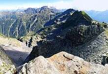
Pizzo di Claro (also known as Visagno) is a 2,727 metres high mountain of the Lepontine Alps, located on the border between the Swiss cantons of Ticino and Graubünden. It overlooks Claro on its western side, although Cresciano is closer. On its eastern side it overlooks the valley of Calanca near Arvigo (Graubünden). A small lake lies west of the summit at 2,198 metres, Lago Canee.
Marked trails lead to the summit from both sides, the shortest route starting from above Arvigo.
References
External links
This article is issued from Wikipedia - version of the 5/8/2016. The text is available under the Creative Commons Attribution/Share Alike but additional terms may apply for the media files.