Pittsville, Wisconsin
| Pittsville, Wisconsin | |
|---|---|
| City | |
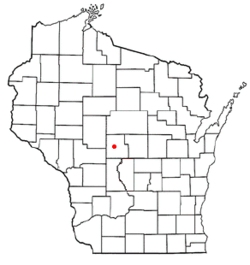 Location of Pittsville, Wisconsin | |
| Coordinates: 44°26′25″N 90°7′42″W / 44.44028°N 90.12833°WCoordinates: 44°26′25″N 90°7′42″W / 44.44028°N 90.12833°W | |
| Country | United States |
| State | Wisconsin |
| County | Wood |
| Area[1] | |
| • Total | 1.98 sq mi (5.13 km2) |
| • Land | 1.97 sq mi (5.10 km2) |
| • Water | 0.01 sq mi (0.03 km2) |
| Elevation[2] | 1,033 ft (315 m) |
| Population (2010)[3] | |
| • Total | 874 |
| • Estimate (2012[4]) | 867 |
| • Density | 443.7/sq mi (171.3/km2) |
| Time zone | Central (CST) (UTC-6) |
| • Summer (DST) | CDT (UTC-5) |
| Area code(s) | 715 & 534 |
| FIPS code | 55-63100[5] |
| GNIS feature ID | 1571567[2] |
| Website |
pittsvillewi |

Pittsville is a city in Wood County, Wisconsin, United States. The population was 874 at the 2010 census.
Geography
Pittsville is located at 44°26′25″N 90°7′42″W / 44.44028°N 90.12833°W (44.440409, -90.128249).[6]
According to the United States Census Bureau, the city has a total area of 1.98 square miles (5.13 km2), of which, 1.97 square miles (5.10 km2) is land and 0.01 square miles (0.03 km2) is water.[1]
Demographics
| Historical population | |||
|---|---|---|---|
| Census | Pop. | %± | |
| 1880 | 163 | — | |
| 1890 | 653 | 300.6% | |
| 1900 | 634 | −2.9% | |
| 1910 | 450 | −29.0% | |
| 1920 | 504 | 12.0% | |
| 1930 | 508 | 0.8% | |
| 1940 | 556 | 9.4% | |
| 1950 | 636 | 14.4% | |
| 1960 | 661 | 3.9% | |
| 1970 | 708 | 7.1% | |
| 1980 | 810 | 14.4% | |
| 1990 | 838 | 3.5% | |
| 2000 | 866 | 3.3% | |
| 2010 | 874 | 0.9% | |
| Est. 2015 | 849 | [7] | −2.9% |
2010 census
As of the census[3] of 2010, there were 874 people, 338 households, and 238 families residing in the city. The population density was 443.7 inhabitants per square mile (171.3/km2). There were 378 housing units at an average density of 191.9 per square mile (74.1/km2). The racial makeup of the city was 97.9% White, 0.3% Native American, 0.8% Asian, and 0.9% from two or more races. Hispanic or Latino of any race were 0.8% of the population.
There were 338 households of which 35.2% had children under the age of 18 living with them, 55.0% were married couples living together, 10.7% had a female householder with no husband present, 4.7% had a male householder with no wife present, and 29.6% were non-families. 25.4% of all households were made up of individuals and 11.3% had someone living alone who was 65 years of age or older. The average household size was 2.55 and the average family size was 3.03.
The median age in the city was 36 years. 27.5% of residents were under the age of 18; 7.2% were between the ages of 18 and 24; 26% were from 25 to 44; 24.9% were from 45 to 64; and 14.5% were 65 years of age or older. The gender makeup of the city was 50.0% male and 50.0% female.
2000 census
As of the census[5] of 2000, there were 866 people, 331 households, and 238 families residing in the city. The population density was 432.9 people per square mile (167.2/km²). There were 351 housing units at an average density of 175.5 per square mile (67.8/km²). The racial makeup of the city was 98.96% White, 0.12% African American, 0.35% Native American, 0.12% from other races, and 0.46% from two or more races. Hispanic or Latino of any race were 0.23% of the population.
There were 331 households out of which 39.0% had children under the age of 18 living with them, 57.7% were married couples living together, 9.7% had a female householder with no husband present, and 27.8% were non-families. 25.7% of all households were made up of individuals and 12.1% had someone living alone who was 65 years of age or older. The average household size was 2.60 and the average family size was 3.08.
In the city the population was spread out with 29.2% under the age of 18, 8.4% from 18 to 24, 30.8% from 25 to 44, 19.4% from 45 to 64, and 12.1% who were 65 years of age or older. The median age was 34 years. For every 100 females there were 100.9 males. For every 100 females age 18 and over, there were 97.1 males.
The median income for a household in the city was $36,750, and the median income for a family was $41,964. Males had a median income of $30,500 versus $20,625 for females. The per capita income for the city was $16,257. About 2.2% of families and 5.4% of the population were below the poverty line, including 5.4% of those under age 18 and 12.3% of those age 65 or over.
Notable people
- Red Blanchard, country musician
- Amos E. Germer, Wisconsin legislator and lawyer
- MaryAnn Lippert, Wisconsin legislator and educator
Education
The city is also home to the Pittsville School District, which has a school population of about 750 students.[9]
References
- 1 2 "US Gazetteer files 2010". United States Census Bureau. Retrieved 2012-11-18.
- 1 2 "US Board on Geographic Names". United States Geological Survey. 2007-10-25. Retrieved 2008-01-31.
- 1 2 "American FactFinder". United States Census Bureau. Retrieved 2012-11-18.
- ↑ "Population Estimates". United States Census Bureau. Retrieved 2013-06-24.
- 1 2 "American FactFinder". United States Census Bureau. Retrieved 2008-01-31.
- ↑ "US Gazetteer files: 2010, 2000, and 1990". United States Census Bureau. 2011-02-12. Retrieved 2011-04-23.
- ↑ "Annual Estimates of the Resident Population for Incorporated Places: April 1, 2010 to July 1, 2015". Retrieved July 2, 2016.
- ↑ "Census of Population and Housing". Census.gov. Retrieved June 4, 2015.
- ↑ Pittsville School District
External links
- City of Pittsville
- Sanborn fire insurance maps: 1894 1914
- Maps from plat books: 1909 1928
Municipalities and communities of Wood County, Wisconsin, United States | ||
|---|---|---|
| Cities | 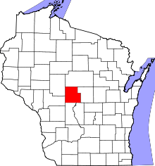 | |
| Villages | ||
| Towns | ||
| CDPs | ||
| Unincorporated communities | ||
| Indian reservation | ||
| Footnotes | ‡This populated place also has portions in an adjacent county or counties | |