Pittsgrove Township, New Jersey
| Pittsgrove Township, New Jersey | |
|---|---|
| Township | |
| Township of Pittsgrove | |
|
Moshe Bayuk House | |
| Motto: Old Values, New Ideas: Working Together For All | |
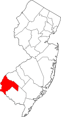
 Pittsgrove Township highlighted in Salem County. Inset map: Salem County highlighted in the State of New Jersey. | |
| Coordinates: 39°32′34″N 75°07′48″W / 39.54265°N 75.129901°WCoordinates: 39°32′34″N 75°07′48″W / 39.54265°N 75.129901°W[1][2] | |
| Country |
|
| State |
|
| County | Salem |
| Royal charter | December 6, 1769 |
| Incorporated | February 21, 1798 |
| Named for | William Pitt, 1st Earl of Chatham |
| Government[3] | |
| • Type | Township |
| • Body | Township Committee |
| • Mayor | Dr. Fiore J. Copare (R, term ends December 31, 2016)[4][5] |
| • Administrator | Michael DiGiorgio[6] |
| • Clerk | Mimi Marlor[6] |
| Area[1] | |
| • Total | 45.915 sq mi (118.920 km2) |
| • Land | 45.083 sq mi (116.765 km2) |
| • Water | 0.832 sq mi (2.155 km2) 1.81% |
| Area rank |
38th of 566 in state 2nd of 15 in county[1] |
| Elevation[7] | 108 ft (33 m) |
| Population (2010 Census)[8][9][10] | |
| • Total | 9,393 |
| • Estimate (2015)[11] | 9,081 |
| • Rank |
253rd of 566 in state 2nd of 15 in county[12] |
| • Density | 208.3/sq mi (80.4/km2) |
| • Density rank |
504th of 566 in state 7th of 15 in county[12] |
| Time zone | Eastern (EST) (UTC-5) |
| • Summer (DST) | Eastern (EDT) (UTC-4) |
| ZIP code | 08318[13] |
| Area code(s) | 856 exchange: 358[14] |
| FIPS code | 3403359130[1][15][16] |
| GNIS feature ID | 1729723[17] |
| Website |
www |

Pittsgrove Township is a township in Salem County, in the U.S. state of New Jersey. As of the 2010 United States Census, the township's population was 9,393,[8][9][10] reflecting an increase of 500 (+5.6%) from the 8,893 counted in the 2000 Census, which had in turn increased by 772 (+9.5%) from the 8,121 counted in the 1990 Census.[18]
Pittsgrove Township was formed by Royal charter on December 6, 1769 and was incorporated by an act of the New Jersey Legislature on February 21, 1798, as one of the initial group of 104 townships established in New Jersey. Portions of the township were taken on March 4, 1822, to form Centreville Township (which was restored in 1829 when the township was dissolved), on March 10, 1846, to form Upper Pittsgrove Township and on January 28, 1893, to form Elmer borough.[19] The township was named for William Pitt, 1st Earl of Chatham, a supporter of the colonial cause.[20][21]
Geography
According to the United States Census Bureau, the township had a total area of 45.915 square miles (118.920 km2), including 45.083 square miles (116.765 km2) of land and 0.832 square miles (2.155 km2) of water (1.81%).[1][2]
Olivet (with a 2010 Census population of 1,408[22]) is an unincorporated community and census-designated place (CDP) located within Pittsgrove Township.[23][24][25]
Other unincorporated communities, localities and place names located partially or completely within the township include Alliance, Brotmanville, Centerton, Centerton, Daretown, Greenville, Norma, Norma Station, Palatine, Parvin Lake, Rainbow Lake, Six Points, Union Grove, Upper Neck and Willow Grove.[26]
The township borders Elmer Borough and Upper Pittsgrove Township. Pittsgrove Township also borders Cumberland County and Gloucester County.
Demographics
| Historical population | |||
|---|---|---|---|
| Census | Pop. | %± | |
| 1810 | 1,991 | — | |
| 1820 | 2,040 | 2.5% | |
| 1830 | 2,216 | 8.6% | |
| 1840 | 2,390 | 7.9% | |
| 1850 | 1,151 | * | −51.8% |
| 1860 | 1,233 | 7.1% | |
| 1870 | 1,667 | 35.2% | |
| 1880 | 1,433 | −14.0% | |
| 1890 | 1,914 | 33.6% | |
| 1900 | 2,092 | * | 9.3% |
| 1910 | 2,394 | 14.4% | |
| 1920 | 1,842 | −23.1% | |
| 1930 | 2,091 | 13.5% | |
| 1940 | 2,157 | 3.2% | |
| 1950 | 2,808 | 30.2% | |
| 1960 | 3,785 | 34.8% | |
| 1970 | 4,618 | 22.0% | |
| 1980 | 6,954 | 50.6% | |
| 1990 | 8,121 | 16.8% | |
| 2000 | 8,893 | 9.5% | |
| 2010 | 9,393 | 5.6% | |
| Est. 2015 | 9,081 | [11][27] | −3.3% |
| Population sources: 1810-2000[28] 1810-1920[29] 1840[30] 1850-1870[31] 1850[32] 1870[33] 1880-1890[34] 1890-1910[35] 1910-1930[36] 1930-1990[37] 2000[38][39] 2010[8][9][10] * = Lost territory in previous decade.[19] | |||
Census 2010
The 2010 United States Census counted 9,393 people, 3,307 households, and 2,576 families residing in the township. The population density was 208.3 per square mile (80.4/km2). The township contained 3,445 housing units at an average density of 76.4 per square mile (29.5/km2). The racial makeup of the township was 88.17% (8,282) White, 6.97% (655) Black or African American, 0.42% (39) Native American, 0.94% (88) Asian, 0.01% (1) Pacific Islander, 1.39% (131) from other races, and 2.10% (197) from two or more races. Hispanics or Latinos of any race were 4.80% (451) of the population.[8]
Out of a total of 3,307 households, 31.8% had children under the age of 18 living with them, 60.1% were married couples living together, 12.4% had a female householder with no husband present, and 22.1% were non-families. 17.8% of all households were made up of individuals, and 7.5% had someone living alone who was 65 years of age or older. The average household size was 2.80 and the average family size was 3.15.[8]
In the township, 23.3% of the population were under the age of 18, 9.1% from 18 to 24, 22.8% from 25 to 44, 32.3% from 45 to 64, and 12.5% who were 65 years of age or older. The median age was 41.6 years. For every 100 females the census counted 99.0 males, but for 100 females at least 18 years old, it was 95.0 males.[8]
The Census Bureau's 2006-2010 American Community Survey showed that (in 2010 inflation-adjusted dollars) median household income was $74,348 (with a margin of error of +/- $6,547) and the median family income was $83,564 (+/- $7,149). Males had a median income of $56,300 (+/- $5,678) versus $38,056 (+/- $6,727) for females. The per capita income for the borough was $28,606 (+/- $1,671). About 2.4% of families and 4.7% of the population were below the poverty line, including 5.0% of those under age 18 and 7.0% of those age 65 or over.[40]
Census 2000
As of the 2000 United States Census[15] there were 8,893 people, 3,020 households, and 2,422 families residing in the township. The population density was 196.8 people per square mile (76.0/km²). There were 3,155 housing units at an average density of 69.8 per square mile (27.0/km²). The racial makeup of the township was 88.14% White, 8.04% African American, 0.38% Native American, 0.58% Asian, 0.04% Pacific Islander, 1.29% from other races, and 1.52% from two or more races. Hispanic or Latino of any race were 3.41% of the population.[38][39]
There were 3,020 households out of which 38.1% had children under the age of 18 living with them, 64.9% were married couples living together, 10.7% had a female householder with no husband present, and 19.8% were non-families. 16.2% of all households were made up of individuals and 6.2% had someone living alone who was 65 years of age or older. The average household size was 2.90 and the average family size was 3.23.[38][39]
In the township the population was spread out with 26.7% under the age of 18, 8.0% from 18 to 24, 27.8% from 25 to 44, 26.1% from 45 to 64, and 11.4% who were 65 years of age or older. The median age was 38 years. For every 100 females there were 98.1 males. For every 100 females age 18 and over, there were 93.4 males.[38][39]
The median income for a household in the township was $56,687, and the median income for a family was $63,266. Males had a median income of $42,653 versus $27,173 for females. The per capita income for the township was $21,624. About 3.5% of families and 5.0% of the population were below the poverty line, including 6.8% of those under age 18 and 4.1% of those age 65 or over.[38][39]
Government
Local government
Pittsgrove Township is governed under the Township form of government. The five-member Township Committee is elected directly by the voters at-large in partisan elections to serve three-year terms of office on a staggered basis, with either one or two seats coming up for election each year as part of the November general election in a three-year cycle.[3][41] At an annual reorganization meeting, the Township Committee selects one of its members to serve as Mayor and another as Deputy Mayor.
As of 2016, members of the Pittsgrove Township Committee are Mayor Dr. Fiore Copare (R, term on committee ends December 31, 2017; term as mayor ends 2016), Deputy Mayor H. Kirk Craver (R, term on committee ends 2017; term as deputy mayor ends 2016), Melissa Conover (R, 2016; elected to serve an unexpired term), Linda A. DuBois (R, 2016) and Francesca I. Spinelli (R, 2018).[4][42][43][44][45][46][47]
The Township Council appointed Democrat William Jones to fill the seat expiring in December 2016 that had been held by Ralph Padilla until his resignation from office in December 2014.[48] In the November 2015 general election, Republican Melissa Conover defeated Jones and was elected to serve the one-year balance of the term of office.[45]
Federal, state and county representation
Pittsgrove Township is located in the 2nd Congressional District[49] and is part of New Jersey's 3rd state legislative district.[9][50][51]
New Jersey's Second Congressional District is represented by Frank LoBiondo (R, Ventnor City).[52] New Jersey is represented in the United States Senate by Cory Booker (D, Newark, term ends 2021)[53] and Bob Menendez (D, Paramus, 2019).[54][55]
For the 2016–2017 session (Senate, General Assembly), the 3rd Legislative District of the New Jersey Legislature is represented in the State Senate by Stephen M. Sweeney (D, West Deptford Township) and in the General Assembly by John J. Burzichelli (D, Paulsboro) and Adam Taliaferro (D, Woolwich Township).[56] The Governor of New Jersey is Chris Christie (R, Mendham Township).[57] The Lieutenant Governor of New Jersey is Kim Guadagno (R, Monmouth Beach).[58]
Salem County is governed by a seven-member Board of Chosen Freeholders who are elected at-large to serve three-year terms of office on a staggered basis, with either two or three seats coming up for election each year. At an annual reorganization meeting held in the beginning of January, the board selects a Director and a Deputy Director from among its members. As of 2014, Salem County's Freeholders (with party, residence, term-end year and committee chairmanship listed in parentheses) are Director Julie A. Acton (R, Pennsville Township, 2016; Administration), Deputy Director Dale A. Cross (R, Pennsville Township, 2014; Public Safety), Bruce L. Bobbitt (D, Pilesgrove Township, 2014; Public Services), Ben Laury (R, Elmer, 2015; Public Works) Beth E. Timberman (D, Woodstown, 2015; Social Services), Robert J. Vanderslice (R, Pennsville Township, 2014; Health and Human Services) Lee R. Ware (D, Elsinboro Township, 2016; Transportation, Agriculture and Cultural Affairs).[59][60] Constitutional officers elected on a countywide basis are County Clerk Gilda T. Gill (2014),[61] Sheriff Charles M. Miller (2015)[62] and Surrogate Nicki A. Burke (2015).[63][64]
Politics
As of March 23, 2011, there were a total of 5,928 registered voters in Pittsgrove Township, of which 1,618 (27.3% vs. 30.6% countywide) were registered as Democrats, 1,223 (20.6% vs. 21.0%) were registered as Republicans and 3,085 (52.0% vs. 48.4%) were registered as Unaffiliated. There were 2 voters registered to other parties.[65] Among the township's 2010 Census population, 63.1% (vs. 64.6% in Salem County) were registered to vote, including 82.3% of those ages 18 and over (vs. 84.4% countywide).[65][66]
In the 2012 presidential election, Republican Mitt Romney received 50.2% of the vote (2,114 cast), ahead of Democrat Barack Obama with 48.6% (2,046 votes), and other candidates with 1.1% (47 votes), among the 4,229 ballots cast by the township's 6,130 registered voters (22 ballots were spoiled), for a turnout of 69.0%.[67][68] In the 2008 presidential election, Democrat Barack Obama received 2,279 votes (50.0% vs. 50.4% countywide), ahead of Republican John McCain with 2,162 votes (47.5% vs. 46.6%) and other candidates with 71 votes (1.6% vs. 1.6%), among the 4,554 ballots cast by the township's 6,225 registered voters, for a turnout of 73.2% (vs. 71.8% in Salem County).[69] In the 2004 presidential election, Republican George W. Bush received 2,233 votes (51.0% vs. 52.5% countywide), ahead of Democrat John Kerry with 2,077 votes (47.4% vs. 45.9%) and other candidates with 50 votes (1.1% vs. 1.0%), among the 4,380 ballots cast by the township's 6,022 registered voters, for a turnout of 72.7% (vs. 71.0% in the whole county).[70]
In the 2013 gubernatorial election, Republican Chris Christie received 64.0% of the vote (1,764 cast), ahead of Democrat Barbara Buono with 33.6% (926 votes), and other candidates with 2.4% (67 votes), among the 2,908 ballots cast by the township's 6,077 registered voters (151 ballots were spoiled), for a turnout of 47.9%.[71][72] In the 2009 gubernatorial election, Republican Chris Christie received 1,422 votes (46.9% vs. 46.1% countywide), ahead of Democrat Jon Corzine with 1,198 votes (39.5% vs. 39.9%), Independent Chris Daggett with 243 votes (8.0% vs. 9.7%) and other candidates with 43 votes (1.4% vs. 2.0%), among the 3,035 ballots cast by the township's 6,164 registered voters, yielding a 49.2% turnout (vs. 47.3% in the county).[73]
Education
Public school students from Pittsgrove Township and Elmer borough attend the Pittsgrove Township School District for Kindergarten through twelfth grade as part of a full sending/receiving relationship in which the former Elmer School was integrated into the district as of 2011 and students from both Elmer and Pittsgrove Township attend school together throughout their education.[74][75][76]
As of the 2012-13 school year, the district's five schools had an enrollment of 1,796 students and 132.9 classroom teachers (on an FTE basis), for a student–teacher ratio of 13.51:1.[77] Schools in the district (with 2012-13 enrollment data from the National Center for Education Statistics[78]) are Norma Elementary School[79] for Preschool-K (167 students), Elmer Elementary School[80] for grades 1-2 (212), Olivet Elementary School[81] for grades 3-5 (373), Pittsgrove Township Middle School[82] for grades 6-8 (467) and A.P. Schalick High School[83] for grades 9-12 (577).[84][85]
Transportation
As of May 2010, the township had a total of 125.38 miles (201.78 km) of roadways, the highest in the county, of which 57.54 miles (92.60 km) were maintained by the municipality, 64.99 miles (104.59 km) by Salem County and 2.85 miles (4.59 km) by the New Jersey Department of Transportation.[86]
State highways include Route 56, which passes through the southern part of the township,[87] while a small portion of Route 55 passes through the eastern part of the township[88] County highways include County Route 540, which passes east / west through the township,[89] intersecting and briefly overlapping with County Route 553, which crosses in a north / south direction.[90]
Notable people
People who were born in, residents of, or otherwise closely associated with Pittsgrove Township include:
- Stanley Brotman (1994-2014), Judge of the United States District Court for the District of New Jersey.[91]
- Jack Collins (born 1943), former Speaker of the New Jersey General Assembly.[92]
- Paul Gause (born 1986), professional basketball player for the Newcastle Eagles in the British Basketball League.[93]
- Michael Iaconelli (born 1972), professional bass fisherman, winner of 2003 Bassmaster Classic.[94]
- Kevin Jackson (born 1978), former U.S. soccer midfielder who spent five seasons in the USL First Division and two in the Premier Development League.[95]
- Jamarr Andre Johnson (born 1988), professional basketball player for CLS Knights Surabaya in Indonesia.[96]
- Joseph B. Perskie (1885-1957), Associate Justice of the New Jersey Supreme Court from 1933 to 1947.[97]
References
- 1 2 3 4 5 2010 Census Gazetteer Files: New Jersey County Subdivisions, United States Census Bureau. Accessed May 21, 2015.
- 1 2 US Gazetteer files: 2010, 2000, and 1990, United States Census Bureau. Accessed September 4, 2014.
- 1 2 2012 New Jersey Legislative District Data Book, Rutgers University Edward J. Bloustein School of Planning and Public Policy, March 2013, p. 19.
- 1 2 Township Committee, Pittsgrove Township. Accessed July 30, 2016.
- ↑ 2016 New Jersey Mayors Directory, New Jersey Department of Community Affairs. Accessed June 14, 2016.
- 1 2 Municipal Offices, Pittsgrove Township. Accessed July 30, 2016.
- ↑ U.S. Geological Survey Geographic Names Information System: Township of Pittsgrove, Geographic Names Information System. Accessed March 11, 2013.
- 1 2 3 4 5 6 DP-1 - Profile of General Population and Housing Characteristics: 2010 for Pittsgrove township, Salem County, New Jersey, United States Census Bureau. Accessed January 19, 2013.
- 1 2 3 4 Municipalities Grouped by 2011-2020 Legislative Districts, New Jersey Department of State, p. 2. Accessed January 6, 2013.
- 1 2 3 Profile of General Demographic Characteristics: 2010 for Pittsgrove township, New Jersey Department of Labor and Workforce Development. Accessed January 19, 2013.
- 1 2 PEPANNRES - Annual Estimates of the Resident Population: April 1, 2010 to July 1, 2015 - 2015 Population Estimates for New Jersey municipalities, United States Census Bureau. Accessed May 22, 2016.
- 1 2 GCT-PH1 Population, Housing Units, Area, and Density: 2010 - State -- County Subdivision from the 2010 Census Summary File 1 for New Jersey, United States Census Bureau. Accessed January 19, 2013.
- ↑ Look Up a ZIP Code for Pittsgrove, NJ, United States Postal Service. Accessed January 19, 2013.
- ↑ Area Code Lookup - NPA NXX for Pittsgrove, NJ, Area-Codes.com. Accessed November 1, 2013.
- 1 2 American FactFinder, United States Census Bureau. Accessed September 4, 2014.
- ↑ A Cure for the Common Codes: New Jersey, Missouri Census Data Center. Accessed October 29, 2012.
- ↑ US Board on Geographic Names, United States Geological Survey. Accessed September 4, 2014.
- ↑ Table 7. Population for the Counties and Municipalities in New Jersey: 1990, 2000 and 2010, New Jersey Department of Labor and Workforce Development, February 2011. Accessed January 19, 2013.
- 1 2 Snyder, John P. The Story of New Jersey's Civil Boundaries: 1606-1968, Bureau of Geology and Topography; Trenton, New Jersey; 1969. p. 217. Accessed October 23, 2012.
- ↑ Hutchinson, Viola L. The Origin of New Jersey Place Names, New Jersey Public Library Commission, May 1945. Accessed September 19, 2015.
- ↑ Town and County Names, Visit Salem County. Accessed September 19, 2015. "Set off from Piles Grove and named in honor of Sir William Pitt the famous English statesman and orator, before he accepted the Earldom of Chatham."
- ↑ DP-1 - Profile of General Population and Housing Characteristics: 2010 Demographic Profile Data for Olivet CDP, New Jersey, United States Census Bureau. Accessed January 19, 2013.
- ↑ GCT-PH1 - Population, Housing Units, Area, and Density: 2010 - County -- County Subdivision and Place from the 2010 Census Summary File 1 for Salem County, New Jersey, United States Census Bureau. Accessed January 19, 2013.
- ↑ 2006-2010 American Community Survey Geography for New Jersey, United States Census Bureau. Accessed January 19, 2013.
- ↑ New Jersey: 2010 - Population and Housing Unit Counts - 2010 Census of Population and Housing (CPH-2-32), United States Census Bureau, August 2012. Accessed January 19, 2013.
- ↑ Locality Search, State of New Jersey. Accessed May 21, 2015.
- ↑ Census Estimates for New Jersey April 1, 2010 to July 1, 2015, United States Census Bureau. Accessed May 22, 2016.
- ↑ Barnett, Bob. Population Data for Salem County Municipalities, 1810 - 2000, WestJersey.org, January 6, 2011. Accessed January 19, 2013.
- ↑ Compendium of censuses 1726-1905: together with the tabulated returns of 1905, New Jersey Department of State, 1906. Accessed November 1, 2013.
- ↑ Bowen, Francis. American Almanac and Repository of Useful Knowledge for the Year 1843, p. 232, David H. Williams, 1842. Accessed November 1, 2013.
- ↑ Raum, John O. The History of New Jersey: From Its Earliest Settlement to the Present Time, Volume 1, p. 255, J. E. Potter and company, 1877. Accessed January 19, 2013. "Pittsgrove township was formed from Pilesgrove, and named after Sir William Pitt. It is sixteen miles from Salem. In this township are the small villages of Pittstown (now called Elmer) and Centreville. In 1850 the population was 1,151; in 1860, 1,231; in 1870, 1,667."
- ↑ Debow, James Dunwoody Brownson. The Seventh Census of the United States: 1850, p. 140. R. Armstrong, 1853. Accessed January 19, 2013.
- ↑ Staff. A compendium of the ninth census, 1870, p. 260. United States Census Bureau, 1872. Accessed January 19, 2013.
- ↑ Porter, Robert Percival. Preliminary Results as Contained in the Eleventh Census Bulletins: Volume III - 51 to 75, p. 99. United States Census Bureau, 1890. Accessed January 19, 2013.
- ↑ Thirteenth Census of the United States, 1910: Population by Counties and Minor Civil Divisions, 1910, 1900, 1890, United States Census Bureau, p. 338. Accessed January 19, 2013.
- ↑ Fifteenth Census of the United States : 1930 - Population Volume I, United States Census Bureau, p. 718. Accessed January 19, 2013.
- ↑ Table 6. New Jersey Resident Population by Municipality: 1930 - 1990, New Jersey Department of Labor and Workforce Development. Accessed June 28, 2015.
- 1 2 3 4 5 Census 2000 Profiles of Demographic / Social / Economic / Housing Characteristics for Pittsgrove township, New Jersey, United States Census Bureau. Accessed October 31, 2016.
- 1 2 3 4 5 DP-1: Profile of General Demographic Characteristics: 2000 - Census 2000 Summary File 1 (SF 1) 100-Percent Data for Pittsgrove township, Salem County, New Jersey, United States Census Bureau. Accessed January 19, 2013.
- ↑ DP03: Selected Economic Characteristics from the 2006-2010 American Community Survey 5-Year Estimates for Pittsgrove township, Salem County, New Jersey, United States Census Bureau. Accessed January 19, 2013.
- ↑ "Forms of Municipal Government in New Jersey", p. 7. Rutgers University Center for Government Studies. Accessed June 3, 2015.
- ↑ 2016 User Friendly Budget, Pittsgrove Township. Accessed July 30, 2016.
- ↑ The Official Salem County Directory, Salem County, New Jersey, February 4, 2016. Accessed July 29, 2016.
- ↑ Municipalities in Salem County, Salem County, New Jersey Clerk. Accessed July 29, 2016.
- 1 2 November 3, 2015 Summary Report Salem County Official Results, Salem County, New Jersey Clerk, updated January 13, 2016. Accessed July 29, 2016.
- ↑ November 4, 2014 Summary Report Salem County Official Results, Salem County, New Jersey Clerk, updated November 24, 2014. Accessed July 29, 2016.
- ↑ November 5, 2013 Summary Report Salem County Unofficial Results, Salem County, New Jersey, updated November 5, 2013. Accessed July 29, 2016.
- ↑ Wehner, Brittany M. "Pittsgrove Township Committee reorganizes, appoints Copare mayor", NJ.com, January 2, 2015. Accessed July 30, 2016. "The township committee is comprised of the mayor, deputy mayor, Democrats William Jones and Edward Myers Sr., and Republican Linda DuBois.Committeeman Jones was selected to complete the term of former mayor Ralph Padilla, who resigned from his position on the committee after less than one year in to his first term. Padilla stepped down due to an unspecified medical condition in December."
- ↑ Plan Components Report, New Jersey Redistricting Commission, December 23, 2011. Accessed January 6, 2013.
- ↑ 2016 New Jersey Citizen's Guide to Government, p. 63, New Jersey League of Women Voters. Accessed July 20, 2016.
- ↑ Districts by Number for 2011-2020, New Jersey Legislature. Accessed January 6, 2013.
- ↑ Directory of Representatives: New Jersey, United States House of Representatives. Accessed January 5, 2012.
- ↑ About Cory Booker, United States Senate. Accessed January 26, 2015. "He now owns a home and lives in Newark's Central Ward community."
- ↑ Biography of Bob Menendez, United States Senate, January 26, 2015. "He currently lives in Paramus and has two children, Alicia and Robert."
- ↑ Senators of the 114th Congress from New Jersey. United States Senate. Accessed January 26, 2015. "Booker, Cory A. - (D - NJ) Class II; Menendez, Robert - (D - NJ) Class I"
- ↑ Legislative Roster 2016-2017 Session, New Jersey Legislature. Accessed January 17, 2016.
- ↑ "About the Governor". State of New Jersey. Retrieved 2010-01-21.
- ↑ "About the Lieutenant Governor". State of New Jersey. Retrieved 2010-01-21.
- ↑ Board of Chosen Freeholders, Salem County, New Jersey. Accessed July 27, 2014.
- ↑ 2014 County Data Sheet, Salem County, New Jersey. Accessed July 27, 2014.
- ↑ County Clerk, Salem County Clerk's Office . Accessed July 27, 2014.
- ↑ Sheriff's Office, Salem County, New Jersey. Accessed July 27, 2014.
- ↑ Surrogate's Court, Salem County, New Jersey. Accessed July 27, 2014.
- ↑ The Official 2013 Salem County Directory, Salem County, New Jersey. Accessed July 27, 2014.
- 1 2 Voter Registration Summary - Salem, New Jersey Department of State Division of Elections, March 23, 2011. Accessed January 19, 2013.
- ↑ GCT-P7: Selected Age Groups: 2010 - State -- County Subdivision; 2010 Census Summary File 1 for New Jersey, United States Census Bureau. Accessed January 19, 2013.
- ↑ "Presidential General Election Results - November 6, 2012 - Salem County" (PDF). New Jersey Department of Elections. March 15, 2013. Retrieved December 24, 2014.
- ↑ "Number of Registered Voters and Ballots Cast - November 6, 2012 - General Election Results - Salem County" (PDF). New Jersey Department of Elections. March 15, 2013. Retrieved December 24, 2014.
- ↑ 2008 Presidential General Election Results: Salem County, New Jersey Department of State Division of Elections, December 23, 2008. Accessed January 19, 2013.
- ↑ 2004 Presidential Election: Salem County, New Jersey Department of State Division of Elections, December 13, 2004. Accessed January 19, 2013.
- ↑ "Governor - Salem County" (PDF). New Jersey Department of Elections. January 29, 2014. Retrieved December 24, 2014.
- ↑ "Number of Registered Voters and Ballots Cast - November 5, 2013 - General Election Results - Salem County" (PDF). New Jersey Department of Elections. January 29, 2014. Retrieved December 24, 2014.
- ↑ 2009 Governor: Salem County, New Jersey Department of State Division of Elections, December 31, 2009. Accessed January 19, 2013.
- ↑ Dailey, Jennifer. "Elmer and Pittsgrove school districts to merge through send and receive agreement", Today's Sunbeam, June 17, 2009. Accessed October 9, 2013. "The Elmer Board of Education voted unanimously during its school board meeting here Tuesday night to merge with Pittsgrove through a full send and receive agreement. The agreement could have Elmer and Pittsgrove students attending school together."
- ↑ Dunn, Phil. "Pittsgrove Township Board of Education weighing how many choice students it will accept into district", Today's Sunbeam, December 19, 2011. Accessed October 9, 2013. "Brodzik said the 2011 number includes the influx of students they gained from Elmer since the school became part of the Pittsgrove district."
- ↑ Elmer Elementary School 2014 Report Card Narrative, New Jersey Department of Education. Accessed July 19, 2016. "The Elmer School has been part of the Pittsgrove Township School District for 4 years. Previously the Borough of Elmer's Kindergarten through fourth grade children attended school at the Elmer School while the rest of their students participated in a send/receive agreement with Pittsgrove Township Schools for grades five through twelve. A full send/receive agreement with the Elmer Borough Board of Education was reached for the 2010-2011 school year. All students from both Pittsgrove and Elmer attend school together from preschool through twelfth grade. Elmer Elementary School now houses 200 Pittsgrove and Elmer students in grades one and two."
- ↑ District information for Pittsgrove Township School District, National Center for Education Statistics. Accessed March 8, 2015.
- ↑ School Data for the Pittsgrove Township School District, National Center for Education Statistics. Accessed March 8, 2015.
- ↑ Norma Elementary School, Pittsgrove Township School District. Accessed March 8, 2015.
- ↑ Elmer Elementary School, Pittsgrove Township School District. Accessed March 8, 2015.
- ↑ Olivet Elementary School, Pittsgrove Township School District. Accessed March 8, 2015.
- ↑ Pittsgrove Township Middle School, Pittsgrove Township School District. Accessed October 9, 2013.
- ↑ A.P. Schalick High School, Pittsgrove Township School District. Accessed March 8, 2015.
- ↑ Schools, Pittsgrove Township School District. Accessed March 8, 2015.
- ↑ New Jersey School Directory for the Pittsgrove Township School District, New Jersey Department of Education. Accessed March 8, 2015.
- ↑ Salem County Mileage by Municipality and Jurisdiction, New Jersey Department of Transportation, May 2010. Accessed November 1, 2013.
- ↑ Route 56 Straight Line Diagram, New Jersey Department of Transportation, February 2009. Accessed November 1, 2013.
- ↑ Route 55 Straight Line Diagram, New Jersey Department of Transportation, January 2009. Accessed November 1, 2013.
- ↑ County Route 540 Straight Line Diagram, New Jersey Department of Transportation, October 2006. Accessed November 1, 2013.
- ↑ County Route 553 Straight Line Diagram, New Jersey Department of Transportation, September 2007. Accessed November 1, 2013.
- ↑ Von Bergen, Jane M.; and Naedele, Walter F. "Stanley S. Brotman, 89, longtime federal judge", The Philadelphia Inquirer, February 26, 2014. Accessed October 18, 2015. "Stanley S. Brotman, 89, of Voorhees, a former federal judge in New Jersey, died Friday, Feb. 21, at Kennedy University Hospital in Stratford.... Mr. Brotman grew up in Brotmanville, a village near Vineland established by his grandfather, a Russian immigrant who moved his coat factory from Brooklyn to South Jersey, providing jobs for immigrants and helping them settle in a new land."
- ↑ Preston, Jennifer. "Man of the House". The New York Times, February 4, 1996. Accessed February 10, 2013. "He and his wife, Betsy, have owned their three-acre farm in Pittsgrove Township since 1974, when they traded in their Gloucester City row house for the rural life."
- ↑ Ryan, Shannon. "Cats will face an ex-South Jersey standout", The Philadelphia Inquirer, February 10, 2007. Accessed September 19, 2015. "Gause, a 5-foot-11 sophomore guard from Pittsgrove, N.J., stayed put, and today at the Continental Airlines Arena, he will help the Pirates take on Villanova in a Big East meeting."
- ↑ via Associated Press. "Pittsgrove Township's Michael Iaconelli leads Bassmaster Classic", The Press of Atlantic City, February 23, 2013. Accessed May 31, 2014. "Cliff Pace of Petal, Miss., and 2003 Bassmaster Classic champ Michael Iaconelli of Pittsgrove, N.J., tied for the first-day lead at the world championship of bass fishing on Grand Lake O' the Cherokees."
- ↑ Huffman, Beth. "SCHALICK GRAD JACKSON HOPES HE'LL CATCH ON WITH MLS FIRE", The Philadelphia Inquirer, February 17, 2000. Accessed August 10, 2008.
- ↑ Jamarr Johnson - 2008-2009 Men's Basketball, Widener University. Accessed May 8, 2016. "Hometown: Pittsgrove, NJ; High School: Schalick"
- ↑ Staff. "Joseph B. Perskie, Ex-Associate Justice Of New Jersey Supreme Court, Dies at 71", The New York Times, May 30, 1957. Accessed July 5, 2016. "A native of Alliance, Mr. Perskie came to the resort area at the age of 11. He attended public schools here and was graduated from Atlantic City High School in 1904 and Pennsylvania Law School in 1907."
External links
- Pittsgrove Township website
- Pittsgrove Township page on Salem County Clerk's website
- Pittsgrove Township School District website
- Pittsgrove Township School District's 2014–15 School Report Card from the New Jersey Department of Education
- School Data for the Pittsgrove Township School District, National Center for Education Statistics