Pitmegea River
| Pitmegea River | |
| Country | United States |
|---|---|
| State | Alaska |
| Borough | North Slope |
| Source | De Long Mountains |
| - elevation | 1,076 ft (328 m) [1] |
| - coordinates | 68°37′30″N 163°19′54″W / 68.62500°N 163.33167°W [2] |
| Mouth | Chukchi Sea |
| - location | Cape Sabine, about 30 miles (48 km) east of Cape Lisburne[3] |
| - elevation | 0 ft (0 m) [2] |
| - coordinates | 68°54′53″N 164°37′32″W / 68.91472°N 164.62556°WCoordinates: 68°54′53″N 164°37′32″W / 68.91472°N 164.62556°W [2] |
| Length | 42 mi (68 km) [4] |
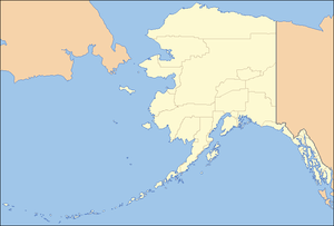 Location of the mouth of the Pitmegea River in Alaska
| |
The Pitmegea River is a 42-mile (68 km) stream in the western North Slope Borough of the U.S. state of Alaska.[4] From its source in the De Long Mountains, the river flows generally northwest to the Chukchi Sea at Cape Sabine, about 30 miles (48 km) east of Cape Lisburne[3] A prospector who explored the river in 1888 reported its Inuit name as Pitmegeak.[2]
See also
References
- ↑ Derived by entering source coordinates in Google Earth.
- 1 2 3 4 "Pitmegea River". Geographic Names Information System. United States Geological Survey. January 1, 2000. Retrieved September 9, 2013.
- 1 2 Alaska Atlas & Gazetteer (7th ed.). Yarmouth, Maine: DeLorme. 2010. p. 134. ISBN 978-0-89933-289-5.
- 1 2 Orth, Donald J.; United States Geological Survey (1971) [1967]. Dictionary of Alaska Place Names: Geological Survey Professional Paper 567 (PDF). University of Alaska Fairbanks. United States Government Printing Office. p. 761. Retrieved September 9, 2013.
This article is issued from Wikipedia - version of the 9/10/2016. The text is available under the Creative Commons Attribution/Share Alike but additional terms may apply for the media files.