Pisinemo, Arizona
| Pisinemo, Arizona O'odham: Pisin Moʼo | |
|---|---|
| CDP | |
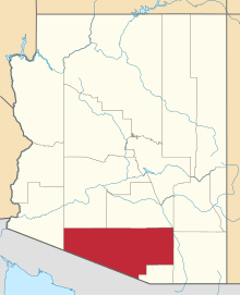
 Location in Pima County and the state of Arizona | |
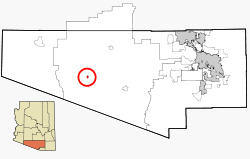
 Pisinemo, Arizona Location in the United States | |
| Coordinates: 32°2′28″N 112°18′52″W / 32.04111°N 112.31444°WCoordinates: 32°2′28″N 112°18′52″W / 32.04111°N 112.31444°W | |
| Country | United States |
| State | Arizona |
| County | Pima |
| Area | |
| • Total | 1.7 sq mi (4.4 km2) |
| • Land | 1.7 sq mi (4.3 km2) |
| • Water | 0.0 sq mi (0.0 km2) |
| Elevation | 1,890 ft (576 m) |
| Population (2000) | |
| • Total | 237 |
| • Density | 139.4/sq mi (53.9/km2) |
| Time zone | MST (no DST) (UTC-7) |
| FIPS code | 04-56470 |
| GNIS feature ID | 1866991 |
Pisinemo (O'odham Pisin Moʼo) is a census-designated place (CDP) in Pima County, Arizona, United States. The population was 237 at the 2000 census.
Geography
The village of Pisinemo is located at 32°2′28″N 112°18′52″W / 32.04111°N 112.31444°W (32.041078, -112.314459).[1]
The name Pisinemo is actually a failed attempt by the Motor Vehicle Division to put the traditional name of Pisin Mo'o onto road side signs along Highway 86 which runs through the Tohono O'odham Nation. Pisin Mo'o is Tohono O'odham for "Buffalo Head". (The O'odham pronunciation of "Pisin Mo'o" is approximately [pisinə moʔo], which is relatively close to the Anglicized spelling.)
According to the United States Census Bureau, the CDP has a total area of 1.7 square miles (4.4 km2), all of it land.
Demographics
As of the census[2] of 2000, there were 237 people, 70 households, and 48 families residing in the CDP. The population density was 141.4 people per square mile (54.5/km²). There were 87 housing units at an average density of 51.9/sq mi (20.0/km²). The racial makeup of the CDP was 2.11% White and 97.89% Native American. 1.69% of the population were Hispanic or Latino of any race.
There were 70 households out of which 35.7% had children under the age of 18 living with them, 22.9% were married couples living together, 31.4% had a female householder with no husband present, and 31.4% were non-families. 28.6% of all households were made up of individuals and 8.6% had someone living alone who was 65 years of age or older. The average household size was 3.39 and the average family size was 4.13.
In the CDP the population was spread out with 34.2% under the age of 18, 13.1% from 18 to 24, 23.6% from 25 to 44, 22.4% from 45 to 64, and 6.8% who were 65 years of age or older. The median age was 28 years. For every 100 females there were 104.3 males. For every 100 females age 18 and over, there were 88.0 males.
The median income for a household in the CDP was $13,977, and the median income for a family was $17,917. Males had a median income of $0 versus $28,750 for females. The per capita income for the CDP was $5,507. About 48.8% of families and 50.2% of the population were below the poverty line, including 45.7% of those under the age of eighteen and none of those sixty five or over.
References
- ↑ "US Gazetteer files: 2010, 2000, and 1990". United States Census Bureau. 2011-02-12. Retrieved 2011-04-23.
- ↑ "American FactFinder". United States Census Bureau. Retrieved 2008-01-31.