Pinto Martins – Fortaleza International Airport
| Pinto Martins – Fortaleza International Airport Aeroporto Internacional Pinto Martins – Fortaleza | |||||||||||
|---|---|---|---|---|---|---|---|---|---|---|---|
 | |||||||||||
| IATA: FOR – ICAO: SBFZ | |||||||||||
| Summary | |||||||||||
| Airport type | Public/Military | ||||||||||
| Operator | Infraero | ||||||||||
| Serves | Fortaleza | ||||||||||
| Elevation AMSL | 25 m / 82 ft | ||||||||||
| Coordinates | 03°46′33″S 038°31′56″W / 3.77583°S 38.53222°WCoordinates: 03°46′33″S 038°31′56″W / 3.77583°S 38.53222°W | ||||||||||
| Website | Infraero FOR | ||||||||||
| Map | |||||||||||
 FOR Location in Brazil | |||||||||||
| Runways | |||||||||||
| |||||||||||
| Statistics (2015) | |||||||||||
| |||||||||||
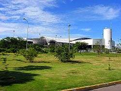
Pinto Martins – Fortaleza International Airport (IATA: FOR, ICAO: SBFZ) is the airport serving Fortaleza, Brazil. It is named after Euclides Pinto Martins (1892–1924) a Ceará-born aviator, who in 1922 was one of the pioneers of the air-link between New York and Rio de Janeiro. It is operated by Infraero. Some of its facilities are shared with the Fortaleza Air Force Base of the Brazilian Air Force.
History
The airport has its origins on a runway built in the 1930s and which was used by the Ceará Flying School until 2000.
During World War II, the airport was an important allied base supporting the Southern Atlantic operations.
On May 13, 1952 the original name, Cocorote Airport, was changed to its present name. In 1966 a passenger terminal and apron were built. Those facilities are now used by general aviation operations.
Since January 7, 1974 the airport is operated by Infraero and in 1997 it was upgraded to international category.
In February 1998 a new passenger terminal was opened. On August 31, 2009, Infraero unveiled a BRL525 million (USD276.6 million; EUR193.8 million) investment plan to up-grade Pinto Martins International Airport focusing on the preparations for the 2014 FIFA World Cup which will be held in Brazil, Fortaleza being one of the venue cities. The investment will be distributed in the renovation and enlargement of passenger terminal, apron, and parking with completion due in November 2013.[4]
Airlines and destinations
Passenger
Cargo
Accidents and incidents
- June 8, 1982: a VASP Boeing 727–212 registration PP-SRK operating flight 168 from Rio de Janeiro-Galeão to Fortaleza collided with a mountain while on approach to Fortaleza. The captain descended below a minimum descent altitude. All 137 passengers and crew died.[5][6]
- October 21, 1998: an Embraer EMB-120 Brasilia, registration PT-WKH, crashed on short finals to runway 13. The aircraft was arriving from Teresina, carrying medical supplies. Three people on board were killed, and one woman on the ground was also killed.
Access
The airport is located 6 km (4 mi) south of downtown Fortaleza.
See also
References
- ↑ "Estatísticas" (in Portuguese). Infraero. 2 February 2016. Retrieved 16 May 2016.
- ↑ "Airport Official Website" (in Portuguese). Infraero.
- ↑ "Lista de aeródromos públicos" (in Portuguese). ANAC.
- ↑ Rittner, Daniel; Braga, Paulo Victor (August 31, 2009). "Infraero vai gastar R$5 bi em reforma de aeroportos". Valor Econômico (in Portuguese). pp. A4.
- ↑ "Accident description PP-SRK". Aviation Safety Network. Retrieved August 12, 2011.
- ↑ Germano da Silva, Carlos Ari César (2008). "VASP 168". O rastro da bruxa: história da aviação comercial brasileira no século XX através dos seus acidentes 1928–1996 (in Portuguese) (2 ed.). Porto Alegre: EDIPUCRS. pp. 318–326. ISBN 978-85-7430-760-2.
External links
- Airport information for SBFZ at World Aero Data. Data current as of October 2006.Source: DAFIF.
- Airport information for SBFZ at Great Circle Mapper. Source: DAFIF (effective October 2006).
- Current weather for SBFZ at NOAA/NWS
- Accident history for FOR at Aviation Safety Network
- Pinto Martins International Airport Photo Archive at airliners.net
Myia