Pinehurst, Massachusetts
| Pinehurst, Massachusetts | |
|---|---|
| Census-designated place | |
|
Church of Saint Mary | |
| Coordinates: 42°32′1″N 71°13′46″W / 42.53361°N 71.22944°WCoordinates: 42°32′1″N 71°13′46″W / 42.53361°N 71.22944°W | |
| Country | United States |
| State | Massachusetts |
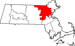
| County | Middlesex |
| Area | |
| • Total | 3.8 sq mi (9.9 km2) |
| • Land | 3.8 sq mi (9.9 km2) |
| • Water | 0.0 sq mi (0.0 km2) |
| Elevation | 105 ft (32 m) |
| Population (2010) | |
| • Total | 7,152 |
| • Density | 1,900/sq mi (720/km2) |
| ZIP code | 01866 (PO Boxes Only) |
| Area code(s) | 978 |
| FIPS code | 25-53680 |
| GNIS feature ID | 0618551 |

Pinehurst is an unincorporated village and census-designated place (CDP) in the town of Billerica, Middlesex County, Massachusetts, United States. The population was 7,152 at the 2010 census.[1] It is located in the southeastern part of town along Massachusetts Route 3A between the Shawsheen River and the Burlington town line.[2][3]
Pinehurst's zip code is 01866 and is for mail delivery to the Pinehurst PO Station only. Home and office mail delivery in Pinehurst must use the Billerica, MA zip code (01821).
Geography
Pinehurst is located at 42°32′1″N 71°13′46″W / 42.53361°N 71.22944°W (42.533545, -71.229582).[4]
According to the United States Census Bureau, the CDP has a total area of 9.9 km² (3.8 mi²). 9.9 km² (3.8 mi²) of it is land and 0.26% is water.
Demographics
As of the census[5] of 2000, there were 6,941 people, 2,245 households, and 1,874 families residing in the CDP. The population density was 701.6/km² (1,818.1/mi²). There were 2,265 housing units at an average density of 228.9/km² (593.3/mi²). The racial makeup of the CDP was 94.93% White, 1.02% African American, 0.16% Native American, 2.39% Asian, 0.03% Pacific Islander, 0.19% from other races, and 1.28% from two or more races. Hispanic or Latino of any race were 1.30% of the population.
There were 2,245 households out of which 39.7% had children under the age of 18 living with them, 70.6% were married couples living together, 8.9% had a female householder with no husband present, and 16.5% were non-families. 12.7% of all households were made up of individuals and 4.4% had someone living alone who was 65 years of age or older. The average household size was 3.09 and the average family size was 3.39.
In the CDP the population was spread out with 27.1% under the age of 18, 6.8% from 18 to 24, 33.4% from 25 to 44, 24.8% from 45 to 64, and 8.0% who were 65 years of age or older. The median age was 36 years. For every 100 females there were 99.0 males. For every 100 females age 18 and over, there were 96.4 males.
The median income for a household in the CDP was $73,713, and the median income for a family was $76,369. Males had a median income of $49,811 versus $37,983 for females. The per capita income for the CDP was $25,334. About 3.9% of families and 3.8% of the population were below the poverty line, including 3.9% of those under age 18 and 3.8% of those age 65 or over.
References
- ↑ "Profile of General Population and Housing Characteristics: 2010 Demographic Profile Data (DP-1): Pinehurst CDP, Massachusetts". U.S. Census Bureau, American Factfinder. Retrieved April 10, 2012.
- ↑ http://www.town.billerica.ma.us/
- ↑ http://www.billericahistorical.com/
- ↑ "US Gazetteer files: 2010, 2000, and 1990". United States Census Bureau. 2011-02-12. Retrieved 2011-04-23.
- ↑ "American FactFinder". United States Census Bureau. Retrieved 2008-01-31.
- Hazen, Henry A. (1883). History of Billerica 1653-1883. A. Williams and Co. Old Corner Bookstore 1883.