Pinedale, Wyoming
| Pinedale, Wyoming | |
|---|---|
| Town | |
|
Entering Downtown Pinedale | |
| Motto: All the Civilization You Need | |
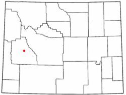 Location of Pinedale, Wyoming | |
 Pinedale, Wyoming Location in the United States | |
| Coordinates: 42°51′58″N 109°51′53″W / 42.86611°N 109.86472°WCoordinates: 42°51′58″N 109°51′53″W / 42.86611°N 109.86472°W | |
| Country | United States |
| State | Wyoming |
| County | Sublette |
| Government | |
| • Mayor | Bob Jones |
| Area[1] | |
| • Total | 2.15 sq mi (5.57 km2) |
| • Land | 2.15 sq mi (5.57 km2) |
| • Water | 0 sq mi (0 km2) |
| Elevation | 7,182 ft (2,189 m) |
| Population (2010)[2] | |
| • Total | 2,030 |
| • Estimate (2012[3]) | 2,043 |
| • Density | 944.2/sq mi (364.6/km2) |
| Time zone | Mountain (MST) (UTC-7) |
| • Summer (DST) | MDT (UTC-6) |
| ZIP code | 82941 |
| Area code(s) | 307 |
| FIPS code | 56-61580[4] |
| GNIS feature ID | 1604444[5] |
| Website | www.townofpinedale.us |

Pinedale is a town in and the county seat of Sublette County, Wyoming, United States.[6] The population was 2,030 at the 2010 census. Pinedale is an important hunting outfitting town and a gateway to the Wind River Mountains. It is also a major gateway to the Jackson Hole area in Wyoming. Pinedale is also near several large natural gas fields, including the Pinedale Anticline and Jonah Field. Attractions include the Museum of the Mountain Man, Green River Rendezvous Days, White Pine Ski Area, and the Town Park System along the Pine Creek Corridor in the middle of town. The mayor is Bob Jones, who was elected in 2014.[7]
Geography and climate
Pinedale is located at 42°51′58″N 109°51′53″W / 42.86611°N 109.86472°W (42.866162, −109.864622)[8] and sits at an elevation of 7,175 feet above sea level. According to the United States Census Bureau, the town has a total area of 2.15 square miles (5.57 km2), all of it land.[1]
There are 1,300 lakes around the Pinedale area. One lake in particular, just four miles from Pinedale, named Fremont Lake is the most commonly used lake and is Wyoming's second largest natural lake.
Pine Creek flows from nearby Fremont Lake through the town on its way to the Green River.
Primarily due to its high elevation, Pinedale has a subarctic climate (Köppen climate classification Dfc).
| Climate data for Pinedale, Wyoming | |||||||||||||
|---|---|---|---|---|---|---|---|---|---|---|---|---|---|
| Month | Jan | Feb | Mar | Apr | May | Jun | Jul | Aug | Sep | Oct | Nov | Dec | Year |
| Record high °F (°C) | 55 (13) |
54 (12) |
67 (19) |
77 (25) |
85 (29) |
90 (32) |
94 (34) |
91 (33) |
89 (32) |
86 (30) |
67 (19) |
54 (12) |
94 (34) |
| Average high °F (°C) | 25.8 (−3.4) |
29.9 (−1.2) |
38.6 (3.7) |
49.4 (9.7) |
60.2 (15.7) |
70.2 (21.2) |
77.3 (25.2) |
76.4 (24.7) |
66.8 (19.3) |
54.9 (12.7) |
36.7 (2.6) |
27.1 (−2.7) |
51.11 (10.63) |
| Daily mean °F (°C) | 12.9 (−10.6) |
16.1 (−8.8) |
25.3 (−3.7) |
35.4 (1.9) |
44.6 (7) |
53.6 (12) |
59.5 (15.3) |
57.3 (14.1) |
48.6 (9.2) |
38.5 (3.6) |
23.9 (−4.5) |
14.4 (−9.8) |
35.84 (2.14) |
| Average low °F (°C) | −0.1 (−17.8) |
2.2 (−16.6) |
12.0 (−11.1) |
21.1 (−6.1) |
29.0 (−1.7) |
36.9 (2.7) |
41.7 (5.4) |
38.2 (3.4) |
30.4 (−0.9) |
22.1 (−5.5) |
11.0 (−11.7) |
1.7 (−16.8) |
20.52 (−6.39) |
| Record low °F (°C) | −44 (−42) |
−42 (−41) |
−32 (−36) |
−13 (−25) |
−2 (−19) |
18 (−8) |
23 (−5) |
18 (−8) |
8 (−13) |
−6 (−21) |
−28 (−33) |
−49 (−45) |
−49 (−45) |
| Average precipitation inches (mm) | 0.71 (18) |
0.53 (13.5) |
0.74 (18.8) |
0.92 (23.4) |
1.73 (43.9) |
1.06 (26.9) |
1.15 (29.2) |
1.04 (26.4) |
1.18 (30) |
0.77 (19.6) |
0.76 (19.3) |
0.60 (15.2) |
11.19 (284.2) |
| Source #1: NOAA (normals, 1971–2000)[9] | |||||||||||||
| Source #2: The Weather Channel (Records)[10] | |||||||||||||
Wildlife
Pinedale and the surrounding area are home to a large population of wildlife including both grizzly and black bear, moose, elk, pronghorn, mule deer, whitetail deer, bighorn sheep, and mountain lions. Over seven species of trout can be found in the area lakes.
Demographics
| Historical population | |||
|---|---|---|---|
| Census | Pop. | %± | |
| 1920 | 94 | — | |
| 1930 | 219 | 133.0% | |
| 1940 | 647 | 195.4% | |
| 1950 | 770 | 19.0% | |
| 1960 | 965 | 25.3% | |
| 1970 | 948 | −1.8% | |
| 1980 | 1,066 | 12.4% | |
| 1990 | 1,181 | 10.8% | |
| 2000 | 1,412 | 19.6% | |
| 2010 | 2,030 | 43.8% | |
| Est. 2015 | 1,923 | [11] | −5.3% |
2010 census
As of the census[2] of 2010, there were 2,030 people, 847 households, and 484 families residing in the town. The population density was 944.2 inhabitants per square mile (364.6/km2). There were 1,080 housing units at an average density of 502.3 per square mile (193.9/km2). The racial makeup of the town was 90.5% White, 0.7% African American, 0.6% Native American, 1.3% Asian, 4.8% from other races, and 2.0% from two or more races. Hispanic or Latino of any race were 9.9% of the population.
There were 847 households of which 30.1% had children under the age of 18 living with them, 44.9% were married couples living together, 8.4% had a female householder with no husband present, 3.9% had a male householder with no wife present, and 42.9% were non-families. 31.4% of all households were made up of individuals and 8.2% had someone living alone who was 65 years of age or older. The average household size was 2.37 and the average family size was 2.96.
The median age in the town was 33.5 years. 23.1% of residents were under the age of 18; 9.6% were between the ages of 18 and 24; 33.2% were from 25 to 44; 24.9% were from 45 to 64; and 9.1% were 65 years of age or older. The gender makeup of the town was 54.8% male and 45.2% female.
2000 census
As of the census[4] of 2000, there were 1,412 people, 582 households, and 368 families residing in the town. The population density was 996.5 people per square mile (383.9/km²). There were 718 housing units at an average density of 506.7 per square mile (195.2/km²). The racial makeup of the town was 96.95% White, 0.35% African American, 0.71% Native American, 0.14% Asian, 0.14% Pacific Islander, 0.42% from other races, and 1.27% from two or more races. Hispanic or Latino of any race were 1.49% of the population.
There were 582 households out of which 32.0% had children under the age of 18 living with them, 52.4% were married couples living together, 7.4% had a female householder with no husband present, and 36.6% were non-families. 30.1% of all households were made up of individuals and 8.9% had someone living alone who was 65 years of age or older. The average household size was 2.30 and the average family size was 2.89.
In the town the population was spread out with 24.6% under the age of 18, 6.3% from 18 to 24, 26.6% from 25 to 44, 26.3% from 45 to 64, and 16.1% who were 65 years of age or older. The median age was 39 years. For every 100 females there were 100.0 males. For every 100 females age 18 and over, there were 97.8 males.
The median income for a household in the town was $35,188, and the median income for a family was $40,880. Males had a median income of $31,976 versus $22,143 for females. The per capita income for the town was $20,441. About 7.8% of families and 8.9% of the population were below the poverty line, including 5.5% of those under age 18 and 10.4% of those age 65 or over.
Education
Public education in the town of Pinedale is provided by Sublette County School District #1. Schools serving the town include Pinedale Elementary School (grades K-5), Pinedale Middle School (grades 6–8), and Pinedale High School (grades 9–12).
Tourism
The region offers many outdoor activities with its close proximity to the Wind River Range. These activities include fishing, hiking, camping, boating, four-wheeling, hunting, skiing/snowboarding, snowmobiling, ice fishing, and ice skating. The town hosts the Green River Rendezvous, a reenactment of historic fur trader gatherings at the Upper Green River Rendezvous Site in nearby Daniel. During Rendezvous, rodeos take place at the rodeo grounds and many businesses and vendors set up booths around town to sells goods.[13] For travel and tourism information for Pinedale, Wyoming go to: www.visitpinedale.org.
References
- 1 2 "US Gazetteer files 2010". United States Census Bureau. Archived from the original on January 24, 2012. Retrieved 2012-12-14.
- 1 2 "American FactFinder". United States Census Bureau. Retrieved 2012-12-14.
- ↑ "Population Estimates". United States Census Bureau. Archived from the original on June 17, 2013. Retrieved 2013-06-01.
- 1 2 "American FactFinder". United States Census Bureau. Retrieved 2008-01-31.
- ↑ "US Board on Geographic Names". United States Geological Survey. 2007-10-25. Retrieved 2008-01-31.
- ↑ "Find a County". National Association of Counties. Archived from the original on May 31, 2011. Retrieved 2011-06-07.
- ↑ "Pinedale municipal election results". Retrieved 2014-08-05.
- ↑ "US Gazetteer files: 2010, 2000, and 1990". United States Census Bureau. 2011-02-12. Retrieved 2011-04-23.
- ↑ "Climatography of the United States NO.81" (PDF). National Oceanic and Atmospheric Administration. Retrieved January 11, 2011.
- ↑ "Monthly Averages for Pinedale, WY". The Weather Channel. Retrieved January 13, 2011.
- ↑ "Annual Estimates of the Resident Population for Incorporated Places: April 1, 2010 to July 1, 2015". Retrieved July 2, 2016.
- ↑ "Census of Population and Housing". Census.gov. Archived from the original on May 11, 2015. Retrieved June 4, 2015.
- ↑ "79th Annual Green River Rendezvous". Retrieved 14 May 2014.
External links
- Town website
- Pinedale Roundup Online
- Pinedale Online
- Pinedale Community Message Board
- Chamber of Commerce
- Socioeconomics of Sublette County
Municipalities and communities of Sublette County, Wyoming, United States | ||
|---|---|---|
| Towns | 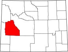 | |
| CDPs | ||
| Unincorporated communities | ||
| Ghost towns | ||